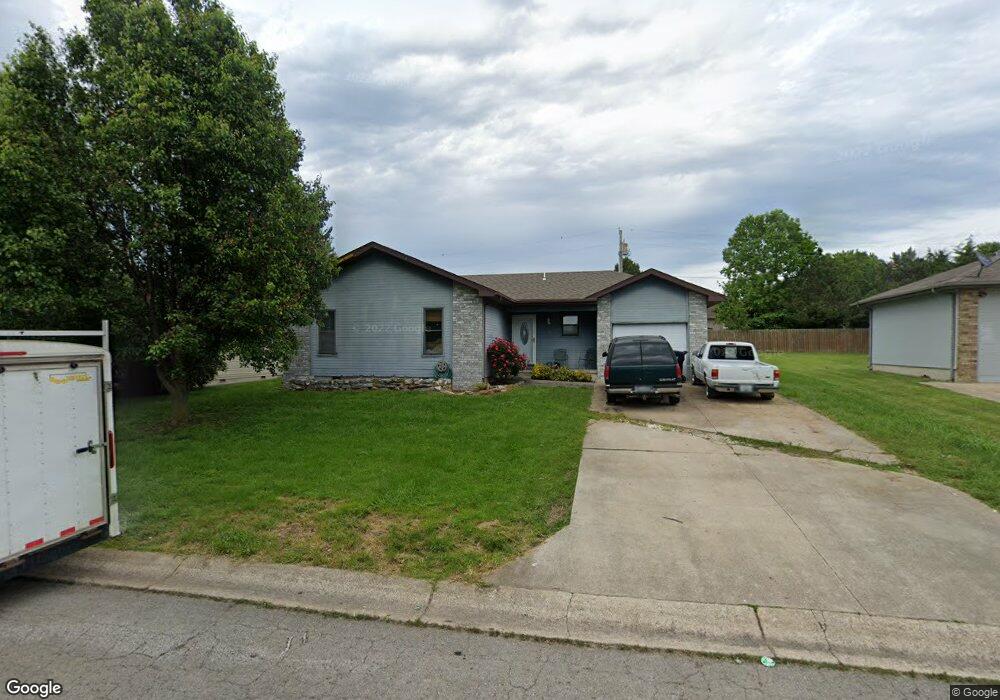
1129 Fowler Rd Lebanon, MO 65536
Estimated Value: $158,294 - $181,000
3
Beds
1
Bath
1,600
Sq Ft
$106/Sq Ft
Est. Value
About This Home
This home is located at 1129 Fowler Rd, Lebanon, MO 65536 and is currently estimated at $168,824, approximately $105 per square foot. 1129 Fowler Rd is a home located in Laclede County with nearby schools including Joe D. Esther Elementary School, Maplecrest Elementary School, and Boswell Elementary School.
Ownership History
Date
Name
Owned For
Owner Type
Purchase Details
Closed on
Dec 22, 2020
Sold by
Quick Peppers Investments Llc
Bought by
Quick Corey
Current Estimated Value
Purchase Details
Closed on
May 17, 2010
Sold by
Fannie Mae
Bought by
Quick Brian A
Home Financials for this Owner
Home Financials are based on the most recent Mortgage that was taken out on this home.
Original Mortgage
$43,500
Interest Rate
5.14%
Mortgage Type
Future Advance Clause Open End Mortgage
Purchase Details
Closed on
Jan 21, 2010
Sold by
Record Kevin M and Record Lella M
Bought by
Federal National Mortgage Association
Create a Home Valuation Report for This Property
The Home Valuation Report is an in-depth analysis detailing your home's value as well as a comparison with similar homes in the area
Home Values in the Area
Average Home Value in this Area
Purchase History
| Date | Buyer | Sale Price | Title Company |
|---|---|---|---|
| Quick Corey | -- | Hogan Land Title | |
| Quick Brian A | -- | None Available | |
| Federal National Mortgage Association | $63,994 | None Available |
Source: Public Records
Mortgage History
| Date | Status | Borrower | Loan Amount |
|---|---|---|---|
| Previous Owner | Quick Brian A | $43,500 |
Source: Public Records
Tax History Compared to Growth
Tax History
| Year | Tax Paid | Tax Assessment Tax Assessment Total Assessment is a certain percentage of the fair market value that is determined by local assessors to be the total taxable value of land and additions on the property. | Land | Improvement |
|---|---|---|---|---|
| 2025 | $643 | $12,690 | $0 | $0 |
| 2024 | $643 | $11,270 | $0 | $0 |
| 2023 | $662 | $11,270 | $0 | $0 |
| 2022 | $617 | $11,270 | $0 | $0 |
| 2021 | $680 | $11,267 | $1,577 | $9,690 |
| 2020 | $683 | $11,267 | $1,577 | $9,690 |
| 2019 | $654 | $11,270 | $1,580 | $9,690 |
| 2018 | $614 | $11,270 | $1,580 | $9,690 |
| 2017 | $582 | $11,270 | $0 | $0 |
| 2016 | $582 | $11,270 | $0 | $0 |
| 2015 | $582 | $11,270 | $0 | $0 |
| 2014 | $582 | $11,270 | $0 | $0 |
| 2013 | -- | $11,270 | $0 | $0 |
Source: Public Records
Map
Nearby Homes
- TBD Phillips Dr
- 000 U S Route 66
- 11 Sunrise Dr
- 1507 Finn Dr
- 2176 Beck Ln
- 1511 Rader Dr
- 1515 Rader Dr
- 0 Ivey Ln Unit MIS25060889
- 2133 Cedarwood Ct
- 2101 Emmy Ave
- 2301 Cranberry Ln
- 517 Holly St
- 225 Garfield St
- 888 W 2nd St
- 11 Willow Ln
- 704 W 2nd St
- 216 Coach Rd
- 100 State Highway 32
- 14300 State Highway 32
- 885 W 4th St