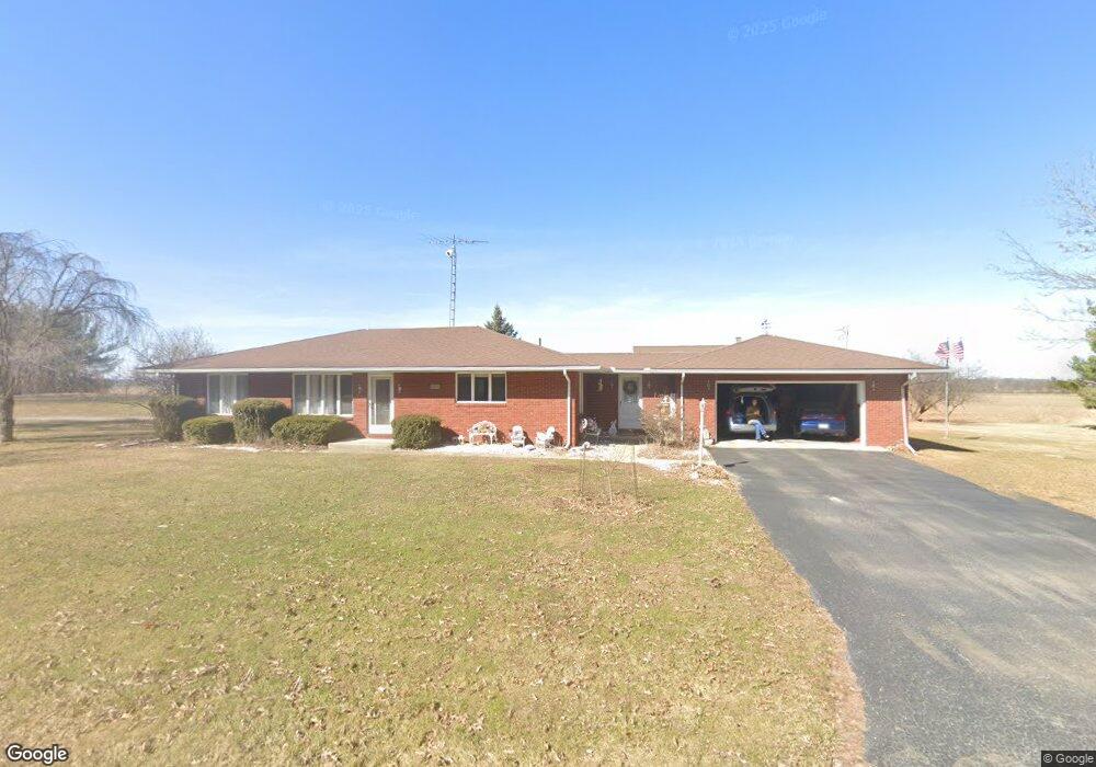
11292 County Road 45 Findlay, OH 45840
Estimated Value: $190,000 - $339,000
3
Beds
2
Baths
2,072
Sq Ft
$132/Sq Ft
Est. Value
About This Home
This home is located at 11292 County Road 45, Findlay, OH 45840 and is currently estimated at $272,910, approximately $131 per square foot. 11292 County Road 45 is a home located in Hancock County with nearby schools including Liberty-Benton Elementary School, Liberty-Benton Middle School, and Liberty-Benton High School.
Ownership History
Date
Name
Owned For
Owner Type
Purchase Details
Closed on
Jun 29, 2010
Sold by
Wulff Robert W and Wulff Douglas W
Bought by
Smiraldo Phillip G and Smiraldo Elaine M
Current Estimated Value
Home Financials for this Owner
Home Financials are based on the most recent Mortgage that was taken out on this home.
Original Mortgage
$148,750
Outstanding Balance
$99,536
Interest Rate
4.86%
Mortgage Type
Future Advance Clause Open End Mortgage
Estimated Equity
$173,374
Purchase Details
Closed on
Oct 27, 1989
Bought by
Roberts Nancy L
Create a Home Valuation Report for This Property
The Home Valuation Report is an in-depth analysis detailing your home's value as well as a comparison with similar homes in the area
Home Values in the Area
Average Home Value in this Area
Purchase History
| Date | Buyer | Sale Price | Title Company |
|---|---|---|---|
| Smiraldo Phillip G | $175,000 | Hancock Title | |
| Roberts Nancy L | $90,900 | -- |
Source: Public Records
Mortgage History
| Date | Status | Borrower | Loan Amount |
|---|---|---|---|
| Open | Smiraldo Phillip G | $148,750 |
Source: Public Records
Tax History Compared to Growth
Tax History
| Year | Tax Paid | Tax Assessment Tax Assessment Total Assessment is a certain percentage of the fair market value that is determined by local assessors to be the total taxable value of land and additions on the property. | Land | Improvement |
|---|---|---|---|---|
| 2024 | $2,427 | $68,400 | $8,370 | $60,030 |
| 2023 | $2,367 | $68,400 | $8,370 | $60,030 |
| 2022 | $2,343 | $68,400 | $8,370 | $60,030 |
| 2021 | $2,152 | $55,010 | $8,050 | $46,960 |
| 2020 | $2,158 | $55,010 | $8,050 | $46,960 |
| 2019 | $2,117 | $55,010 | $8,050 | $46,960 |
| 2018 | $1,709 | $48,020 | $7,000 | $41,020 |
| 2017 | $862 | $48,020 | $7,000 | $41,020 |
| 2016 | $1,681 | $48,020 | $7,000 | $41,020 |
| 2015 | $1,817 | $50,910 | $7,000 | $43,910 |
| 2014 | $1,836 | $50,910 | $7,000 | $43,910 |
| 2012 | $1,861 | $49,440 | $7,000 | $42,440 |
Source: Public Records
Map
Nearby Homes
- 0 Penrose Dr
- 3323 Western Ave
- 0 Township Road 77
- 3065 S Main St
- 0 Viburnum Ct Unit 6121366
- 0 Viburnum Ct Unit 20243687
- 0 Virbunum Ct Unit 87 305267
- 401 Bittersweet Dr
- 500 Blue Bonnet Dr
- 11787 County Road 180
- 164 Church Hill Dr
- 128 Church Hill Dr
- 0 Township Road 227
- 2010 S Main St
- 10601 County Road 9
- 13385 Deer Landing Dr
- 211 Fairlawn Place
- 1609 Foraker Ave
- 1818 Westview Dr
- 11741 Township Road 10
- 11292 County Road 45
- 11230 County Road 45
- 11496 County Road 45
- 11050 County Road 45
- 14238 County Road 75
- 11528 County Road 45
- 13922 Township Road 76
- 11778 County Road 45
- 10786 County Road 45
- 0 County Road 45
- 14522 County Road 75
- 10675 County Road 45
- 11081 County Road 40
- 11047 County Road 40
- 10936 County Road 40
- 11950 County Rd
- 13401 Township Road 76
- 13754 S R 68
- 10617 County Road 45
- 11986 Trail 77