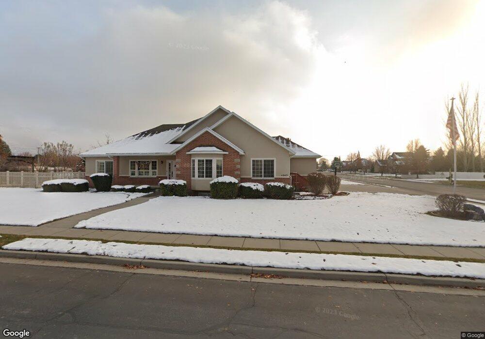
11292 Sampson Dr Highland, UT 84003
Estimated Value: $910,000 - $1,103,000
3
Beds
2
Baths
2,182
Sq Ft
$453/Sq Ft
Est. Value
About This Home
This home is located at 11292 Sampson Dr, Highland, UT 84003 and is currently estimated at $987,593, approximately $452 per square foot. 11292 Sampson Dr is a home located in Utah County with nearby schools including Highland Elementary School, Timberline Middle School, and Lone Peak High School.
Ownership History
Date
Name
Owned For
Owner Type
Purchase Details
Closed on
Feb 13, 2019
Sold by
Peterson Matthew Lane and Peterson Danae
Bought by
Peterson Matthew Lane and Peterson Danae
Current Estimated Value
Home Financials for this Owner
Home Financials are based on the most recent Mortgage that was taken out on this home.
Original Mortgage
$484,350
Outstanding Balance
$424,962
Interest Rate
4.4%
Mortgage Type
New Conventional
Estimated Equity
$562,631
Purchase Details
Closed on
Jun 5, 2013
Sold by
Peterson Matthew Lane and Peterson Danae
Bought by
Peterson Matthew Lane and Peterson Danae
Home Financials for this Owner
Home Financials are based on the most recent Mortgage that was taken out on this home.
Original Mortgage
$394,000
Interest Rate
3.37%
Mortgage Type
New Conventional
Purchase Details
Closed on
Mar 30, 2012
Sold by
Peterson Matthew L and Peterson Danae
Bought by
Peterson Family Trust
Purchase Details
Closed on
Aug 25, 2008
Sold by
Peterson Matthew L and Peterson Danae
Bought by
Peterson Matthew L and Peterson Danae
Home Financials for this Owner
Home Financials are based on the most recent Mortgage that was taken out on this home.
Original Mortgage
$389,000
Interest Rate
6.27%
Mortgage Type
New Conventional
Purchase Details
Closed on
Jul 17, 2006
Sold by
Rouleau Norman J and Rouleau Ann
Bought by
Peterson Matthew I and Peterson Danae
Home Financials for this Owner
Home Financials are based on the most recent Mortgage that was taken out on this home.
Original Mortgage
$360,000
Interest Rate
7.6%
Mortgage Type
Purchase Money Mortgage
Purchase Details
Closed on
Sep 2, 2005
Sold by
Rouleau Norman J and Rouleau Ann
Bought by
Rouleau Norman J and Rouleau Ann
Purchase Details
Closed on
Apr 26, 2000
Sold by
J D D Investments Lc
Bought by
Rouleau Norman J and Rouleau Ann
Home Financials for this Owner
Home Financials are based on the most recent Mortgage that was taken out on this home.
Original Mortgage
$213,375
Interest Rate
8.24%
Create a Home Valuation Report for This Property
The Home Valuation Report is an in-depth analysis detailing your home's value as well as a comparison with similar homes in the area
Home Values in the Area
Average Home Value in this Area
Purchase History
| Date | Buyer | Sale Price | Title Company |
|---|---|---|---|
| Peterson Matthew Lane | -- | Advantage Title Llc | |
| Peterson Matthew Lane | -- | None Available | |
| Peterson Matthew Lane | -- | None Available | |
| Peterson Family Trust | -- | None Available | |
| Peterson Matthew L | -- | Advanced Title | |
| Peterson Matthew I | -- | Empire Land Title Company | |
| Rouleau Norman J | -- | -- | |
| Rouleau Norman J | -- | Guardian Title Salt Lake |
Source: Public Records
Mortgage History
| Date | Status | Borrower | Loan Amount |
|---|---|---|---|
| Open | Peterson Matthew Lane | $484,350 | |
| Closed | Peterson Matthew Lane | $394,000 | |
| Closed | Peterson Matthew L | $389,000 | |
| Closed | Peterson Matthew I | $360,000 | |
| Previous Owner | Rouleau Norman J | $213,375 |
Source: Public Records
Tax History Compared to Growth
Tax History
| Year | Tax Paid | Tax Assessment Tax Assessment Total Assessment is a certain percentage of the fair market value that is determined by local assessors to be the total taxable value of land and additions on the property. | Land | Improvement |
|---|---|---|---|---|
| 2025 | $3,714 | $470,635 | $527,600 | $328,100 |
| 2024 | $3,714 | $458,755 | $0 | $0 |
| 2023 | $3,424 | $456,280 | $0 | $0 |
| 2022 | $3,730 | $481,910 | $0 | $0 |
| 2021 | $3,272 | $629,700 | $319,200 | $310,500 |
| 2020 | $3,116 | $588,100 | $277,600 | $310,500 |
| 2019 | $2,848 | $562,200 | $277,600 | $284,600 |
| 2018 | $2,996 | $562,200 | $277,600 | $284,600 |
| 2017 | $2,834 | $283,855 | $0 | $0 |
| 2016 | $2,738 | $256,245 | $0 | $0 |
| 2015 | $2,805 | $248,820 | $0 | $0 |
| 2014 | $2,690 | $236,555 | $0 | $0 |
Source: Public Records
Map
Nearby Homes
- 5077 W 11000 N
- 629 S Pheasant Ridge Cir
- 682 Healey Blvd
- 5159 W 11000 N
- 5984 W 11200 N Unit 1
- 88 W Cascade Ave
- 909 Ridge Ln
- 10861 N Panorama Dr
- 5377 W Evergreen Way
- 4224 W Park Dr
- 10685 N Jerling Dr
- 250 S Main St Unit 7
- 250 S Main St Unit 20
- 250 S Main St Unit 25
- 177 W Canyon Crest Rd
- 201 E Red Pine Dr Unit 17
- 10905 N Vercelli Dr
- 10763 N Dosh Ln
- 10925 N Marsala Dr
- 5983 W 11270 N Unit 4
- 4863 W 11300 N
- 4863 Jonathan Rd
- 4841 Jonathan Rd
- 11293 N Sampson Dr
- 11293 N 4880 W Unit 3
- 4862 W 11300 N
- 4864 W Joey Ct
- 4864 Joey Ct
- 4862 Jonathan Rd
- 4862 Jonathan Rd Unit 13
- 4862 W Jonathon Rd
- 4817 Jonathan Rd
- 4817 Jonathan Rd Unit 16
- 4838 W 11300 N
- 11263 N Sampson Dr
- 4842 11240 N
- 4817 W Jonathon Rd
- 4838 Jonathan Rd
- 11263 N Sampson Dr
- 4896 W Jonathon Rd