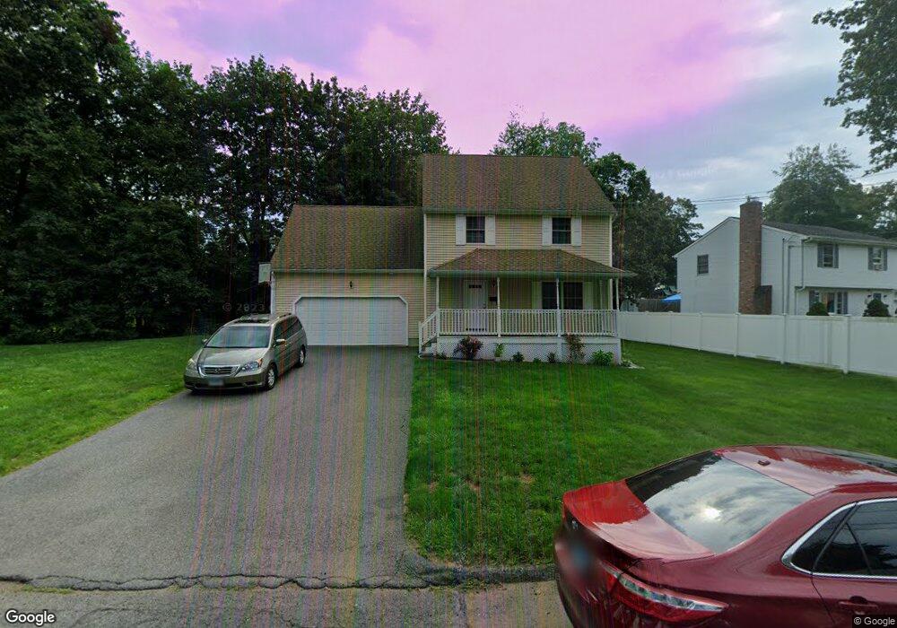
113 Avondale Rd Manchester, CT 06042
Bowers NeighborhoodEstimated Value: $368,819 - $404,000
3
Beds
3
Baths
1,720
Sq Ft
$222/Sq Ft
Est. Value
About This Home
This home is located at 113 Avondale Rd, Manchester, CT 06042 and is currently estimated at $381,705, approximately $221 per square foot. 113 Avondale Rd is a home located in Hartford County with nearby schools including Bowers School, Illing Middle School, and Elisabeth M. Bennet Academy.
Ownership History
Date
Name
Owned For
Owner Type
Purchase Details
Closed on
Sep 10, 2004
Sold by
Kld Dev Llc
Bought by
Quaye Joyce
Current Estimated Value
Purchase Details
Closed on
May 30, 2003
Sold by
Est Obright Mary C and Rodonis Albert V
Bought by
Kdl Properties Llc
Create a Home Valuation Report for This Property
The Home Valuation Report is an in-depth analysis detailing your home's value as well as a comparison with similar homes in the area
Home Values in the Area
Average Home Value in this Area
Purchase History
| Date | Buyer | Sale Price | Title Company |
|---|---|---|---|
| Quaye Joyce | $257,300 | -- | |
| Quaye Joyce | $257,300 | -- | |
| Kdl Properties Llc | $45,000 | -- | |
| Kdl Properties Llc | $45,000 | -- |
Source: Public Records
Mortgage History
| Date | Status | Borrower | Loan Amount |
|---|---|---|---|
| Open | Kdl Properties Llc | $224,450 | |
| Closed | Kdl Properties Llc | $73,000 | |
| Closed | Kdl Properties Llc | $247,000 |
Source: Public Records
Tax History Compared to Growth
Tax History
| Year | Tax Paid | Tax Assessment Tax Assessment Total Assessment is a certain percentage of the fair market value that is determined by local assessors to be the total taxable value of land and additions on the property. | Land | Improvement |
|---|---|---|---|---|
| 2025 | $8,048 | $202,100 | $39,600 | $162,500 |
| 2024 | $7,817 | $202,100 | $39,600 | $162,500 |
| 2023 | $7,518 | $202,100 | $39,600 | $162,500 |
| 2022 | $7,371 | $202,100 | $39,600 | $162,500 |
| 2021 | $6,033 | $165,200 | $34,000 | $131,200 |
| 2020 | $6,033 | $165,200 | $34,000 | $131,200 |
| 2019 | $6,033 | $165,200 | $34,000 | $131,200 |
| 2018 | $5,916 | $165,200 | $34,000 | $131,200 |
| 2017 | $5,757 | $165,200 | $34,000 | $131,200 |
| 2016 | $6,074 | $174,300 | $43,100 | $131,200 |
| 2015 | $6,045 | $174,300 | $43,100 | $131,200 |
| 2014 | $5,926 | $174,300 | $43,100 | $131,200 |
Source: Public Records
Map
Nearby Homes
- 210 Green Rd
- 29 Bretton Rd
- 4 Buckingham St
- 213 Oakland St Unit D
- 85 Henry St
- 70 Weaver Rd
- 40 Grove St Unit B
- 120 Green Manor Rd
- 244 Oakland St Unit E
- 244 Oakland St Unit H
- 28 Elizabeth Dr
- 56 Elizabeth Dr
- 143 Benton St
- 41 Delmont St
- 94 Middle Turnpike E Unit 4
- 178 Parker St
- 85 Benton St
- 74 North St
- 50 North St
- 9 Cook St
- 105 Avondale Rd
- 302 Woodbridge St
- 126 Avondale Rd
- 122 Avondale Rd
- 132 Avondale Rd
- 314 Woodbridge St
- 116 Avondale Rd
- 95 Avondale Rd
- 286 Woodbridge St
- 49 Auburn Rd
- 112 Avondale Rd
- 280 Woodbridge St
- 108 Avondale Rd
- 39 Auburn Rd
- 293 Woodbridge St
- 303 Woodbridge St
- 69 Oakwood Rd
- 73 Oakwood Rd
- 274 Woodbridge St
- 63 Oakwood Rd