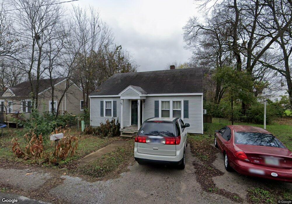
113 Bates St Lewisburg, TN 37091
Estimated Value: $98,272 - $160,000
--
Bed
1
Bath
896
Sq Ft
$150/Sq Ft
Est. Value
About This Home
This home is located at 113 Bates St, Lewisburg, TN 37091 and is currently estimated at $134,818, approximately $150 per square foot. 113 Bates St is a home located in Marshall County with nearby schools including Marshall Elementary School, Oak Grove Elementary School, and Westhills Elementary School.
Ownership History
Date
Name
Owned For
Owner Type
Purchase Details
Closed on
Jul 3, 2007
Sold by
Chase Posey Clinton
Bought by
Joseph Currier and Joseph Tonya
Current Estimated Value
Purchase Details
Closed on
Jan 27, 1998
Sold by
Associates Financial Serv
Bought by
Clinton Posey
Purchase Details
Closed on
Sep 12, 1997
Sold by
Mealer Jessie M
Bought by
Associates Financial Servi
Purchase Details
Closed on
Oct 8, 1991
Bought by
Mealer Jessie M
Purchase Details
Closed on
Aug 23, 1991
Bought by
Knowis Rufus and Knowis Lorene
Create a Home Valuation Report for This Property
The Home Valuation Report is an in-depth analysis detailing your home's value as well as a comparison with similar homes in the area
Home Values in the Area
Average Home Value in this Area
Purchase History
| Date | Buyer | Sale Price | Title Company |
|---|---|---|---|
| Joseph Currier | $29,000 | -- | |
| Clinton Posey | $35,900 | -- | |
| Associates Financial Servi | $30,000 | -- | |
| Mealer Jessie M | $27,000 | -- | |
| Knowis Rufus | $28,000 | -- |
Source: Public Records
Tax History Compared to Growth
Tax History
| Year | Tax Paid | Tax Assessment Tax Assessment Total Assessment is a certain percentage of the fair market value that is determined by local assessors to be the total taxable value of land and additions on the property. | Land | Improvement |
|---|---|---|---|---|
| 2024 | -- | $12,825 | $1,400 | $11,425 |
| 2023 | $398 | $12,825 | $1,400 | $11,425 |
| 2022 | $398 | $12,825 | $1,400 | $11,425 |
| 2021 | $371 | $7,975 | $1,050 | $6,925 |
| 2020 | $428 | $9,200 | $1,050 | $8,150 |
| 2019 | $415 | $9,200 | $1,050 | $8,150 |
| 2018 | $410 | $9,200 | $1,050 | $8,150 |
| 2017 | $410 | $9,200 | $1,050 | $8,150 |
| 2016 | $402 | $7,850 | $1,000 | $6,850 |
| 2015 | $367 | $7,850 | $1,000 | $6,850 |
| 2014 | $367 | $7,850 | $1,000 | $6,850 |
Source: Public Records
Map
Nearby Homes
- 543 2nd Ave N
- 638 2nd Ave N
- 416 1st Ave N
- 316 Haynes St
- 231 Greenwood St
- 319 Greenwood St
- 594 5th Ave N
- 0 New Lake Rd Unit RTC3030964
- 726 Thomas Ave
- 1600 Larry Dospil Dr
- 627 6th Ave N
- 630 6th Ave N
- 319 E Hill Ave
- 215 5th Ave N
- 518 Maple St
- 525 Maple St
- 610 Forrest St
- 535 Clayton Ave
- 380 Baxter Ave
- 224 Hardison Ave