Estimated Value: $116,000 - $144,000
3
Beds
1
Bath
1,190
Sq Ft
$112/Sq Ft
Est. Value
About This Home
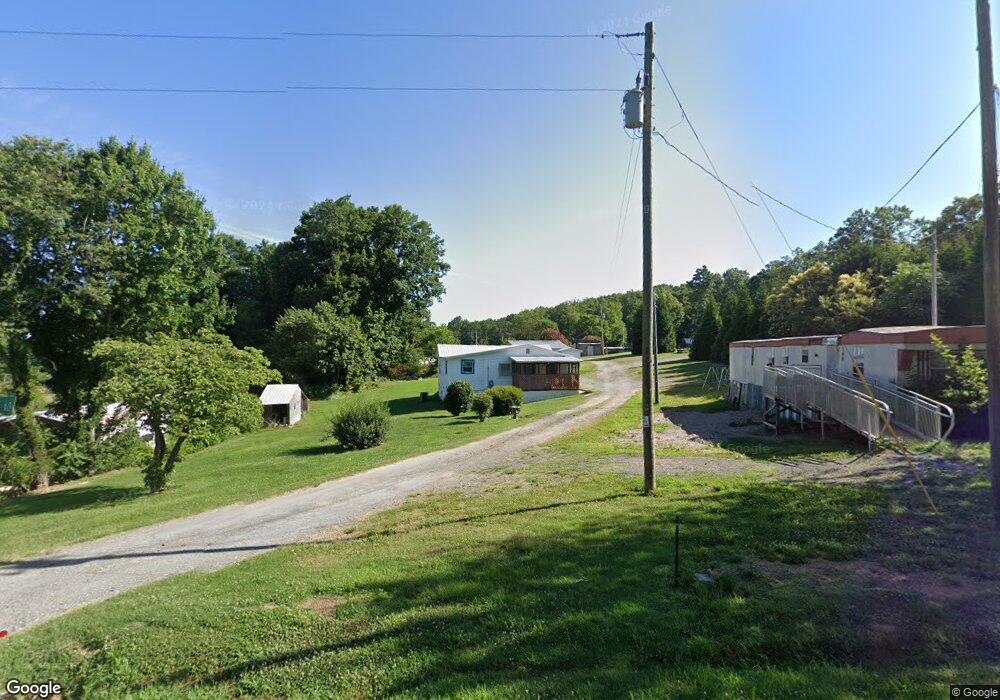
This home is located at 113 Boggs Dr, Star, NC 27356 and is currently estimated at $133,494, approximately $112 per square foot. 113 Boggs Dr is a home located in Montgomery County with nearby schools including Star Elementary School, Mount Gilead Elementary School, and East Middle School.
Ownership History
Date
Name
Owned For
Owner Type
Purchase Details
Closed on
Mar 14, 2023
Sold by
Beane Timothy Lee and Beane Shanna Mae
Bought by
Beane Timothy Lee and Beane Kierra Anne
Current Estimated Value
Purchase Details
Closed on
Sep 11, 2018
Sold by
Boggs Walter Ray and Boggs Danielle
Bought by
Beane Timothy Lee and Beane Shanna Mae
Home Financials for this Owner
Home Financials are based on the most recent Mortgage that was taken out on this home.
Original Mortgage
$28,760
Interest Rate
4.5%
Mortgage Type
New Conventional
Purchase Details
Closed on
Jan 1, 1987
Bought by
Boggs Wade Walter and Boggs Peggy P
Create a Home Valuation Report for This Property
The Home Valuation Report is an in-depth analysis detailing your home's value as well as a comparison with similar homes in the area
Purchase History
| Date | Buyer | Sale Price | Title Company |
|---|---|---|---|
| Beane Timothy Lee | -- | None Listed On Document | |
| Beane Timothy Lee | -- | None Listed On Document | |
| Beane Timothy Lee | $29,000 | None Available | |
| Boggs Wade Walter | $1,000 | -- |
Source: Public Records
Mortgage History
| Date | Status | Borrower | Loan Amount |
|---|---|---|---|
| Previous Owner | Beane Timothy Lee | $28,760 |
Source: Public Records
Tax History
| Year | Tax Paid | Tax Assessment Tax Assessment Total Assessment is a certain percentage of the fair market value that is determined by local assessors to be the total taxable value of land and additions on the property. | Land | Improvement |
|---|---|---|---|---|
| 2025 | $406 | $66,083 | $5,300 | $60,783 |
| 2024 | $4 | $66,083 | $5,300 | $60,783 |
| 2023 | $406 | $66,083 | $5,300 | $60,783 |
| 2022 | $406 | $66,083 | $5,300 | $60,783 |
| 2021 | $406 | $66,083 | $5,300 | $60,783 |
| 2020 | $406 | $66,083 | $5,300 | $60,783 |
| 2018 | $216 | $34,800 | $6,400 | $28,400 |
| 2017 | $236 | $34,800 | $6,400 | $28,400 |
| 2016 | -- | $34,800 | $6,400 | $28,400 |
| 2015 | -- | $34,800 | $0 | $0 |
| 2014 | -- | $34,804 | $0 | $0 |
Source: Public Records
Map
Nearby Homes
- 0000 Boone Farm Rd
- 2356 Ether Rd
- 2322 Ether Rd
- 2304 Ether Rd
- 2342 Ether Rd
- 2288 Ether Rd
- 5329 Seagrove Plank Rd
- 7039 Abner Rd
- 1385 Foxburrow Rd
- 7355 Pisgah Covered Bridge Rd
- 7355 Pisgah Covered Bridge Rd Unit 1
- 5364 Pisgah Covered Bridge Rd
- 172 Atkins Dairy Rd
- 455 Hogan Farm Rd
- 116 Bullins Ln
- 103 Cardinal Ave
- 2006 Okeewemee Rd
- 132 Smith Lake Rd
- 0 Atkinson Farm Rd
- 000 Atkinson Farm Rd
- 112 Bee Tree Mountain Dr
- 108 Boggs Dr
- 1336 Black Ankle Rd
- 132 Boggs Dr
- 1370 Black Ankle Rd
- 131 Bee Tree Mountain Dr
- 1344 Black Ankle Rd
- 1378 Black Ankle Rd
- 1324 Black Ankle Rd
- 1329 Black Ankle Rd
- 1420 Black Ankle Rd
- 1346 Black Ankle Rd
- 113 Pond Dam Dr
- 156 Bee Tree Mountain Dr
- 1400 Black Ankle Rd
- 1412 Black Ankle Rd
- 1428 Black Ankle Rd
- 2444 Ether Rd
- 2456 Ether Rd
- 2480 Ether Rd
Your Personal Tour Guide
Ask me questions while you tour the home.