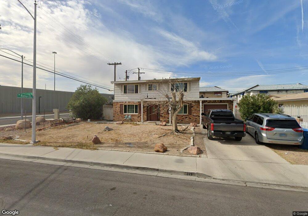
113 Catalini St Unit 1 Las Vegas, NV 89107
Michael Way NeighborhoodEstimated Value: $335,000 - $408,000
4
Beds
3
Baths
2,040
Sq Ft
$185/Sq Ft
Est. Value
About This Home
This home is located at 113 Catalini St Unit 1, Las Vegas, NV 89107 and is currently estimated at $377,217, approximately $184 per square foot. 113 Catalini St Unit 1 is a home located in Clark County with nearby schools including J.T. McWlliams Elementary School, Robert O Gibson Middle School, and Western High School.
Ownership History
Date
Name
Owned For
Owner Type
Purchase Details
Closed on
Jul 5, 2013
Sold by
Lizarraga Reynecke Frank Ernesto
Bought by
Lizarraga Francisco and Lizarraga Maria M
Current Estimated Value
Purchase Details
Closed on
Aug 16, 2011
Sold by
Federal National Mortgage Association
Bought by
Reynecke Frank Ernesto Lizarraga
Purchase Details
Closed on
Nov 8, 2010
Sold by
Calhoun Donald R and Calhoun Susan M
Bought by
Federal National Mortgage Association
Create a Home Valuation Report for This Property
The Home Valuation Report is an in-depth analysis detailing your home's value as well as a comparison with similar homes in the area
Home Values in the Area
Average Home Value in this Area
Purchase History
| Date | Buyer | Sale Price | Title Company |
|---|---|---|---|
| Lizarraga Francisco | -- | None Listed On Document | |
| Lizarraga Francisco | -- | None Listed On Document | |
| Reynecke Frank Ernesto Lizarraga | $46,500 | Servicelink Irvine | |
| Federal National Mortgage Association | $94,566 | Accommodation |
Source: Public Records
Tax History Compared to Growth
Tax History
| Year | Tax Paid | Tax Assessment Tax Assessment Total Assessment is a certain percentage of the fair market value that is determined by local assessors to be the total taxable value of land and additions on the property. | Land | Improvement |
|---|---|---|---|---|
| 2025 | $1,039 | $58,993 | $29,750 | $29,243 |
| 2024 | $962 | $58,993 | $29,750 | $29,243 |
| 2023 | $962 | $55,399 | $29,050 | $26,349 |
| 2022 | $891 | $49,123 | $25,550 | $23,573 |
| 2021 | $826 | $46,429 | $24,500 | $21,929 |
| 2020 | $764 | $42,298 | $21,000 | $21,298 |
| 2019 | $716 | $38,039 | $17,500 | $20,539 |
| 2018 | $683 | $34,969 | $15,750 | $19,219 |
| 2017 | $1,141 | $34,818 | $15,750 | $19,068 |
| 2016 | $641 | $29,584 | $11,200 | $18,384 |
| 2015 | $638 | $27,613 | $9,800 | $17,813 |
| 2014 | $619 | $18,331 | $5,250 | $13,081 |
Source: Public Records
Map
Nearby Homes
- 204 Orland St Unit 2
- 208 Orland St Unit 10
- 208 Orland St Unit 9
- 212 Orland St Unit 23
- 212 Orland St Unit 28
- 212 Orland St Unit 22
- 212 Orland St Unit 19
- 212 Orland St Unit 17
- 304 Orland St Unit 53
- 304 Orland St Unit 56
- 304 Orland St Unit 39
- 304 Orland St Unit 38
- 304 Orland St Unit 47
- 304 Orland St Unit 43
- 5620 Roseridge Ave
- 5713 Whiteridge Ave
- 5705 Pearldrop Ave
- 600 Woodmount Dr
- 5612 Pearldrop Ave
- 5709 Goldmount Ave
- 117 Catalini St Unit 1
- 112 Orland St
- 5617 Tanya Ave
- 116 Orland St
- 116 Orland St Unit 7
- 116 Orland St Unit 2
- 116 Orland St Unit 1
- 116 Orland St Unit 4
- 205 Catalini St
- 120 Orland St Unit 7
- 120 Orland St Unit 6
- 120 Orland St
- 120 Orland St Unit 3
- 120 Orland St Unit 8
- 120 Orland St Unit 5
- 5613 Tanya Ave
- 200 Catalini St
- 204 Orland St Unit 8
- 204 Orland St Unit 1
- 204 Orland St Unit 7