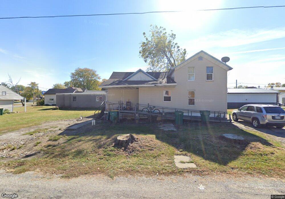
113 E Grove St Streator, IL 61364
Estimated Value: $61,000 - $95,000
Studio
2
Baths
1,737
Sq Ft
$47/Sq Ft
Est. Value
About This Home
This home is located at 113 E Grove St, Streator, IL 61364 and is currently estimated at $81,512, approximately $46 per square foot. 113 E Grove St is a home located in LaSalle County with nearby schools including Centennial Elementary School, Northlawn Junior High School, and Streator Township High School.
Ownership History
Date
Name
Owned For
Owner Type
Purchase Details
Closed on
Jan 31, 2013
Sold by
Bantry Bay Properties Llc
Bought by
Mendoza Jose
Current Estimated Value
Purchase Details
Closed on
Jun 30, 2008
Sold by
Bank Of Pontiac
Bought by
Bantry Bay Properties Llc
Home Financials for this Owner
Home Financials are based on the most recent Mortgage that was taken out on this home.
Original Mortgage
$25,000
Interest Rate
6.1%
Mortgage Type
Future Advance Clause Open End Mortgage
Purchase Details
Closed on
Feb 22, 2008
Sold by
Rider Paul A and Rider Paul
Bought by
Bank Of Pontiac
Create a Home Valuation Report for This Property
The Home Valuation Report is an in-depth analysis detailing your home's value as well as a comparison with similar homes in the area
Home Values in the Area
Average Home Value in this Area
Purchase History
| Date | Buyer | Sale Price | Title Company |
|---|---|---|---|
| Mendoza Jose | $35,000 | None Available | |
| Bantry Bay Properties Llc | $25,000 | None Available | |
| Bank Of Pontiac | -- | None Available |
Source: Public Records
Mortgage History
| Date | Status | Borrower | Loan Amount |
|---|---|---|---|
| Previous Owner | Bantry Bay Properties Llc | $25,000 |
Source: Public Records
Tax History
| Year | Tax Paid | Tax Assessment Tax Assessment Total Assessment is a certain percentage of the fair market value that is determined by local assessors to be the total taxable value of land and additions on the property. | Land | Improvement |
|---|---|---|---|---|
| 2024 | $767 | $7,170 | $2,561 | $4,609 |
| 2023 | $709 | $6,157 | $2,199 | $3,958 |
| 2022 | $650 | $5,379 | $1,921 | $3,458 |
| 2021 | $621 | $5,076 | $1,813 | $3,263 |
| 2020 | $599 | $4,916 | $1,756 | $3,160 |
| 2019 | $572 | $4,605 | $1,645 | $2,960 |
| 2018 | $570 | $4,389 | $1,568 | $2,821 |
| 2017 | $563 | $4,366 | $1,560 | $2,806 |
| 2016 | $577 | $4,687 | $1,675 | $3,012 |
| 2015 | $620 | $4,614 | $1,649 | $2,965 |
| 2012 | -- | $5,302 | $1,895 | $3,407 |
Source: Public Records
Map
Nearby Homes
- 1002 N Park St
- 910 N Bloomington St
- 112 W Grant St
- 215 Prospect Ave
- 512 E Bronson St
- 324 W Sumner St
- 107 W Larue St
- 906 N Wasson St
- 304 W Morrell St
- 424 W Bluff St
- 608 N Wasson St
- 118 W 3rd St
- 509 W Grant St
- 619 W Bluff St
- 1712 N Bloomington St
- 710 Short St
- Lot 1 E 1st St
- 1003 Bazore St
- 703 Iowa Ave
- North Illinois 23
- 1118 N Park St
- 1116 N Park St
- 1202 N Park St
- 1114 N Park St
- 110 E Grove St
- 108 E Bronson St
- 105 E Grove St
- 211-215 E Grove St
- 110 E Bronson St
- 112 E Bronson St
- 106 E Grove St
- 1112 N Park St
- 104 E Grove St
- 1117 N Park St
- 101 E Grove St
- 109 E Bluff St
- 102 E Grove St
- 1115 N Park St
- 202 E Grove St
- 1107 N Park St
Your Personal Tour Guide
Ask me questions while you tour the home.