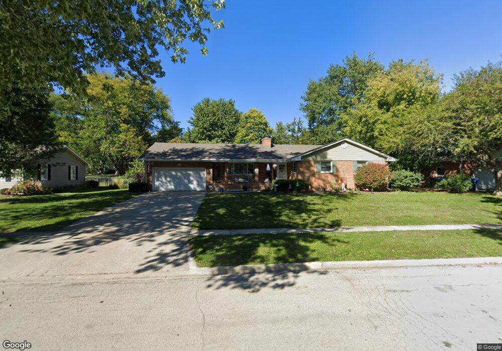
113 Forsythe Ln Dekalb, IL 60115
Estimated Value: $297,000 - $318,000
4
Beds
3
Baths
2,220
Sq Ft
$140/Sq Ft
Est. Value
About This Home
This home is located at 113 Forsythe Ln, Dekalb, IL 60115 and is currently estimated at $310,348, approximately $139 per square foot. 113 Forsythe Ln is a home located in DeKalb County with nearby schools including Jefferson Elementary School, Clinton Rosette Middle School, and De Kalb High School.
Ownership History
Date
Name
Owned For
Owner Type
Purchase Details
Closed on
Apr 17, 2017
Sold by
Andreasen Haakon L and Andreasen Carol J
Bought by
Kunigonis Michael and Kunigonis Amy
Current Estimated Value
Home Financials for this Owner
Home Financials are based on the most recent Mortgage that was taken out on this home.
Original Mortgage
$169,100
Outstanding Balance
$140,291
Interest Rate
4.1%
Mortgage Type
New Conventional
Estimated Equity
$170,057
Create a Home Valuation Report for This Property
The Home Valuation Report is an in-depth analysis detailing your home's value as well as a comparison with similar homes in the area
Home Values in the Area
Average Home Value in this Area
Purchase History
| Date | Buyer | Sale Price | Title Company |
|---|---|---|---|
| Kunigonis Michael | $178,000 | -- |
Source: Public Records
Mortgage History
| Date | Status | Borrower | Loan Amount |
|---|---|---|---|
| Open | Kunigonis Michael | $169,100 |
Source: Public Records
Tax History Compared to Growth
Tax History
| Year | Tax Paid | Tax Assessment Tax Assessment Total Assessment is a certain percentage of the fair market value that is determined by local assessors to be the total taxable value of land and additions on the property. | Land | Improvement |
|---|---|---|---|---|
| 2024 | $6,175 | $82,117 | $15,229 | $66,888 |
| 2023 | $6,175 | $71,599 | $13,278 | $58,321 |
| 2022 | $6,000 | $65,370 | $15,154 | $50,216 |
| 2021 | $6,121 | $61,311 | $14,213 | $47,098 |
| 2020 | $6,248 | $60,333 | $13,986 | $46,347 |
| 2019 | $6,098 | $57,962 | $13,436 | $44,526 |
| 2018 | $5,930 | $55,996 | $12,980 | $43,016 |
| 2017 | $5,334 | $53,827 | $12,477 | $41,350 |
| 2016 | $5,240 | $52,468 | $12,162 | $40,306 |
| 2015 | -- | $49,714 | $11,524 | $38,190 |
| 2014 | -- | $49,923 | $16,674 | $33,249 |
| 2013 | -- | $52,440 | $17,515 | $34,925 |
Source: Public Records
Map
Nearby Homes
- 225 Delcy Dr
- 124 Tilton Park Dr
- 125 Tilton Park Dr
- 114 Joanne Ln
- 437 W Hillcrest Dr
- 1882 Tallmeadow Dr
- 717 N 1st St
- 2820 N 1st St
- 950 Sycamore Rd
- 911 N 9th St
- 845 N 10th St
- 582 W Dresser Rd
- 828 N 9th St
- 827 N 11th St
- 959 N 12th St
- 1005 N 13th St
- 230 Augusta Ave
- 345 Augusta Ave
- 305 College Ave
- 322 College Ave