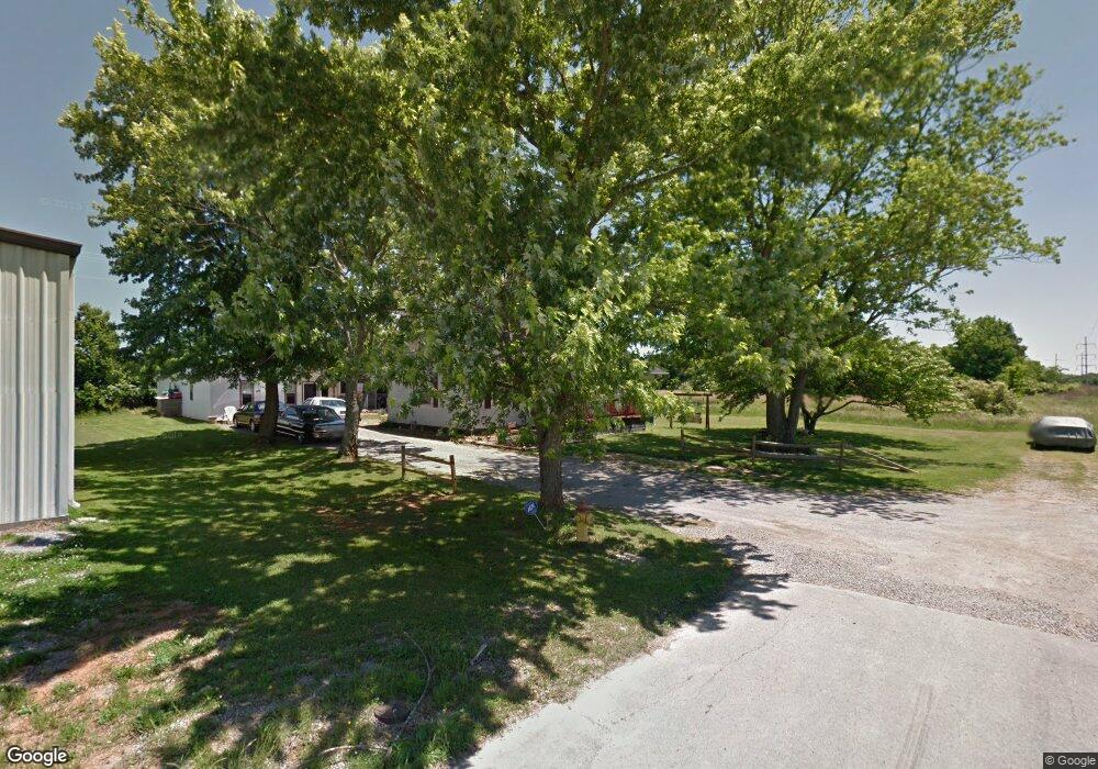
113 Hay St Shelbyville, TN 37160
Estimated Value: $189,358 - $276,000
--
Bed
1
Bath
1,148
Sq Ft
$203/Sq Ft
Est. Value
About This Home
This home is located at 113 Hay St, Shelbyville, TN 37160 and is currently estimated at $232,840, approximately $202 per square foot. 113 Hay St is a home located in Bedford County with nearby schools including Harris Middle School and Victory Baptist Academy.
Ownership History
Date
Name
Owned For
Owner Type
Purchase Details
Closed on
Jan 24, 2011
Sold by
Sanborn Charles H
Bought by
Wall Derek E
Current Estimated Value
Home Financials for this Owner
Home Financials are based on the most recent Mortgage that was taken out on this home.
Original Mortgage
$59,055
Outstanding Balance
$40,281
Interest Rate
4.79%
Estimated Equity
$192,559
Purchase Details
Closed on
Dec 16, 2005
Sold by
Jacobs Terry R
Bought by
Sanborn Charles H
Purchase Details
Closed on
Oct 25, 1999
Sold by
Jacobs Ralph
Bought by
Jacobs Terry R and Jacobs Vicki L
Home Financials for this Owner
Home Financials are based on the most recent Mortgage that was taken out on this home.
Original Mortgage
$44,800
Interest Rate
7.76%
Purchase Details
Closed on
Jan 1, 1986
Bought by
Jacobs Ralph Lois
Create a Home Valuation Report for This Property
The Home Valuation Report is an in-depth analysis detailing your home's value as well as a comparison with similar homes in the area
Home Values in the Area
Average Home Value in this Area
Purchase History
| Date | Buyer | Sale Price | Title Company |
|---|---|---|---|
| Wall Derek E | $71,800 | -- | |
| Sanborn Charles H | $64,000 | -- | |
| Jacobs Terry R | $56,000 | -- | |
| Jacobs Ralph Lois | $41,500 | -- |
Source: Public Records
Mortgage History
| Date | Status | Borrower | Loan Amount |
|---|---|---|---|
| Open | Wall Derek E | $59,055 | |
| Previous Owner | Jacobs Ralph Lois | $44,800 |
Source: Public Records
Tax History Compared to Growth
Tax History
| Year | Tax Paid | Tax Assessment Tax Assessment Total Assessment is a certain percentage of the fair market value that is determined by local assessors to be the total taxable value of land and additions on the property. | Land | Improvement |
|---|---|---|---|---|
| 2025 | -- | $35,625 | $0 | $0 |
| 2024 | -- | $35,625 | $4,025 | $31,600 |
| 2023 | $1,355 | $35,625 | $4,025 | $31,600 |
| 2022 | $1,394 | $35,625 | $4,025 | $31,600 |
| 2021 | $1,266 | $35,625 | $4,025 | $31,600 |
| 2020 | $973 | $35,625 | $4,025 | $31,600 |
| 2019 | $973 | $21,950 | $3,875 | $18,075 |
| 2018 | $942 | $21,950 | $3,875 | $18,075 |
| 2017 | $942 | $21,750 | $3,875 | $17,875 |
| 2014 | $728 | $18,577 | $0 | $0 |
Source: Public Records
Map
Nearby Homes
- 204 S Hillcrest Dr
- 1404 Cypress St
- 1024 Tennessee 64
- 107 Rockwood Dr
- 1725 Wartrace Pike
- 225 Eagle Blvd
- 314 Maplewood Dr
- 207 Martha St
- 1683 Madison St
- 211 S Fairoak St
- 631 E Lane St
- 627 E Lane St
- 112 Elizabeth St
- 215 Coney Island Rd
- 104 Curbow Ct
- 108 Virginia Ct
- 117 Blue Ribbon Pkwy
- 807 Shoma Dr
- 464 Whitthorne St
- 11 Amos Smith Rd
- 140 Hay St Unit 82-E
- 129 Hay St Unit 82-E
- 125 Hay St Unit 82-E
- 101 Hay St
- 1210 Madison St
- 271 Anthony Ln
- 1100 Madison St
- 277 Anthony Ln
- 263 Anthony Ln
- 0 Anthony Ln
- 1057 Madison St
- 312 Neely Ave
- 1113 Madison St
- 1052 Madison St
- 1115 Madison St
- 245 Anthony Ln
- 1111 Madison St
- 1301 Birch St
- 400 Neely Ave
- 223 Anthony Ln
