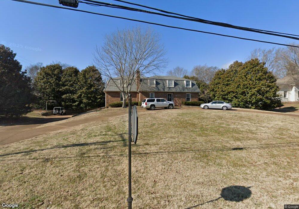
113 High Lea Rd Brentwood, TN 37027
Estimated Value: $1,090,000 - $1,626,000
--
Bed
3
Baths
3,558
Sq Ft
$354/Sq Ft
Est. Value
About This Home
This home is located at 113 High Lea Rd, Brentwood, TN 37027 and is currently estimated at $1,258,762, approximately $353 per square foot. 113 High Lea Rd is a home located in Williamson County with nearby schools including Scales Elementary School, Brentwood Middle School, and Brentwood High School.
Ownership History
Date
Name
Owned For
Owner Type
Purchase Details
Closed on
Aug 20, 2001
Sold by
Mayhugh Mark D and Mayhugh Cindy L
Bought by
Mayhugh Mary Darwin and Mayhugh Cindy Leigh
Current Estimated Value
Purchase Details
Closed on
May 19, 2000
Sold by
Brackin Henry B and Brackin Sanom
Bought by
Mayhugh Mark D and Mayhugh Cindy L
Home Financials for this Owner
Home Financials are based on the most recent Mortgage that was taken out on this home.
Original Mortgage
$231,100
Outstanding Balance
$79,003
Interest Rate
8.2%
Estimated Equity
$1,179,759
Purchase Details
Closed on
Jul 5, 1996
Sold by
Wayne Tidwell Larry
Bought by
Brackin Henry B
Create a Home Valuation Report for This Property
The Home Valuation Report is an in-depth analysis detailing your home's value as well as a comparison with similar homes in the area
Home Values in the Area
Average Home Value in this Area
Purchase History
| Date | Buyer | Sale Price | Title Company |
|---|---|---|---|
| Mayhugh Mary Darwin | -- | -- | |
| Mayhugh Mark D | $288,900 | Lehman Land Title Inc | |
| Brackin Henry B | $190,000 | -- | |
| Tidwell Candida G | -- | -- |
Source: Public Records
Mortgage History
| Date | Status | Borrower | Loan Amount |
|---|---|---|---|
| Open | Mayhugh Mark D | $231,100 | |
| Closed | Mayhugh Mark D | $28,920 |
Source: Public Records
Tax History Compared to Growth
Tax History
| Year | Tax Paid | Tax Assessment Tax Assessment Total Assessment is a certain percentage of the fair market value that is determined by local assessors to be the total taxable value of land and additions on the property. | Land | Improvement |
|---|---|---|---|---|
| 2025 | $3,804 | $327,075 | $150,000 | $177,075 |
| 2024 | $3,804 | $175,325 | $78,750 | $96,575 |
| 2023 | $3,804 | $175,325 | $78,750 | $96,575 |
| 2022 | $3,804 | $175,325 | $78,750 | $96,575 |
| 2021 | $3,804 | $175,325 | $78,750 | $96,575 |
| 2020 | $3,435 | $133,175 | $53,750 | $79,425 |
| 2019 | $3,435 | $133,175 | $53,750 | $79,425 |
| 2018 | $3,342 | $133,175 | $53,750 | $79,425 |
| 2017 | $3,316 | $133,175 | $53,750 | $79,425 |
| 2016 | $0 | $133,175 | $53,750 | $79,425 |
| 2015 | -- | $109,125 | $43,750 | $65,375 |
| 2014 | $480 | $109,125 | $43,750 | $65,375 |
Source: Public Records
Map
Nearby Homes
- 6103 Bryan Place
- 1307 Old Hickory Blvd
- 1222 Old Hickory Blvd
- 922 Dorset Dr
- 321 Granny White Pike
- 1404 Old Hickory Blvd
- 309 Hayeswood Dr
- 6224 Waxwood Ct
- 528 Waxwood Dr
- 6101 Belle Rive Dr
- 1144 Oman Dr
- 6301 Belle Rive Dr
- 5218 Meadowlake Rd
- 57 Annandale
- 520 Dekemont Ln
- 1613 Windy Ridge Dr
- 1122 Oman Dr
- 6313 Wescates Ct
- 1708 Woodsong Dr
- 6321 Wescates Ct
- 111 High Lea Rd
- 6033 Wellesley Way
- 112 Long Valley Rd
- 6035 Wellesley Way
- 114 Long Valley Rd
- 110 Long Valley Rd
- 6037 Wellesley Way
- 6031 Wellesley Way
- 108 Long Valley Rd
- 116 Long Valley Rd
- 6039 Wellesley Way
- 6020 Maryland Way
- 6029 Wellesley Way
- 203 High Lea Rd
- 200 High Lea Rd
- 6030 Wellesley Way
- 6041 Wellesley Way
- 6027 Wellesley Way
- 200 Long Valley Rd
- 6028 Wellesley Way