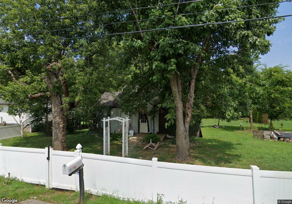
113 Mcbride St McMinnville, TN 37110
Estimated Value: $149,498 - $203,000
--
Bed
1
Bath
856
Sq Ft
$196/Sq Ft
Est. Value
About This Home
This home is located at 113 Mcbride St, McMinnville, TN 37110 and is currently estimated at $167,375, approximately $195 per square foot. 113 Mcbride St is a home located in Warren County with nearby schools including Bobby Ray Memorial Elementary School, Warren County Middle School, and Warren County High School.
Ownership History
Date
Name
Owned For
Owner Type
Purchase Details
Closed on
Nov 8, 2024
Sold by
Jones Roddey Mary and Roddey Mary K
Bought by
Mary J Roddey Living Trust and Roddey
Current Estimated Value
Purchase Details
Closed on
Mar 8, 1999
Sold by
Boyd Jimmy A
Bought by
Roddey William R and Roddey Mary J
Purchase Details
Closed on
Mar 5, 1999
Bought by
Reece Roddey William and Jones Mary
Purchase Details
Closed on
Feb 23, 1999
Bought by
Booker Carl
Purchase Details
Closed on
Oct 24, 1989
Bought by
Boyd Jimmy A and Boyd Shannon
Create a Home Valuation Report for This Property
The Home Valuation Report is an in-depth analysis detailing your home's value as well as a comparison with similar homes in the area
Home Values in the Area
Average Home Value in this Area
Purchase History
| Date | Buyer | Sale Price | Title Company |
|---|---|---|---|
| Mary J Roddey Living Trust | -- | Waterstone Title | |
| Mary J Roddey Living Trust | -- | Waterstone Title | |
| Roddey William R | $20,750 | -- | |
| Reece Roddey William | $20,800 | -- | |
| Booker Carl | $19,300 | -- | |
| Boyd Jimmy A | $3,500 | -- |
Source: Public Records
Tax History Compared to Growth
Tax History
| Year | Tax Paid | Tax Assessment Tax Assessment Total Assessment is a certain percentage of the fair market value that is determined by local assessors to be the total taxable value of land and additions on the property. | Land | Improvement |
|---|---|---|---|---|
| 2024 | -- | $10,475 | $2,300 | $8,175 |
| 2023 | $426 | $10,475 | $2,300 | $8,175 |
| 2022 | $400 | $10,475 | $2,300 | $8,175 |
| 2021 | $400 | $10,475 | $2,300 | $8,175 |
| 2020 | $194 | $10,475 | $2,300 | $8,175 |
| 2019 | $405 | $9,350 | $2,250 | $7,100 |
| 2018 | $379 | $9,350 | $2,250 | $7,100 |
| 2017 | $379 | $9,350 | $2,250 | $7,100 |
| 2016 | $379 | $9,350 | $2,250 | $7,100 |
| 2015 | $381 | $9,350 | $2,250 | $7,100 |
| 2014 | $367 | $9,350 | $2,250 | $7,100 |
| 2013 | $367 | $8,990 | $0 | $0 |
Source: Public Records
Map
Nearby Homes
- 123 Mount View Ave
- 108 King St
- 108 Van Buren St
- 139 Lance St
- 119 Virginia St
- 118 Van Buren St
- 113 Havron St
- 104 Virginia St
- 107 Grundy St
- 101 Falla St
- 305 W Sparta St
- 226 Roosevelt Rd
- 117 Crain St
- 218 Roosevelt Rd
- 127 Jefferson St
- 635 N Spring St
- 215 W Sparta St
- 103 Franklin St
- 422 Pace St
- 418 Pace St
- 111 Mcbride St
- 115 Mcbride St
- 124 Mount View Ave
- 109 Mcbride St
- 125 Mount View Ave
- 122 Mount View Ave
- 105 Mcbride St
- 117 Mcbride St
- 120 Mount View Ave
- 121 Mount View Ave
- 103 Mcbride St
- 124 King St
- 118 Mount View Ave
- 122 King St
- 119 Mount View Ave Unit 2
- 119 Mount View Ave Unit 3
- 120 King St
- 116 Mount View Ave
- 118 King St
- 117 Mount View Ave