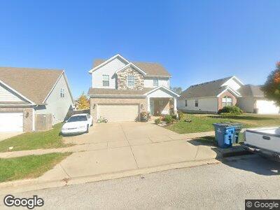
113 Meadowcrest Dr Georgetown, KY 40324
South Scott County NeighborhoodEstimated Value: $324,068 - $379,000
4
Beds
3
Baths
1,904
Sq Ft
$187/Sq Ft
Est. Value
About This Home
This home is located at 113 Meadowcrest Dr, Georgetown, KY 40324 and is currently estimated at $356,017, approximately $186 per square foot. 113 Meadowcrest Dr is a home located in Scott County with nearby schools including Lemons Mill Elementary School, Creekside Elementary School, and Georgetown Middle School.
Ownership History
Date
Name
Owned For
Owner Type
Purchase Details
Closed on
May 23, 2018
Sold by
Harmony Hb Llc
Bought by
Baird Daniel and Baird Amy L
Current Estimated Value
Home Financials for this Owner
Home Financials are based on the most recent Mortgage that was taken out on this home.
Original Mortgage
$219,602
Interest Rate
4.4%
Mortgage Type
New Conventional
Purchase Details
Closed on
Mar 6, 2018
Sold by
Dennis Anderson Lemons Mill Development
Bought by
Harmony Hb Llc
Create a Home Valuation Report for This Property
The Home Valuation Report is an in-depth analysis detailing your home's value as well as a comparison with similar homes in the area
Home Values in the Area
Average Home Value in this Area
Purchase History
| Date | Buyer | Sale Price | Title Company |
|---|---|---|---|
| Baird Daniel | $231,160 | Bluegrass Land Title Llc | |
| Harmony Hb Llc | $40,587 | None Available |
Source: Public Records
Mortgage History
| Date | Status | Borrower | Loan Amount |
|---|---|---|---|
| Open | Baird Daniel | $214,000 | |
| Closed | Baird Daniel | $219,602 |
Source: Public Records
Tax History Compared to Growth
Tax History
| Year | Tax Paid | Tax Assessment Tax Assessment Total Assessment is a certain percentage of the fair market value that is determined by local assessors to be the total taxable value of land and additions on the property. | Land | Improvement |
|---|---|---|---|---|
| 2024 | $2,497 | $277,700 | $0 | $0 |
| 2023 | $2,360 | $260,300 | $45,000 | $215,300 |
| 2022 | $1,965 | $231,160 | $42,000 | $189,160 |
| 2021 | $2,178 | $231,160 | $42,000 | $189,160 |
| 2020 | $1,986 | $231,160 | $42,000 | $189,160 |
| 2019 | $2,018 | $231,160 | $0 | $0 |
| 2018 | $217 | $25,000 | $0 | $0 |
| 2017 | $218 | $25,000 | $0 | $0 |
| 2016 | $201 | $25,000 | $0 | $0 |
| 2015 | $200 | $25,000 | $0 | $0 |
| 2014 | $207 | $25,000 | $0 | $0 |
| 2011 | $16 | $25,000 | $0 | $0 |
Source: Public Records
Map
Nearby Homes
- 127 Meadowcrest Dr
- 214 Pleasant View Dr
- 166 Ruth Miller Dr
- 158 Ruth Miller Dr
- 170 Ruth Miller Dr
- 164 Ruth Miller Dr
- 160 Ruth Miller Dr
- 156 Ruth Miller Dr
- 152 Ruth Miller Dr
- 140 Ruth Miller Dr
- 94 Ruth Miller Dr
- 96 Ruth Miller Dr
- 88 Ruth Miller Dr
- 103 Sun Drop Ln
- 174 Ruth Miller Dr
- 147 Ruth Miller Dr
- 89 Ruth Miller Dr
- 145 Ruth Miller Dr
- 143 Ruth Miller Dr
- 168 Ruth Miller Dr
- 113 Meadowcrest Dr
- 115 Meadowcrest Dr
- 111 Meadowcrest Dr
- 109 Meadowcrest Dr
- 112 Summit Dr
- 110 Summit Dr
- 114 Summit Dr
- 119 Meadowcrest Dr
- 107 Meadowcrest Dr
- 108 Summit Dr
- 116 Summit Dr
- 110 Meadowcrest Dr
- 112 Meadowcrest Dr
- 108 Meadowcrest Dr
- 106 Summit Dr
- 114 Meadowcrest Dr
- 121 Meadowcrest Dr
- 105 Meadowcrest Dr
- 118 Summit Dr
- 106 Meadowcrest Dr