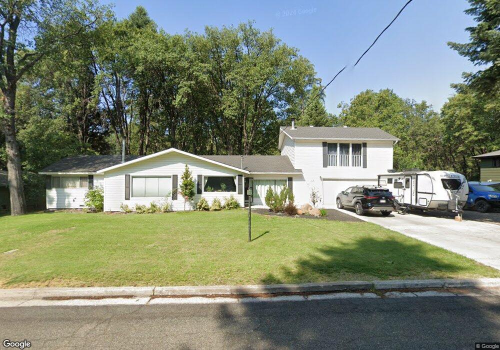
113 N Adams Dr Mount Shasta, CA 96067
Estimated Value: $532,000 - $625,384
3
Beds
2
Baths
2,430
Sq Ft
$240/Sq Ft
Est. Value
About This Home
This home is located at 113 N Adams Dr, Mount Shasta, CA 96067 and is currently estimated at $582,846, approximately $239 per square foot. 113 N Adams Dr is a home located in Siskiyou County with nearby schools including Mt. Shasta Elementary School, Mt. Shasta High School, and Golden Eagle Charter School.
Ownership History
Date
Name
Owned For
Owner Type
Purchase Details
Closed on
Sep 10, 2020
Sold by
Jaffe James L
Bought by
Rowley Emily I and Rowley Kyle M
Current Estimated Value
Home Financials for this Owner
Home Financials are based on the most recent Mortgage that was taken out on this home.
Original Mortgage
$310,000
Outstanding Balance
$274,594
Interest Rate
2.8%
Mortgage Type
New Conventional
Estimated Equity
$308,252
Purchase Details
Closed on
Aug 2, 2001
Sold by
Jaffe James Louis
Bought by
Jaffe James L
Create a Home Valuation Report for This Property
The Home Valuation Report is an in-depth analysis detailing your home's value as well as a comparison with similar homes in the area
Home Values in the Area
Average Home Value in this Area
Purchase History
| Date | Buyer | Sale Price | Title Company |
|---|---|---|---|
| Rowley Emily I | $387,500 | Mt Shasta T&E Co | |
| Jaffe James L | -- | -- |
Source: Public Records
Mortgage History
| Date | Status | Borrower | Loan Amount |
|---|---|---|---|
| Open | Rowley Emily I | $310,000 |
Source: Public Records
Tax History Compared to Growth
Tax History
| Year | Tax Paid | Tax Assessment Tax Assessment Total Assessment is a certain percentage of the fair market value that is determined by local assessors to be the total taxable value of land and additions on the property. | Land | Improvement |
|---|---|---|---|---|
| 2025 | $4,113 | $388,152 | $82,264 | $305,888 |
| 2023 | $4,113 | $373,081 | $79,070 | $294,011 |
| 2022 | $3,902 | $360,570 | $77,520 | $283,050 |
| 2021 | $3,836 | $353,500 | $76,000 | $277,500 |
| 2020 | $3,534 | $321,646 | $83,385 | $238,261 |
| 2019 | $3,470 | $315,340 | $81,750 | $233,590 |
| 2018 | $3,403 | $309,158 | $80,148 | $229,010 |
| 2017 | $3,370 | $303,097 | $78,577 | $224,520 |
| 2016 | $3,306 | $297,155 | $77,037 | $220,118 |
| 2015 | $3,262 | $292,692 | $75,880 | $216,812 |
| 2014 | $3,203 | $286,959 | $74,394 | $212,565 |
Source: Public Records
Map
Nearby Homes
- 509 Mccloud Ave
- 1007 Mccloud Ave
- 506 Eiler Rd
- 109 N Washington Dr
- 208 Mccloud Ave
- 114 Smith St
- 0 Alma St Apn #057-203-040
- Parcel 1,2,3 Pine Field St
- lot 7 Ream Ave
- parcel 3 Deetz Rd
- 718 Buena Vista Ct
- 0 Berry St
- 1539 Eddy Dr
- 322 E Jessie St
- 00 S Mount Shasta Blvd
- 1227 Eddy Dr
- 312 W Alma St
- 0 S Mount Shasta Blvd
- 201 Terry Lynn Ave
- 704 Marjorie St
- 115 N Adams Dr
- 201 N Adams Dr
- 203 N Adams Dr
- 530 Mccloud Ave
- 102 N Adams Dr
- 528 Mccloud Ave
- 204 N Adams Dr
- 526 Mccloud Ave
- 700 Mccloud Ave
- 524 Mccloud Ave
- 522 Mccloud Ave
- 815 Mormon Way
- 802 Mccloud Ave
- 215 N Adams Dr
- 520 Mccloud Ave
- 804 Mccloud Ave
- 516 Mccloud Ave
- 518 Mccloud Ave
- 533 Mccloud Ave
- 217 N Adams Dr