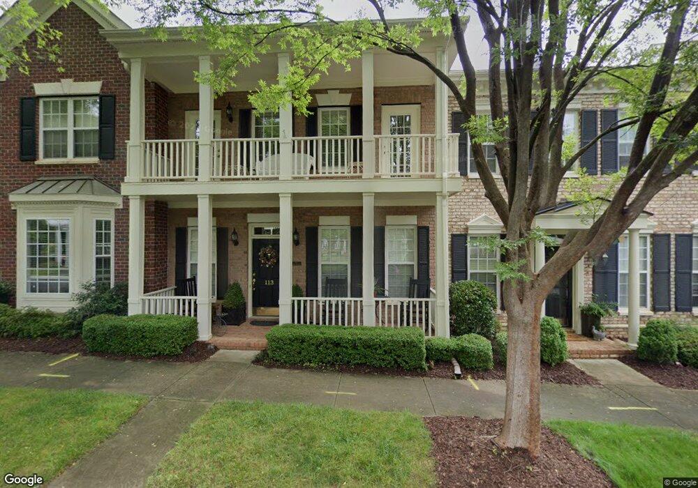
113 N Faulkner Way Unit 179 Davidson, NC 28036
Estimated Value: $601,830 - $623,000
3
Beds
3
Baths
2,014
Sq Ft
$305/Sq Ft
Est. Value
About This Home
This home is located at 113 N Faulkner Way Unit 179, Davidson, NC 28036 and is currently estimated at $613,458, approximately $304 per square foot. 113 N Faulkner Way Unit 179 is a home located in Mecklenburg County with nearby schools including Davidson Elementary School, William Amos Hough High School, and Davidson Green School.
Ownership History
Date
Name
Owned For
Owner Type
Purchase Details
Closed on
Nov 24, 2025
Sold by
Mcdonald Jane Kincheloe
Bought by
Veit Frederick Malcolm and Veit Barbara Ann
Current Estimated Value
Purchase Details
Closed on
May 25, 2016
Sold by
Nott Ronald T and Nott Susan J
Bought by
Mcdonald Jane
Purchase Details
Closed on
Jun 20, 2006
Sold by
Norris Gayle C
Bought by
Nott Ronald T and Nott Susan J
Home Financials for this Owner
Home Financials are based on the most recent Mortgage that was taken out on this home.
Original Mortgage
$284,000
Interest Rate
6.51%
Mortgage Type
Purchase Money Mortgage
Purchase Details
Closed on
May 9, 2003
Sold by
The Cunnane Group Inc
Bought by
Norris Gayle C
Home Financials for this Owner
Home Financials are based on the most recent Mortgage that was taken out on this home.
Original Mortgage
$125,000
Interest Rate
5.86%
Mortgage Type
Purchase Money Mortgage
Create a Home Valuation Report for This Property
The Home Valuation Report is an in-depth analysis detailing your home's value as well as a comparison with similar homes in the area
Home Values in the Area
Average Home Value in this Area
Purchase History
| Date | Buyer | Sale Price | Title Company |
|---|---|---|---|
| Veit Frederick Malcolm | $535,000 | None Listed On Document | |
| Veit Frederick Malcolm | $535,000 | None Listed On Document | |
| Mcdonald Jane | $304,000 | None Available | |
| Mcdonald Jane | $304,000 | None Available | |
| Nott Ronald T | $355,000 | None Available | |
| Nott Ronald T | $355,000 | None Available | |
| Norris Gayle C | $235,000 | -- | |
| Norris Gayle C | $235,000 | -- |
Source: Public Records
Mortgage History
| Date | Status | Borrower | Loan Amount |
|---|---|---|---|
| Previous Owner | Nott Ronald T | $284,000 | |
| Previous Owner | Norris Gayle C | $125,000 |
Source: Public Records
Tax History Compared to Growth
Tax History
| Year | Tax Paid | Tax Assessment Tax Assessment Total Assessment is a certain percentage of the fair market value that is determined by local assessors to be the total taxable value of land and additions on the property. | Land | Improvement |
|---|---|---|---|---|
| 2025 | $3,665 | $482,700 | $105,000 | $377,700 |
| 2024 | $3,665 | $482,700 | $105,000 | $377,700 |
| 2023 | $3,612 | $482,700 | $105,000 | $377,700 |
| 2022 | $3,576 | $375,500 | $105,000 | $270,500 |
| 2021 | $3,646 | $375,500 | $105,000 | $270,500 |
| 2020 | $3,646 | $375,500 | $105,000 | $270,500 |
| 2019 | $3,640 | $375,500 | $105,000 | $270,500 |
| 2018 | $3,563 | $284,200 | $60,000 | $224,200 |
| 2017 | $3,538 | $284,200 | $60,000 | $224,200 |
| 2016 | $3,534 | $284,200 | $60,000 | $224,200 |
| 2015 | $3,531 | $284,200 | $60,000 | $224,200 |
| 2014 | $3,529 | $304,200 | $60,000 | $244,200 |
Source: Public Records
Map
Nearby Homes
- 168 Harper Lee St
- 155 Harper Lee St
- 261 Conroy Ave
- 172 Harper Lee St
- 238 Fairview Ln
- 235 Grey Rd
- 130 Copper Pine Ln Unit 1
- 129 Hunt Camp Trail Unit 15
- 757 Concord Rd
- 866 Concord Rd
- 200 N Downing St
- 720 Dogwood Ln
- 1925 Davis Rd
- 306 Ashby Dr
- 1022 Churchill Rd
- 606 Ardrey Cir
- 208 Kimberly Rd
- 239 Kimberly Rd
- 19104 Newburg Hill Rd
- 19035 Newburg Hill Rd
- 111 N Faulkner Way
- 117 N Faulkner Way Unit GRG
- 117 N Faulkner Way Unit B
- 117 N Faulkner Way
- 115 N Faulkner Way
- 115 N Faulkner Way Unit 115
- 109 N Faulkner Way Unit *
- 121 N Faulkner Way Unit B
- 121 N Faulkner Way
- 119 N Faulkner Way
- 119 N Faulkner Way Unit 182
- 119 N Faulkner Way Unit 37
- 121-B N Faulkner Way
- 110 N Faulkner Way Unit 110
- 110 N Faulkner Way
- 108 N Faulkner Way
- 136 Harper Lee St
- 213 N Faulkner Way
- 213 N Faulkner Way Unit 213
- 134 Harper Lee St