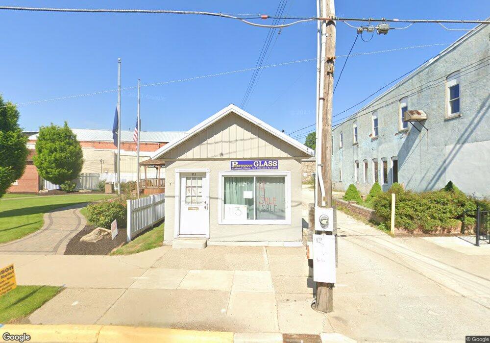
113 N Matteson St Bronson, MI 49028
Estimated Value: $47,963
--
Bed
--
Bath
--
Sq Ft
4,356
Sq Ft Lot
About This Home
This home is located at 113 N Matteson St, Bronson, MI 49028 and is currently estimated at $47,963. 113 N Matteson St is a home located in Branch County with nearby schools including Anderson Elementary School, Ryan Elementary School, and Bronson Junior/Senior High School.
Ownership History
Date
Name
Owned For
Owner Type
Purchase Details
Closed on
Feb 13, 2024
Sold by
Mahaffa James and Reese Michelle
Bought by
Pena Tiburcio Cruz and Lopez Maria Miriam
Current Estimated Value
Purchase Details
Closed on
Nov 1, 2011
Sold by
Mcclish Michelle K and Mcclish William R
Bought by
Reese Sherrie L
Purchase Details
Closed on
Oct 22, 2008
Sold by
Sharp Carl and Lawson Sharp Gloria
Bought by
Mcclish William R and Mcclish Michelle
Home Financials for this Owner
Home Financials are based on the most recent Mortgage that was taken out on this home.
Original Mortgage
$14,625
Interest Rate
5.94%
Mortgage Type
Commercial
Create a Home Valuation Report for This Property
The Home Valuation Report is an in-depth analysis detailing your home's value as well as a comparison with similar homes in the area
Home Values in the Area
Average Home Value in this Area
Purchase History
| Date | Buyer | Sale Price | Title Company |
|---|---|---|---|
| Pena Tiburcio Cruz | $43,000 | None Listed On Document | |
| Mahaffa James E | $30,000 | None Listed On Document | |
| Reese Sherrie L | $15,000 | None Available | |
| Mcclish William R | $19,500 | None Available |
Source: Public Records
Mortgage History
| Date | Status | Borrower | Loan Amount |
|---|---|---|---|
| Previous Owner | Mcclish William R | $14,625 |
Source: Public Records
Tax History Compared to Growth
Tax History
| Year | Tax Paid | Tax Assessment Tax Assessment Total Assessment is a certain percentage of the fair market value that is determined by local assessors to be the total taxable value of land and additions on the property. | Land | Improvement |
|---|---|---|---|---|
| 2025 | $609 | $13,600 | $0 | $0 |
| 2024 | $268 | $13,000 | $0 | $0 |
| 2023 | $250 | $10,400 | $0 | $0 |
| 2022 | $560 | $10,100 | $0 | $0 |
| 2021 | -- | $9,200 | $0 | $0 |
| 2020 | -- | $8,800 | $0 | $0 |
| 2019 | -- | $7,700 | $0 | $0 |
| 2018 | -- | $8,000 | $0 | $0 |
| 2017 | -- | $7,100 | $0 | $0 |
| 2016 | -- | $7,300 | $0 | $0 |
| 2015 | -- | $6,600 | $0 | $0 |
| 2014 | -- | $7,000 | $0 | $0 |
| 2013 | -- | $6,900 | $0 | $0 |
Source: Public Records
Map
Nearby Homes
- 313 N Matteson St
- 214 E Chicago St
- 147 Winona St
- 151 E Corey St
- 337 N Walker St
- 150 Washington St
- 410 Franklin St
- 544 E Chicago St
- 325 N Lincoln St
- 609 E Railroad St
- 695 W Chicago Rd
- V/L Prairie River Rd
- 769 Kosmerick Rd
- 130 Osborn Rd
- 1052 Carpenter Rd
- 406 Taggart Rd
- 786 W Colon Rd
- 912 W Colon Rd
- 1232 Smoker Rd
- 0 Rierson Rd
- 119 N Matteson St
- 121 N Matteson St
- 123 N Matteson St
- 103 E Chicago St
- 114 W Chicago St
- 120 N Matteson St
- 127 N Matteson St
- 124 N Matteson St
- 111 E Chicago St
- 109 E Chicago St
- 113 E Chicago St
- 111 W Chicago St
- 115 E Chicago St
- 130 N Matteson St
- 113 W Chicago St
- 103 W Chicago St
- 210 N Matteson St
- 120 S Matteson St
- 138 W Chicago St
- 119 W Chicago St