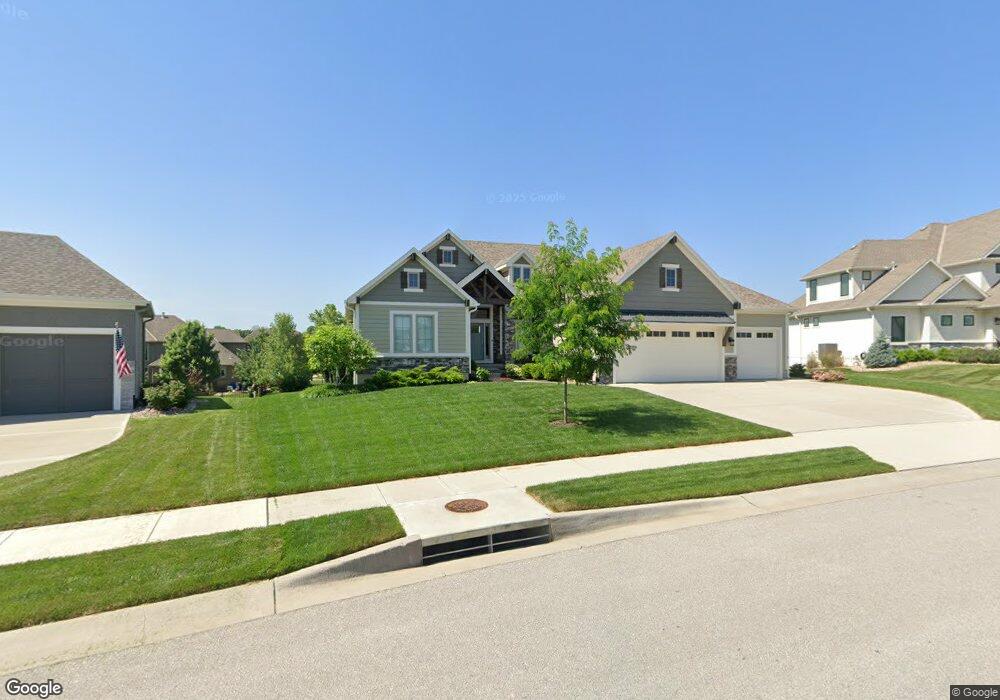
113 NW Carson Dr Lees Summit, MO 64081
Estimated Value: $773,000 - $884,000
4
Beds
4
Baths
2,277
Sq Ft
$358/Sq Ft
Est. Value
About This Home
This home is located at 113 NW Carson Dr, Lees Summit, MO 64081 and is currently estimated at $814,919, approximately $357 per square foot. 113 NW Carson Dr is a home with nearby schools including Cedar Creek Elementary School, Pleasant Lea Middle School, and Lee's Summit Senior High School.
Ownership History
Date
Name
Owned For
Owner Type
Purchase Details
Closed on
Sep 4, 2018
Sold by
Galehomes Ii Inc
Bought by
Mckinney Gary P and Mckinney Tressy A
Current Estimated Value
Home Financials for this Owner
Home Financials are based on the most recent Mortgage that was taken out on this home.
Original Mortgage
$150,000
Outstanding Balance
$52,260
Interest Rate
4.5%
Mortgage Type
New Conventional
Estimated Equity
$762,659
Purchase Details
Closed on
Feb 8, 2018
Sold by
Winterst 6 Llc
Bought by
Galehomes Ii Inc
Create a Home Valuation Report for This Property
The Home Valuation Report is an in-depth analysis detailing your home's value as well as a comparison with similar homes in the area
Home Values in the Area
Average Home Value in this Area
Purchase History
| Date | Buyer | Sale Price | Title Company |
|---|---|---|---|
| Mckinney Gary P | -- | None Available | |
| Galehomes Ii Inc | -- | None Available |
Source: Public Records
Mortgage History
| Date | Status | Borrower | Loan Amount |
|---|---|---|---|
| Open | Mckinney Gary P | $150,000 |
Source: Public Records
Tax History
| Year | Tax Paid | Tax Assessment Tax Assessment Total Assessment is a certain percentage of the fair market value that is determined by local assessors to be the total taxable value of land and additions on the property. | Land | Improvement |
|---|---|---|---|---|
| 2025 | $9,693 | $144,986 | $18,284 | $126,702 |
| 2024 | $9,622 | $134,235 | $14,953 | $119,282 |
| 2023 | $9,622 | $134,235 | $18,652 | $115,583 |
| 2022 | $8,850 | $109,630 | $13,490 | $96,140 |
| 2021 | $1,112 | $13,490 | $13,490 | $0 |
| 2020 | $1,121 | $13,471 | $13,471 | $0 |
| 2019 | $1,090 | $13,471 | $13,471 | $0 |
| 2018 | $0 | $61 | $61 | $0 |
Source: Public Records
Map
Nearby Homes
- 2905 SW Muir Dr
- 205 NW Lovins
- 216 SW Ansel Adams Dr
- 317 NW Lovins
- 316 NW Lovins
- 320 NW Lovins
- 321 NW Lovins
- 214 SW Roosevelt Ridge
- 325 NW Earle Ln
- 316 NW Earle Ln
- 308 NW Earle Ln
- 300 NW Earle Ln
- 321 NW Earle Ln
- 2809 NW Audubon Ln
- 321 NW Nutall Dr
- 129 NW Morton Dr
- 2828 SW Saddlewood Dr
- 451 SW Longview Blvd
- 441 SW Longview Blvd
- 445 SW Longview Blvd
- 117 NW Carson Dr
- 109 NW Carson Dr
- 3000 SW Muir Dr
- 2916 SW Muir Dr
- 3008 SW Muir Dr
- 108 NW Carson Dr
- 105 NW Carson Dr
- 121 NW Carson Dr
- 116 NW Carson Dr
- 3012 SW Muir Dr
- 2912 SW Muir Dr
- 3100 SW Muir Dr
- 100 NW Carson Dr
- 124 NW Carson Dr
- 125 NW Carson Dr
- 2908 SW Muir Dr
- 101 NW Carson Dr
- 3005 SW Muir Dr
- 3001 SW Muir Dr
- 3104 SW Muir Dr
Your Personal Tour Guide
Ask me questions while you tour the home.