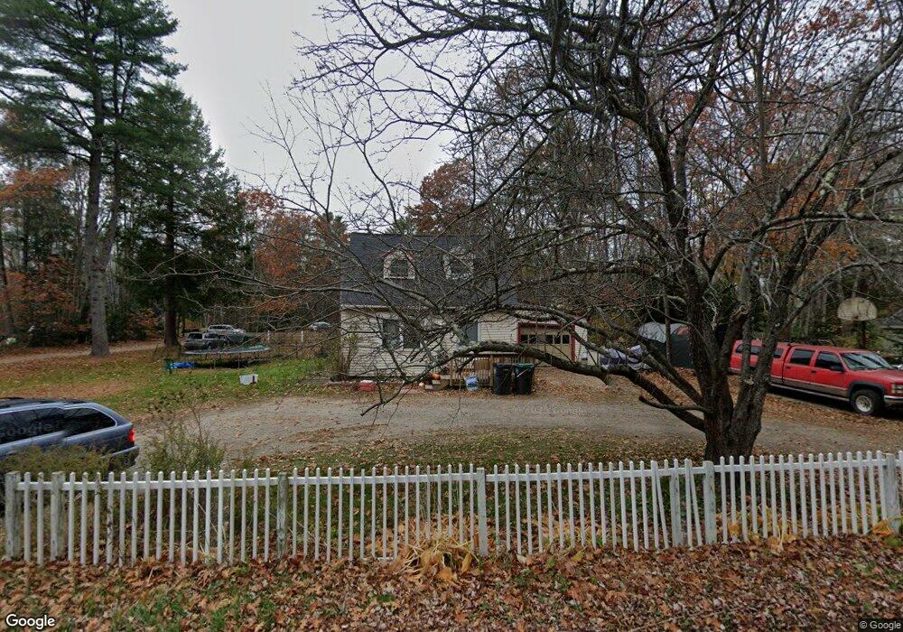
113 Ross Rd Kennebunk, ME 04043
Estimated Value: $384,863 - $491,000
3
Beds
1
Bath
1,512
Sq Ft
$294/Sq Ft
Est. Value
About This Home
This home is located at 113 Ross Rd, Kennebunk, ME 04043 and is currently estimated at $444,966, approximately $294 per square foot. 113 Ross Rd is a home located in York County with nearby schools including Kennebunk High School, School Around Us, and The New School.
Ownership History
Date
Name
Owned For
Owner Type
Purchase Details
Closed on
Oct 3, 2011
Sold by
Derham Tracy L
Bought by
Lynn Henry H
Current Estimated Value
Home Financials for this Owner
Home Financials are based on the most recent Mortgage that was taken out on this home.
Original Mortgage
$117,808
Outstanding Balance
$80,543
Interest Rate
4.15%
Mortgage Type
Purchase Money Mortgage
Estimated Equity
$364,423
Create a Home Valuation Report for This Property
The Home Valuation Report is an in-depth analysis detailing your home's value as well as a comparison with similar homes in the area
Home Values in the Area
Average Home Value in this Area
Purchase History
| Date | Buyer | Sale Price | Title Company |
|---|---|---|---|
| Lynn Henry H | $110,000 | -- |
Source: Public Records
Mortgage History
| Date | Status | Borrower | Loan Amount |
|---|---|---|---|
| Open | Lynn Henry H | $117,808 |
Source: Public Records
Tax History Compared to Growth
Tax History
| Year | Tax Paid | Tax Assessment Tax Assessment Total Assessment is a certain percentage of the fair market value that is determined by local assessors to be the total taxable value of land and additions on the property. | Land | Improvement |
|---|---|---|---|---|
| 2024 | $3,415 | $201,500 | $88,800 | $112,700 |
| 2023 | $3,234 | $201,500 | $88,800 | $112,700 |
| 2022 | $2,942 | $201,500 | $88,800 | $112,700 |
| 2021 | $2,515 | $201,500 | $88,800 | $112,700 |
| 2020 | $3,909 | $201,500 | $88,800 | $112,700 |
| 2019 | $0 | $201,500 | $88,800 | $112,700 |
| 2018 | $2,644 | $151,100 | $66,600 | $84,500 |
| 2017 | $3,453 | $151,100 | $66,600 | $84,500 |
| 2016 | $2,402 | $151,100 | $66,600 | $84,500 |
| 2015 | $2,312 | $151,100 | $66,600 | $84,500 |
| 2014 | $2,436 | $163,500 | $66,600 | $96,900 |
Source: Public Records
Map
Nearby Homes
- 14 Glenwood Dr
- 121 Fletcher St
- 19 Old Alewive Rd
- 18 Longwood Dr
- 10 Intervale Rd
- 31 Oakwood Ln
- 28 Longfellow Ln Unit 15
- 3 Hardwood Dr
- 7 Acorn Cir
- 14 Wiggins Pond Ln
- 12 Chipmunk Trail
- 20 Wonderbrook Dr
- 7 Wonderbrook Dr
- 61 Fletcher St
- 3 Nichols Ln
- 136 Alewive Rd
- 145 Emmons Rd
- 056 Cat Mousam Rd
- 59 Plymouth Grove Unit 11
- 0 Potvin Rd