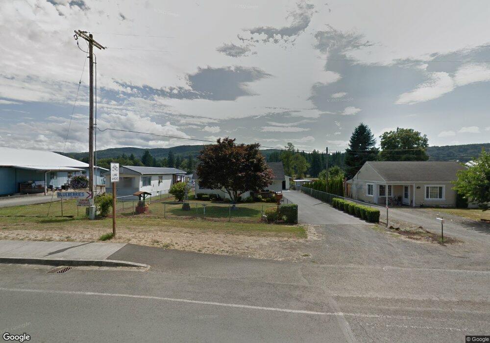
113 W State St Mossyrock, WA 98564
Estimated Value: $322,000 - $364,715
3
Beds
1
Bath
1,316
Sq Ft
$265/Sq Ft
Est. Value
About This Home
This home is located at 113 W State St, Mossyrock, WA 98564 and is currently estimated at $348,179, approximately $264 per square foot. 113 W State St is a home located in Lewis County with nearby schools including Mossyrock Elementary School and Mossyrock Middle/High School.
Ownership History
Date
Name
Owned For
Owner Type
Purchase Details
Closed on
Aug 3, 2017
Sold by
Lambert Helen J and Baker Helen J
Bought by
Morales Isaac and Morales Patricia A
Current Estimated Value
Home Financials for this Owner
Home Financials are based on the most recent Mortgage that was taken out on this home.
Original Mortgage
$174,788
Outstanding Balance
$145,610
Interest Rate
3.9%
Mortgage Type
New Conventional
Estimated Equity
$202,569
Create a Home Valuation Report for This Property
The Home Valuation Report is an in-depth analysis detailing your home's value as well as a comparison with similar homes in the area
Home Values in the Area
Average Home Value in this Area
Purchase History
| Date | Buyer | Sale Price | Title Company |
|---|---|---|---|
| Morales Isaac | $180,194 | Fidelity National Title |
Source: Public Records
Mortgage History
| Date | Status | Borrower | Loan Amount |
|---|---|---|---|
| Open | Morales Isaac | $174,788 |
Source: Public Records
Tax History Compared to Growth
Tax History
| Year | Tax Paid | Tax Assessment Tax Assessment Total Assessment is a certain percentage of the fair market value that is determined by local assessors to be the total taxable value of land and additions on the property. | Land | Improvement |
|---|---|---|---|---|
| 2024 | $2,172 | $326,800 | $80,500 | $246,300 |
| 2023 | $1,941 | $275,100 | $59,300 | $215,800 |
| 2022 | $2,060 | $224,200 | $47,000 | $177,200 |
| 2021 | $1,984 | $224,200 | $47,000 | $177,200 |
| 2020 | $2,041 | $188,100 | $39,200 | $148,900 |
| 2019 | $1,969 | $188,100 | $39,200 | $148,900 |
| 2018 | $1,802 | $173,400 | $35,000 | $138,400 |
| 2017 | $412 | $141,200 | $17,500 | $123,700 |
| 2016 | $408 | $126,500 | $18,000 | $108,500 |
| 2015 | $1,477 | $128,500 | $20,000 | $108,500 |
| 2013 | $1,477 | $128,500 | $20,000 | $108,500 |
Source: Public Records
Map
Nearby Homes
- 219 Mossyrock Ave
- 242 Sunset Dr
- 167 Meadow Ln
- 238 Sunset Ave
- 154 Mossyrock Rd W Unit 5
- 212 Hope St
- 108 Godfrey Rd
- 4057 - 51 U S 12
- 165 Swigert Rd
- 233 Young Rd
- 557 71 Mossyrock Ave
- 302 Mossyrock Rd W
- 119 Deer Ridge Ln
- 128 Valley View Dr
- 154 Valley View Dr
- 295 Degoede Dr
- 174 Riley Way
- 0 Madison Dr
- 281 Jarvis Rd
- 0 Boyd Rd
- 119 W State St
- 101 W State St
- 107 E State St
- 118 W State St
- 106 W State St
- 106 W State St Unit 112
- 130 Mossyrock Rd W
- 100 E State St
- 106 E State St
- 122 E State St
- 149 W State St
- 130 W Main St
- 128 Williams St
- 224 Maple St
- 131 W State St
- 138 E State St
- 137 W State St
- 207 W State St
- 144 E State St
- 124 W Main St
