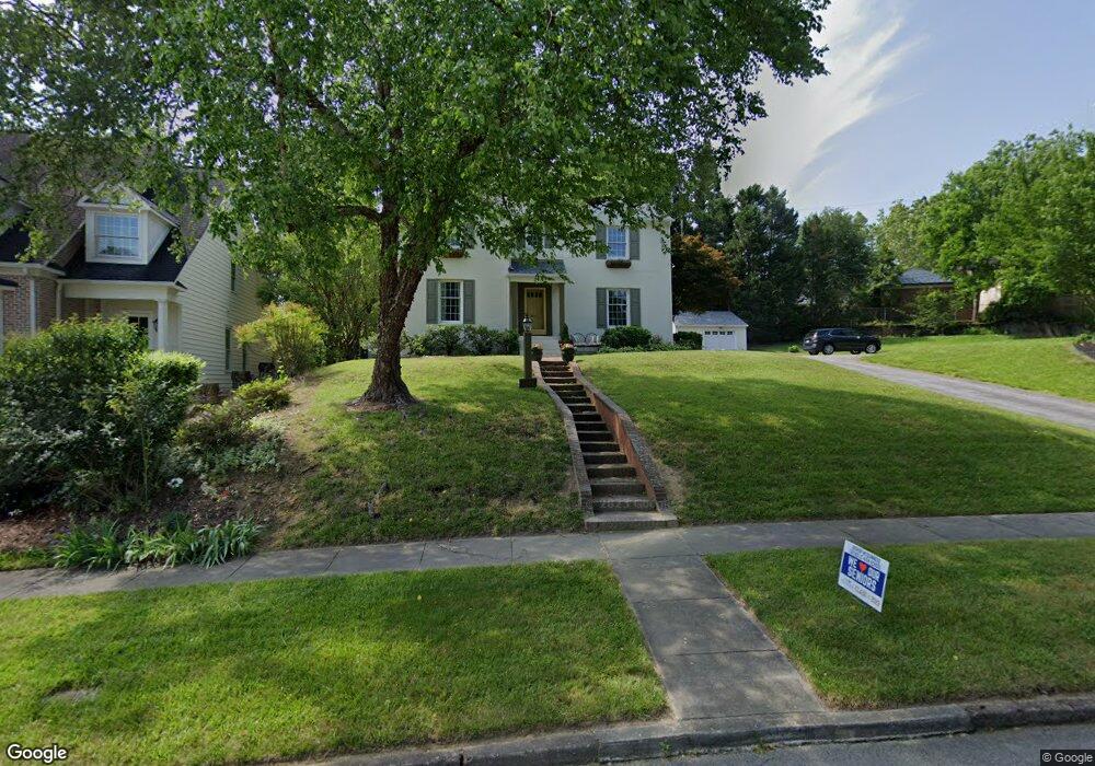
1130 Forest Hill Dr High Point, NC 27262
Greater High Point NeighborhoodEstimated Value: $385,056 - $443,000
2
Beds
3
Baths
2,228
Sq Ft
$186/Sq Ft
Est. Value
About This Home
This home is located at 1130 Forest Hill Dr, High Point, NC 27262 and is currently estimated at $414,014, approximately $185 per square foot. 1130 Forest Hill Dr is a home located in Guilford County with nearby schools including Northwood Elementary School, Ferndale Middle School, and High Point Central High School.
Ownership History
Date
Name
Owned For
Owner Type
Purchase Details
Closed on
Oct 31, 2005
Sold by
Allred Sherrill J and Allred Timothy Randall
Bought by
Hunter James Matthew and Hunter Kerrin
Current Estimated Value
Home Financials for this Owner
Home Financials are based on the most recent Mortgage that was taken out on this home.
Original Mortgage
$279,000
Outstanding Balance
$149,771
Interest Rate
5.71%
Mortgage Type
Fannie Mae Freddie Mac
Estimated Equity
$264,243
Create a Home Valuation Report for This Property
The Home Valuation Report is an in-depth analysis detailing your home's value as well as a comparison with similar homes in the area
Home Values in the Area
Average Home Value in this Area
Purchase History
| Date | Buyer | Sale Price | Title Company |
|---|---|---|---|
| Hunter James Matthew | $310,000 | None Available |
Source: Public Records
Mortgage History
| Date | Status | Borrower | Loan Amount |
|---|---|---|---|
| Open | Hunter James Matthew | $279,000 |
Source: Public Records
Tax History Compared to Growth
Tax History
| Year | Tax Paid | Tax Assessment Tax Assessment Total Assessment is a certain percentage of the fair market value that is determined by local assessors to be the total taxable value of land and additions on the property. | Land | Improvement |
|---|---|---|---|---|
| 2025 | $3,349 | $243,000 | $70,000 | $173,000 |
| 2024 | $3,349 | $243,000 | $70,000 | $173,000 |
| 2023 | $3,349 | $243,000 | $70,000 | $173,000 |
| 2022 | $3,276 | $243,000 | $70,000 | $173,000 |
| 2021 | $2,986 | $216,700 | $60,000 | $156,700 |
| 2020 | $2,986 | $216,700 | $60,000 | $156,700 |
| 2019 | $2,986 | $216,700 | $0 | $0 |
| 2018 | $2,971 | $216,700 | $0 | $0 |
| 2017 | $2,986 | $216,700 | $0 | $0 |
| 2016 | $2,878 | $205,200 | $0 | $0 |
| 2015 | $2,893 | $205,200 | $0 | $0 |
| 2014 | $2,943 | $205,200 | $0 | $0 |
Source: Public Records
Map
Nearby Homes
- 1232 Dovershire Place
- 427 Woodbrook Dr
- 1228 Dovershire Place
- 407 Emerywood Dr
- 416 W Lexington Ave
- 510 Otteray Ave
- 1307 Hempshire Ct
- 824 W Lexington Ave
- 605 Westchester Dr
- 1042 Rockford Rd
- 1408 Wales Dr
- 1319 Robin Hood Rd
- 501 Westchester Dr
- 337 Rockspring Rd
- 335 Rockspring Rd
- 333 Rockspring Rd
- 331 Rockspring Rd
- 313 Rockspring Rd
- 317 Rockspring Rd
- 327 Rockspring Rd
- 1132 Forest Hill Dr
- 1134 Forest Hill Dr
- 1111 Greenway Dr
- 1108 Forest Hill Dr
- 1301 Greenway Dr
- 1110 Forest Hill Dr
- 1109 Greenway Dr
- 1106 Forest Hill Dr
- 1120 Forest Hill Dr
- 1309 Greenway Dr
- 1105 Greenway Dr
- 1103 Greenway Dr
- 1112 Forest Hill Dr
- 1107 Greenway Dr
- 1104 Forest Hill Dr
- 1300 Greenway Dr
- 1210 Greenway Dr
- 1125 Forest Hill Dr
- 1208 Greenway Dr
- 1311 Greenway Dr