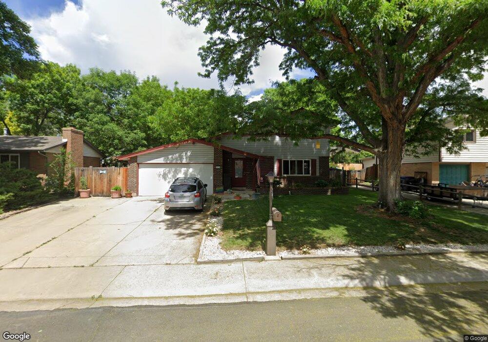
1130 Lefthand Dr Longmont, CO 80501
Southmoor NeighborhoodEstimated Value: $542,688 - $600,000
6
Beds
4
Baths
2,644
Sq Ft
$218/Sq Ft
Est. Value
About This Home
This home is located at 1130 Lefthand Dr, Longmont, CO 80501 and is currently estimated at $577,672, approximately $218 per square foot. 1130 Lefthand Dr is a home located in Boulder County with nearby schools including Burlington Elementary School, Sunset Middle School, and Niwot High School.
Ownership History
Date
Name
Owned For
Owner Type
Purchase Details
Closed on
Aug 31, 2006
Sold by
Rentz John Michael
Bought by
Gibbons Hugh
Current Estimated Value
Home Financials for this Owner
Home Financials are based on the most recent Mortgage that was taken out on this home.
Original Mortgage
$196,000
Outstanding Balance
$118,473
Interest Rate
6.79%
Mortgage Type
Purchase Money Mortgage
Estimated Equity
$459,199
Purchase Details
Closed on
Nov 7, 1991
Bought by
Gibbons Hugh and Gibbons Christine E
Purchase Details
Closed on
Mar 9, 1990
Bought by
Gibbons Hugh and Gibbons Christine E
Purchase Details
Closed on
Mar 16, 1983
Bought by
Gibbons Hugh and Gibbons Christine E
Purchase Details
Closed on
Sep 19, 1978
Bought by
Gibbons Hugh and Gibbons Christine E
Create a Home Valuation Report for This Property
The Home Valuation Report is an in-depth analysis detailing your home's value as well as a comparison with similar homes in the area
Home Values in the Area
Average Home Value in this Area
Purchase History
| Date | Buyer | Sale Price | Title Company |
|---|---|---|---|
| Gibbons Hugh | $245,000 | None Available | |
| Gibbons Hugh | $109,900 | -- | |
| Gibbons Hugh | $105,900 | -- | |
| Gibbons Hugh | -- | -- | |
| Gibbons Hugh | $66,400 | -- |
Source: Public Records
Mortgage History
| Date | Status | Borrower | Loan Amount |
|---|---|---|---|
| Open | Gibbons Hugh | $196,000 |
Source: Public Records
Tax History Compared to Growth
Tax History
| Year | Tax Paid | Tax Assessment Tax Assessment Total Assessment is a certain percentage of the fair market value that is determined by local assessors to be the total taxable value of land and additions on the property. | Land | Improvement |
|---|---|---|---|---|
| 2025 | $3,188 | $33,919 | $11,744 | $22,175 |
| 2024 | $3,188 | $33,919 | $11,744 | $22,175 |
| 2023 | $3,145 | $33,333 | $14,666 | $22,351 |
| 2022 | $2,796 | $28,251 | $10,362 | $17,889 |
| 2021 | $2,832 | $29,065 | $10,661 | $18,404 |
| 2020 | $2,588 | $26,641 | $8,580 | $18,061 |
| 2019 | $2,547 | $26,641 | $8,580 | $18,061 |
| 2018 | $2,139 | $22,522 | $5,976 | $16,546 |
| 2017 | $2,110 | $24,899 | $6,607 | $18,292 |
| 2016 | $1,933 | $20,218 | $5,890 | $14,328 |
| 2015 | $1,842 | $17,536 | $5,254 | $12,282 |
| 2014 | $1,638 | $17,536 | $5,254 | $12,282 |
Source: Public Records
Map
Nearby Homes
- 1350 S Lincoln St
- 1435 Ashcroft Dr
- 1801 S Pratt Pkwy
- 1072 Kane Dr
- 1327 Brookfield Dr
- 919 S Sherman St
- 1328 S Terry St
- 1435 Missouri Ave
- 1343 S Coffman St
- 1456 Sepia Ave
- 1208 S Coffman St
- 1028 Katy Ln
- 9 Seattle Ln
- 832 S Bowen St
- 1518 Sepia Ave
- 1221 S Main St
- 1527 S Vivian St
- 835 Kane Dr Unit E25
- 922 S Coffman St
- 802 Neon Forest Cir
- 1136 Lefthand Dr
- 1124 Lefthand Dr
- 1139 Avon Ln
- 1143 Avon Ln
- 1135 Avon Ln
- 1142 Lefthand Dr
- 1118 Lefthand Dr
- 1129 Lefthand Dr
- 1131 Avon Ln
- 1135 Lefthand Dr
- 1147 Avon Ln
- 1123 Lefthand Dr
- 1148 Lefthand Dr
- 1141 Lefthand Dr
- 1108 Lefthand Dr
- 1117 Lefthand Dr
- 1119 Avon Ln
- 1138 Avon Ln
- 1147 Lefthand Dr
- 1157 Avon Ln