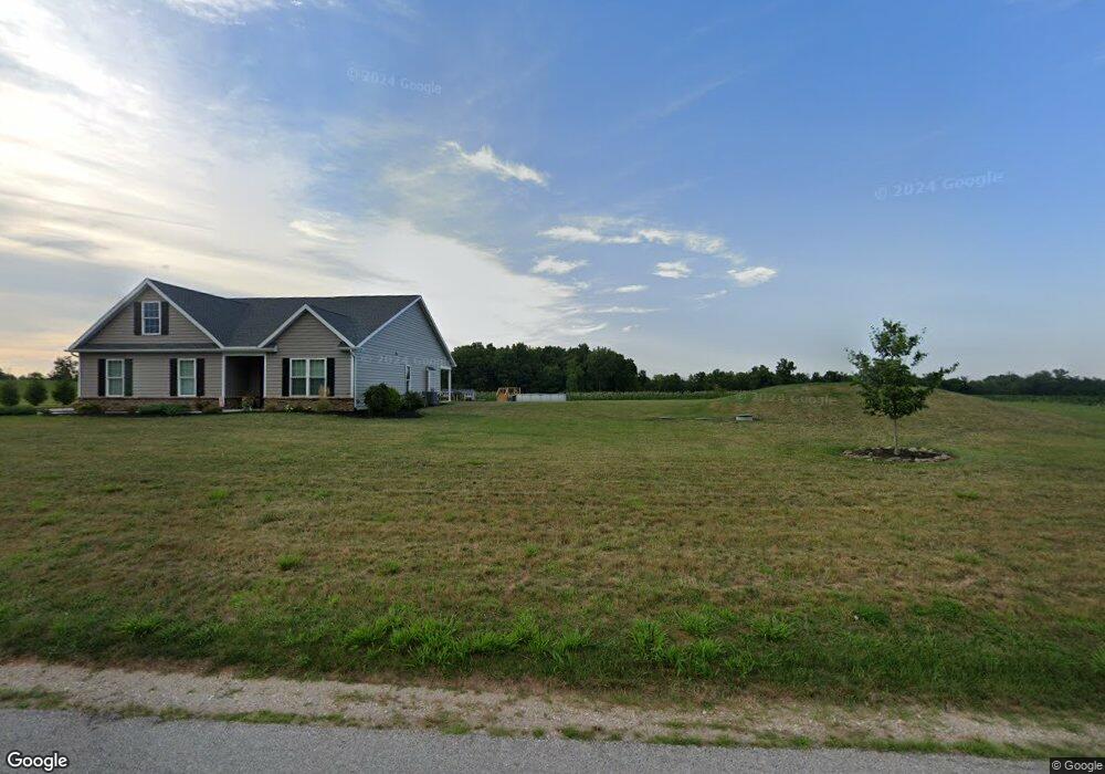
1130 Locust Ln Littlestown, PA 17340
Estimated Value: $388,000 - $578,000
3
Beds
2
Baths
2,016
Sq Ft
$232/Sq Ft
Est. Value
About This Home
This home is located at 1130 Locust Ln, Littlestown, PA 17340 and is currently estimated at $467,878, approximately $232 per square foot. 1130 Locust Ln is a home with nearby schools including Rolling Acres El School, Maple Avenue Middle School, and Littlestown Senior High School.
Ownership History
Date
Name
Owned For
Owner Type
Purchase Details
Closed on
Jul 15, 2020
Sold by
Buckley Nicholas Adam
Bought by
Eiker Jason Lee and Eiker Kari Lynn
Current Estimated Value
Home Financials for this Owner
Home Financials are based on the most recent Mortgage that was taken out on this home.
Original Mortgage
$335,269
Outstanding Balance
$305,694
Interest Rate
4.75%
Mortgage Type
Construction
Estimated Equity
$162,184
Purchase Details
Closed on
Nov 2, 2010
Sold by
Supchak Leonard M and Supchak Eleanor M
Bought by
Supchak Leonard M and Supchak Eleanor M
Create a Home Valuation Report for This Property
The Home Valuation Report is an in-depth analysis detailing your home's value as well as a comparison with similar homes in the area
Home Values in the Area
Average Home Value in this Area
Purchase History
| Date | Buyer | Sale Price | Title Company |
|---|---|---|---|
| Eiker Jason Lee | $70,000 | None Available | |
| Supchak Leonard M | -- | -- |
Source: Public Records
Mortgage History
| Date | Status | Borrower | Loan Amount |
|---|---|---|---|
| Open | Eiker Jason Lee | $335,269 |
Source: Public Records
Tax History Compared to Growth
Tax History
| Year | Tax Paid | Tax Assessment Tax Assessment Total Assessment is a certain percentage of the fair market value that is determined by local assessors to be the total taxable value of land and additions on the property. | Land | Improvement |
|---|---|---|---|---|
| 2025 | $6,701 | $345,700 | $74,500 | $271,200 |
| 2024 | $6,412 | $345,700 | $74,500 | $271,200 |
| 2023 | $6,288 | $345,700 | $74,500 | $271,200 |
| 2022 | $6,244 | $345,700 | $74,500 | $271,200 |
| 2021 | $1,281 | $73,500 | $73,500 | $0 |
| 2020 | $1,263 | $73,500 | $73,500 | $0 |
| 2019 | $1,237 | $73,500 | $73,500 | $0 |
Source: Public Records
Map
Nearby Homes
- 780 White Hall Rd
- 464 Locust Ln
- 0 Littlestown Rd
- 67 Cedarfield Dr
- 70 Sells Station Rd
- 138 Cedarfield Dr Unit 71
- 80 Sells Station Rd
- 28 Bonniefield Cir Unit 25
- 1 Hickory Ave
- 4900 Hanover Rd
- 48 Cannon Ln Unit 105
- 27 Maple St
- 8 Maple St
- 1442 Honda Rd
- 345 Smoketown Rd
- 13 N Pine St
- 34 W Hanover St
- 0 Locust Dr Unit PAAD2015910
- 20c Locust Dr
- 58 Windsor Ct
- 1112 Locust Ln
- 1133 Locust Ln
- 1121 Locust Ln
- 1109 Locust Ln
- 1147 Locust Ln
- 1090 Locust Ln
- 1170 Locust Ln Unit 3
- 1170 Locust Ln Unit 5
- 1170 Locust Ln Unit 4
- 1170 Locust Ln Unit 2
- 1170 Locust Ln
- 1081 Locust Ln
- 1070 Locust Ln
- 1040 Locust Ln Unit 2
- 1045 Locust Ln
- 790 White Hall Rd
- 1245 Locust Ln
- 760 White Hall Rd
- 770 White Hall Rd
- 712 White Hall Rd