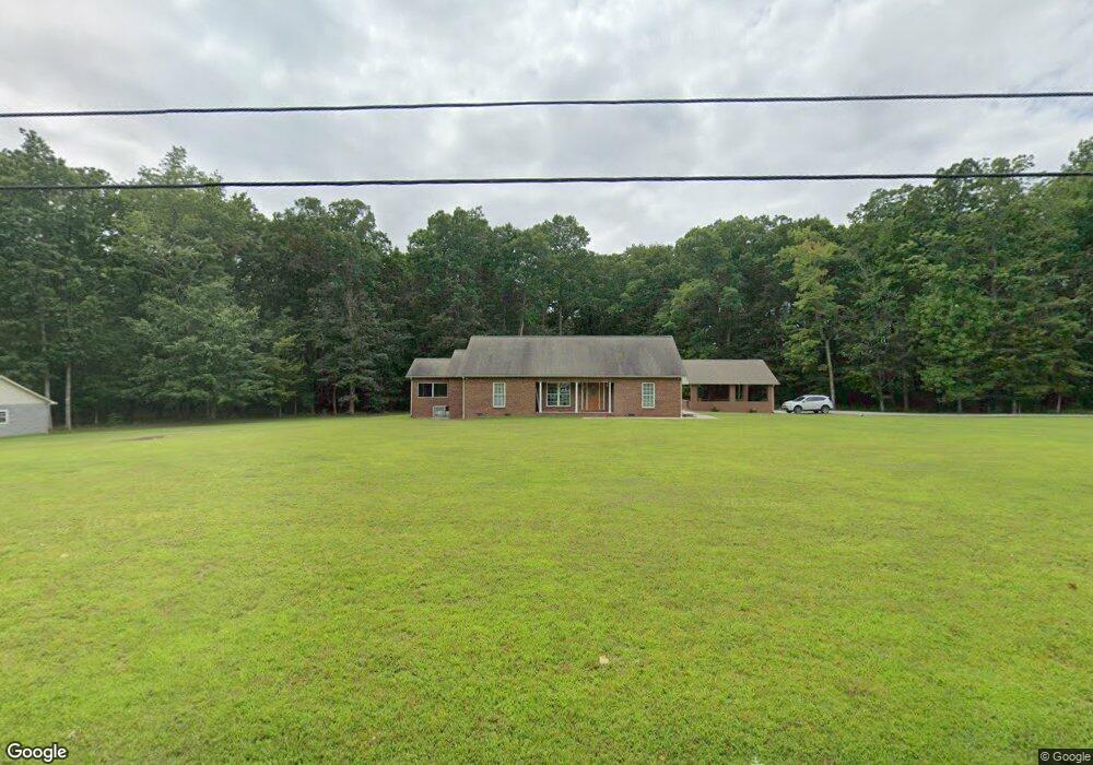
1130 Low Gap Rd Sparta, TN 38583
Estimated Value: $370,000 - $528,000
Studio
2
Baths
2,066
Sq Ft
$218/Sq Ft
Est. Value
About This Home
This home is located at 1130 Low Gap Rd, Sparta, TN 38583 and is currently estimated at $451,216, approximately $218 per square foot. 1130 Low Gap Rd is a home located in White County with nearby schools including Bon De Croft Elementary School, White County Middle School, and White County High School.
Ownership History
Date
Name
Owned For
Owner Type
Purchase Details
Closed on
Jun 10, 2004
Bought by
Kirby Robert L and Kirby Sarah
Current Estimated Value
Purchase Details
Closed on
May 24, 2002
Sold by
Martiin Jack T
Bought by
Scotty Kirby and Scotty Tammie
Home Financials for this Owner
Home Financials are based on the most recent Mortgage that was taken out on this home.
Original Mortgage
$31,000
Interest Rate
6.85%
Purchase Details
Closed on
May 22, 2002
Bought by
Kirby Scotty and Kirby Tammie
Home Financials for this Owner
Home Financials are based on the most recent Mortgage that was taken out on this home.
Original Mortgage
$31,000
Interest Rate
6.85%
Purchase Details
Closed on
Feb 25, 1993
Bought by
Martin Jack T Gerald L Lester
Purchase Details
Closed on
Sep 22, 1977
Bought by
Cope James R and Cope Georgia D
Create a Home Valuation Report for This Property
The Home Valuation Report is an in-depth analysis detailing your home's value as well as a comparison with similar homes in the area
Purchase History
| Date | Buyer | Sale Price | Title Company |
|---|---|---|---|
| Kirby Robert L | $56,000 | -- | |
| Scotty Kirby | $56,750 | -- | |
| Kirby Scotty | $56,800 | -- | |
| Martin Jack T Gerald L Lester | $26,000 | -- | |
| Cope James R | -- | -- |
Source: Public Records
Mortgage History
| Date | Status | Borrower | Loan Amount |
|---|---|---|---|
| Previous Owner | Cope James R | $31,000 |
Source: Public Records
Tax History
| Year | Tax Paid | Tax Assessment Tax Assessment Total Assessment is a certain percentage of the fair market value that is determined by local assessors to be the total taxable value of land and additions on the property. | Land | Improvement |
|---|---|---|---|---|
| 2025 | $1,766 | $125,225 | $46,975 | $78,250 |
| 2024 | $1,456 | $71,025 | $25,600 | $45,425 |
| 2023 | $1,456 | $71,025 | $25,600 | $45,425 |
| 2022 | $1,456 | $71,025 | $25,600 | $45,425 |
| 2021 | $1,456 | $71,025 | $25,600 | $45,425 |
| 2020 | $1,456 | $71,025 | $25,600 | $45,425 |
| 2019 | $1,324 | $64,575 | $25,600 | $38,975 |
| 2018 | $1,324 | $64,575 | $25,600 | $38,975 |
| 2017 | $1,324 | $64,575 | $25,600 | $38,975 |
| 2016 | $1,324 | $64,575 | $25,600 | $38,975 |
| 2015 | $1,195 | $64,575 | $25,600 | $38,975 |
| 2014 | -- | $64,575 | $25,600 | $38,975 |
| 2013 | -- | $63,950 | $25,625 | $38,325 |
Source: Public Records
Map
Nearby Homes
- 1011 Low Gap Rd
- 450 Low Gap Rd
- 1667 Old Bonair Rd
- 1667 Old Bon Air Rd
- 2025 Old Bon Air Rd
- 3908 Lost Creek Rd
- 130 ac Lost Creek Rd
- 00 Lost Creek Rd
- 665 Camp Belle Air Rd
- 179 Holiday Lane Sparta Ln
- 179 Holiday Ln
- 115 Kingwood Dr
- 210 Kingwood Dr
- 5185 Crossville Hwy
- 204 Vandy Cir
- 0 Vandy Cir
- 362 Vandy Cir
- 6232 Crossville Hwy
- 193 Spur Rd
- .23 ac Olen Ln
- na Low Gap Rd
- 000 Low Gap Rd
- 15.85 AC Low Gap Rd
- 10.08 Low Gap Rd
- 5.77 Low Gap Rd
- 5.77 AC Low Gap Rd
- 10.08 AC Low Gap Rd
- LOT 17 Low Gap Rd
- LOT 16 Low Gap Rd
- LOT 12 Low Gap Rd
- LOT 13 Low Gap Rd
- LOT 14 Low Gap Rd
- 00 Low Gap Rd
- 9,10,11 Low Gap Rd
- LOT 9 Low Gap Rd
- LOT 10 Low Gap Rd
- LOT 11 Low Gap Rd
- 5.23ac Low Gap Rd
- 1111 Low Gap Rd
- 1028 Low Gap Rd
Your Personal Tour Guide
Ask me questions while you tour the home.