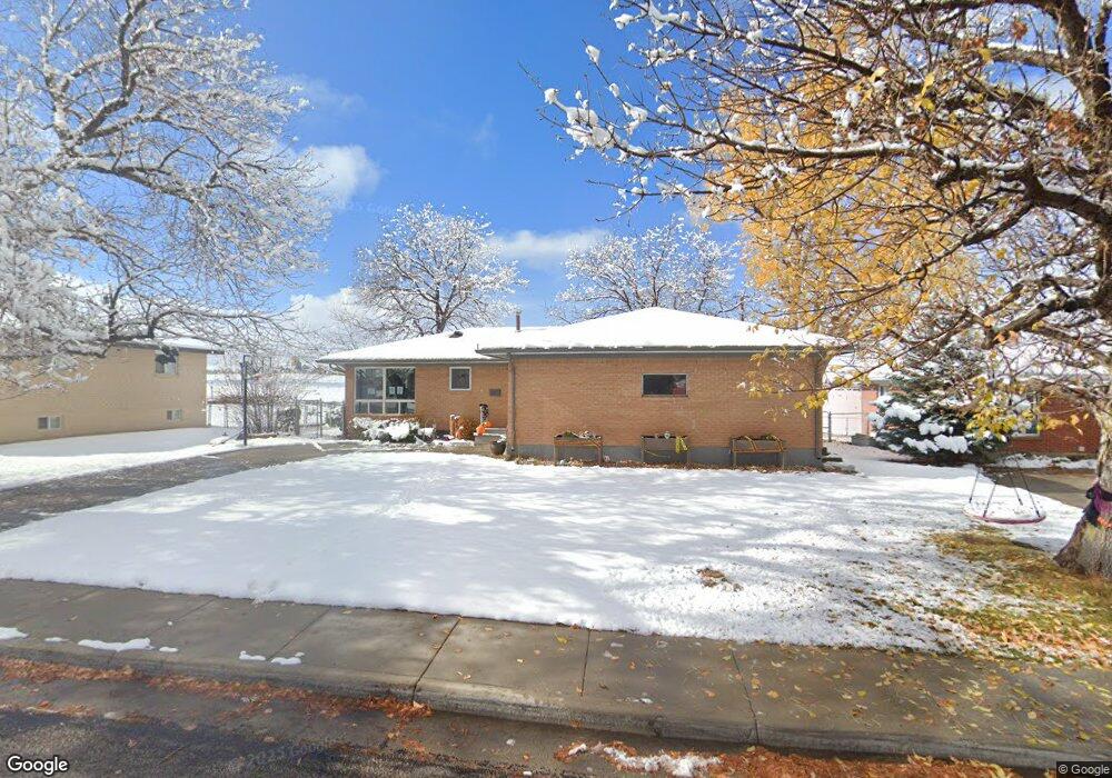
1130 Mcdougall Dr Lander, WY 82520
Estimated Value: $372,000 - $390,179
5
Beds
3
Baths
1,224
Sq Ft
$310/Sq Ft
Est. Value
About This Home
This home is located at 1130 Mcdougall Dr, Lander, WY 82520 and is currently estimated at $379,726, approximately $310 per square foot. 1130 Mcdougall Dr is a home located in Fremont County with nearby schools including Lander Valley High School and Lander Christian Academy.
Ownership History
Date
Name
Owned For
Owner Type
Purchase Details
Closed on
Feb 1, 2022
Sold by
Glassburn Jennifer M and Mchugh Jason
Bought by
Glassburn Jennifer M
Current Estimated Value
Home Financials for this Owner
Home Financials are based on the most recent Mortgage that was taken out on this home.
Original Mortgage
$163,000
Outstanding Balance
$130,300
Interest Rate
2.93%
Mortgage Type
New Conventional
Estimated Equity
$249,426
Purchase Details
Closed on
Jul 24, 2014
Sold by
Hicker Stephen A and Hicker Carol A
Bought by
Bauman Jennifer M
Home Financials for this Owner
Home Financials are based on the most recent Mortgage that was taken out on this home.
Original Mortgage
$184,000
Interest Rate
4.2%
Mortgage Type
New Conventional
Purchase Details
Closed on
Oct 1, 2012
Sold by
Budd Robert Q and Budd Lynn M
Bought by
Hickner Stephen A and Hicker Carol A
Create a Home Valuation Report for This Property
The Home Valuation Report is an in-depth analysis detailing your home's value as well as a comparison with similar homes in the area
Home Values in the Area
Average Home Value in this Area
Purchase History
| Date | Buyer | Sale Price | Title Company |
|---|---|---|---|
| Glassburn Jennifer M | -- | New Title Company Name | |
| Bauman Jennifer M | -- | First American Title Ins Co | |
| Hickner Stephen A | -- | None Available |
Source: Public Records
Mortgage History
| Date | Status | Borrower | Loan Amount |
|---|---|---|---|
| Open | Glassburn Jennifer M | $163,000 | |
| Previous Owner | Bauman Jennifer M | $184,000 |
Source: Public Records
Tax History Compared to Growth
Tax History
| Year | Tax Paid | Tax Assessment Tax Assessment Total Assessment is a certain percentage of the fair market value that is determined by local assessors to be the total taxable value of land and additions on the property. | Land | Improvement |
|---|---|---|---|---|
| 2025 | $2,857 | $28,577 | $3,808 | $24,769 |
| 2024 | $2,857 | $37,015 | $5,077 | $31,938 |
| 2023 | $2,728 | $35,630 | $4,920 | $30,710 |
| 2022 | $2,249 | $30,027 | $4,920 | $25,107 |
| 2021 | $1,998 | $25,816 | $4,793 | $21,023 |
| 2020 | $1,810 | $23,425 | $4,793 | $18,632 |
| 2019 | $1,790 | $22,804 | $4,759 | $18,045 |
| 2018 | $1,779 | $22,412 | $4,759 | $17,653 |
| 2017 | $1,692 | $21,269 | $4,759 | $16,510 |
| 2016 | $1,694 | $21,319 | $4,759 | $16,560 |
| 2015 | $1,608 | $20,468 | $4,759 | $15,709 |
| 2014 | $1,643 | $20,952 | $4,759 | $16,193 |
Source: Public Records
Map
Nearby Homes
- 1120 Mcdougall Dr
- 1140 Mcdougall Dr
- 1110 Mcdougall Dr
- 1110 Mcdougall Dr Unit Cliff
- 1145 Mcdougall Dr
- 1125 Mcdougall Dr
- 1125 Mcdougall Dr Unit Cliff St
- 1160 Mcdougall Dr
- 1100 Mcdougall Dr
- 1100 Mcdougall Dr Unit S. 9th
- 1100 Mcdougall Dr Unit Smith
- 1155 Mcdougall Dr
- 1055 Cliff St
- 1115 Mcdougall Dr
- 1040 Cliff St
- 1090 Mcdougall Dr
- 1045 Cliff St
- 1045 Cliff St Unit McDougall
- 1105 Mcdougall Dr
- 1050 Cascade St