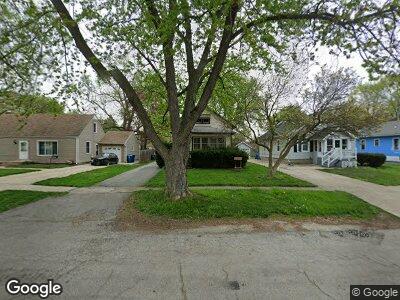
1130 Pearl St Aurora, IL 60505
Southeast Aurora NeighborhoodEstimated Value: $193,000 - $225,000
--
Bed
--
Bath
2,616
Sq Ft
$81/Sq Ft
Est. Value
About This Home
This home is located at 1130 Pearl St, Aurora, IL 60505 and is currently estimated at $212,029, approximately $81 per square foot. 1130 Pearl St is a home located in Kane County with nearby schools including Dieterich Elementary School, K D Waldo Middle School, and East Aurora High School.
Ownership History
Date
Name
Owned For
Owner Type
Purchase Details
Closed on
Jun 11, 2003
Sold by
Mcpherson Monica B and Johnson Monica B
Bought by
Johnson Richard T and Johnson Monica B
Current Estimated Value
Home Financials for this Owner
Home Financials are based on the most recent Mortgage that was taken out on this home.
Original Mortgage
$76,800
Interest Rate
5.3%
Mortgage Type
Purchase Money Mortgage
Purchase Details
Closed on
Jan 8, 1999
Sold by
Bamforth Carrie
Bought by
Mcpherson Monica B
Home Financials for this Owner
Home Financials are based on the most recent Mortgage that was taken out on this home.
Original Mortgage
$80,000
Interest Rate
6.79%
Purchase Details
Closed on
Oct 15, 1998
Sold by
Campbell Virginia Lou
Bought by
Bamforth Carrie
Purchase Details
Closed on
Oct 2, 1998
Sold by
Conner Richard B
Bought by
Campbell Virginia Lou
Purchase Details
Closed on
Sep 20, 1998
Sold by
Richardson Ann Marie and Conner Ann Marie
Bought by
Campbell Virginia Lou
Purchase Details
Closed on
Dec 31, 1994
Sold by
Conner Richard B
Bought by
Conner Richard B and Conner Richard B
Purchase Details
Closed on
Dec 20, 1994
Sold by
Conner Richard B
Bought by
Conner Richard B and Conner Richard B
Create a Home Valuation Report for This Property
The Home Valuation Report is an in-depth analysis detailing your home's value as well as a comparison with similar homes in the area
Home Values in the Area
Average Home Value in this Area
Purchase History
| Date | Buyer | Sale Price | Title Company |
|---|---|---|---|
| Johnson Richard T | -- | Law Title | |
| Mcpherson Monica B | $91,000 | Law Title Insurance Co Inc | |
| Bamforth Carrie | $57,000 | Law Title Insurance Co Inc | |
| Campbell Virginia Lou | -- | Law Title Insurance Co Inc | |
| Campbell Virginia Lou | -- | Law Title Insurance Co Inc | |
| Conner Richard B | -- | -- | |
| Conner Richard B | -- | -- |
Source: Public Records
Mortgage History
| Date | Status | Borrower | Loan Amount |
|---|---|---|---|
| Closed | Johnson Richard T | $88,000 | |
| Closed | Johnson Monica B | $78,483 | |
| Closed | Johnson Monica B | $20,000 | |
| Closed | Johnson Richard T | $76,800 | |
| Closed | Johnson Richard | $6,000 | |
| Closed | Mcpherson Monica B | $80,000 |
Source: Public Records
Tax History Compared to Growth
Tax History
| Year | Tax Paid | Tax Assessment Tax Assessment Total Assessment is a certain percentage of the fair market value that is determined by local assessors to be the total taxable value of land and additions on the property. | Land | Improvement |
|---|---|---|---|---|
| 2023 | $4,158 | $63,641 | $10,181 | $53,460 |
| 2022 | $3,956 | $58,066 | $9,289 | $48,777 |
| 2021 | $3,880 | $54,060 | $8,648 | $45,412 |
| 2020 | $3,677 | $50,214 | $8,033 | $42,181 |
| 2019 | $3,571 | $46,525 | $7,443 | $39,082 |
| 2018 | $3,378 | $43,100 | $6,885 | $36,215 |
| 2017 | $3,215 | $38,784 | $6,344 | $32,440 |
| 2016 | $2,890 | $33,464 | $5,438 | $28,026 |
| 2015 | -- | $28,882 | $4,676 | $24,206 |
| 2014 | -- | $23,138 | $4,297 | $18,841 |
| 2013 | -- | $23,239 | $5,474 | $17,765 |
Source: Public Records
Map
Nearby Homes
- 1028 5th St
- 1228 Lebanon St
- Lot 1 Douglas Ave
- 1210 Douglas Ave
- 1368 Talma St
- 735 Sexton St
- 620 Lebanon St
- 633 Watson St
- 1203 S State St
- 217 Arbor Ridge Dr
- 629 S Union St
- 135 Evans Ave
- 454 Weston Ave
- 150 Hamlet Cir
- 555 S Lasalle St
- 101 Marsch Ave
- 467 N River St
- 170 Montgomery Rd
- 450 Center Ave
- 400 S Lasalle St