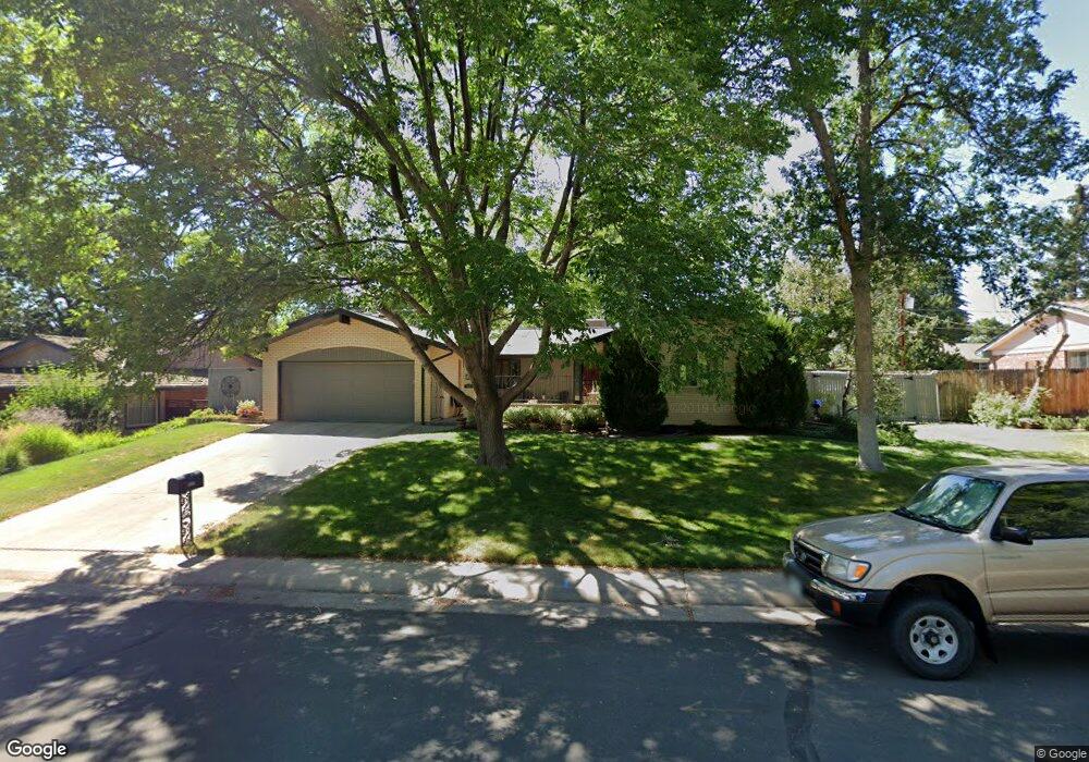
1131 Birdie Rd Broomfield, CO 80020
Broomfield Country Club NeighborhoodEstimated Value: $637,998 - $772,000
3
Beds
2
Baths
2,402
Sq Ft
$297/Sq Ft
Est. Value
About This Home
This home is located at 1131 Birdie Rd, Broomfield, CO 80020 and is currently estimated at $714,250, approximately $297 per square foot. 1131 Birdie Rd is a home located in Broomfield County with nearby schools including Birch Elementary School, Aspen Creek K-8 School, and Broomfield High School.
Ownership History
Date
Name
Owned For
Owner Type
Purchase Details
Closed on
Aug 28, 2009
Sold by
Wolfe Janet S
Bought by
Cormier Mark C and Branz Marian L
Current Estimated Value
Home Financials for this Owner
Home Financials are based on the most recent Mortgage that was taken out on this home.
Original Mortgage
$296,000
Outstanding Balance
$193,288
Interest Rate
5.16%
Mortgage Type
New Conventional
Estimated Equity
$520,962
Purchase Details
Closed on
Mar 25, 2009
Sold by
Dwenger Janet S
Bought by
Wolfe Janet S
Purchase Details
Closed on
Mar 3, 2009
Sold by
Dwenger Janet S
Bought by
Wolfe Janet S
Purchase Details
Closed on
Dec 23, 2008
Sold by
Dwenger Kenneth P
Bought by
Dwenger Janet S
Purchase Details
Closed on
Jul 12, 1978
Create a Home Valuation Report for This Property
The Home Valuation Report is an in-depth analysis detailing your home's value as well as a comparison with similar homes in the area
Home Values in the Area
Average Home Value in this Area
Purchase History
| Date | Buyer | Sale Price | Title Company |
|---|---|---|---|
| Cormier Mark C | $370,000 | Htco | |
| Wolfe Janet S | -- | None Available | |
| Wolfe Janet S | -- | None Available | |
| Dwenger Janet S | -- | None Available | |
| -- | $95,900 | -- |
Source: Public Records
Mortgage History
| Date | Status | Borrower | Loan Amount |
|---|---|---|---|
| Open | Cormier Mark C | $296,000 |
Source: Public Records
Tax History Compared to Growth
Tax History
| Year | Tax Paid | Tax Assessment Tax Assessment Total Assessment is a certain percentage of the fair market value that is determined by local assessors to be the total taxable value of land and additions on the property. | Land | Improvement |
|---|---|---|---|---|
| 2025 | $3,374 | $42,640 | $10,720 | $31,920 |
| 2024 | $3,374 | $42,710 | $9,870 | $32,840 |
| 2023 | $3,368 | $50,500 | $11,120 | $39,380 |
| 2022 | $2,676 | $34,630 | $7,820 | $26,810 |
| 2021 | $2,662 | $35,620 | $8,040 | $27,580 |
| 2020 | $3,026 | $32,170 | $7,510 | $24,660 |
| 2019 | $3,021 | $32,390 | $7,560 | $24,830 |
| 2018 | $2,705 | $28,660 | $7,450 | $21,210 |
| 2017 | $2,664 | $31,690 | $8,240 | $23,450 |
| 2016 | $2,552 | $27,060 | $8,240 | $18,820 |
| 2015 | $2,464 | $24,510 | $8,240 | $16,270 |
| 2014 | $2,281 | $24,510 | $8,240 | $16,270 |
Source: Public Records
Map
Nearby Homes
- 1010 Ash St
- 1152 Clubhouse Dr
- 1123 Oakhurst Dr
- 951 E 10th Ave
- 1175 Oakhurst Dr
- 960 E 10th Ave
- 961 Birch St
- 927 E 7th Ave
- 1201 Dover Ct
- 37 E 14th Place
- 114 E 14th Ct
- 1490 Saint Andrews Dr
- 57 Scott Dr S
- 240 W 6th Ave
- 20 Scott Dr N
- 1732 Peregrine Ln
- 23 Scott Dr N
- 53 Douglas Dr S
- 51 Douglas Dr S
- 685 Daphne St