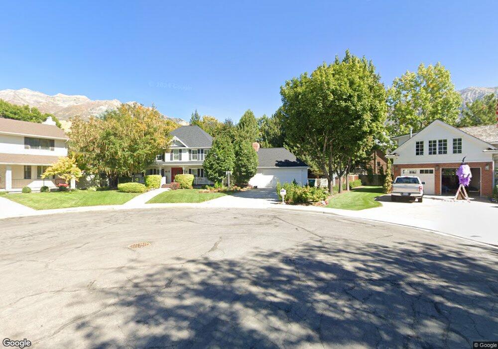
1131 E 1045 N Orem, UT 84097
Old Orchard NeighborhoodEstimated Value: $753,000 - $828,000
4
Beds
4
Baths
4,258
Sq Ft
$184/Sq Ft
Est. Value
About This Home
This home is located at 1131 E 1045 N, Orem, UT 84097 and is currently estimated at $783,985, approximately $184 per square foot. 1131 E 1045 N is a home located in Utah County with nearby schools including Foothill Elementary School, Canyon View Junior High School, and Orem High School.
Ownership History
Date
Name
Owned For
Owner Type
Purchase Details
Closed on
Nov 22, 2024
Sold by
Hacken Family Trust and Hacken Sara M
Bought by
Hacken Family Trust and David T Catmull Revocable Trust
Current Estimated Value
Purchase Details
Closed on
Sep 18, 2018
Sold by
Hacken Sara
Bought by
Hacken Sara M and Hacken Family Trust
Purchase Details
Closed on
Oct 17, 2016
Sold by
Howe Keith Richard and Howe Carrolyn S
Bought by
Catmull David and Hecken Sara
Home Financials for this Owner
Home Financials are based on the most recent Mortgage that was taken out on this home.
Original Mortgage
$384,000
Interest Rate
3.46%
Mortgage Type
New Conventional
Create a Home Valuation Report for This Property
The Home Valuation Report is an in-depth analysis detailing your home's value as well as a comparison with similar homes in the area
Home Values in the Area
Average Home Value in this Area
Purchase History
| Date | Buyer | Sale Price | Title Company |
|---|---|---|---|
| Hacken Family Trust | -- | Us Title | |
| Hacken Sara M | -- | None Available | |
| Catmull David | -- | Access Title Co |
Source: Public Records
Mortgage History
| Date | Status | Borrower | Loan Amount |
|---|---|---|---|
| Previous Owner | Catmull David | $384,000 |
Source: Public Records
Tax History
| Year | Tax Paid | Tax Assessment Tax Assessment Total Assessment is a certain percentage of the fair market value that is determined by local assessors to be the total taxable value of land and additions on the property. | Land | Improvement |
|---|---|---|---|---|
| 2025 | $3,153 | $408,210 | -- | -- |
| 2024 | $2,988 | $385,495 | $0 | $0 |
| 2023 | $2,988 | $392,645 | $0 | $0 |
| 2022 | $2,909 | $370,425 | $0 | $0 |
| 2021 | $2,807 | $541,300 | $241,600 | $299,700 |
| 2020 | $2,614 | $495,500 | $210,100 | $285,400 |
| 2019 | $2,490 | $490,700 | $210,100 | $280,600 |
| 2018 | $2,411 | $454,100 | $210,100 | $244,000 |
| 2017 | $2,328 | $234,795 | $0 | $0 |
| 2016 | $2,345 | $218,185 | $0 | $0 |
| 2015 | $2,293 | $201,740 | $0 | $0 |
| 2014 | $2,137 | $187,165 | $0 | $0 |
Source: Public Records
Map
Nearby Homes
- 1324 N 750 E Unit 3
- 710 E 1280 N
- 1356 N 750 E Unit 11
- 1366 N 750 E
- 733 E 1450 N Unit 5
- 747 E 1500 N Unit 13
- 713 E 1450 N Unit 23
- 566 N Bella Vista Dr
- 713 E 1500 St N Unit 19
- 551 N 900 E
- 976 N 560 E
- 723 E 1450 N Unit 25
- 1643 N Mountain Oaks Dr
- 471 E 700 N
- 372 E 1165 N
- 453 N 650 E
- 362 E 800 N Unit 1
- 540 E Quail Rd
- 1480 N 430 E
- 1371 N 330 E Unit 8
Your Personal Tour Guide
Ask me questions while you tour the home.