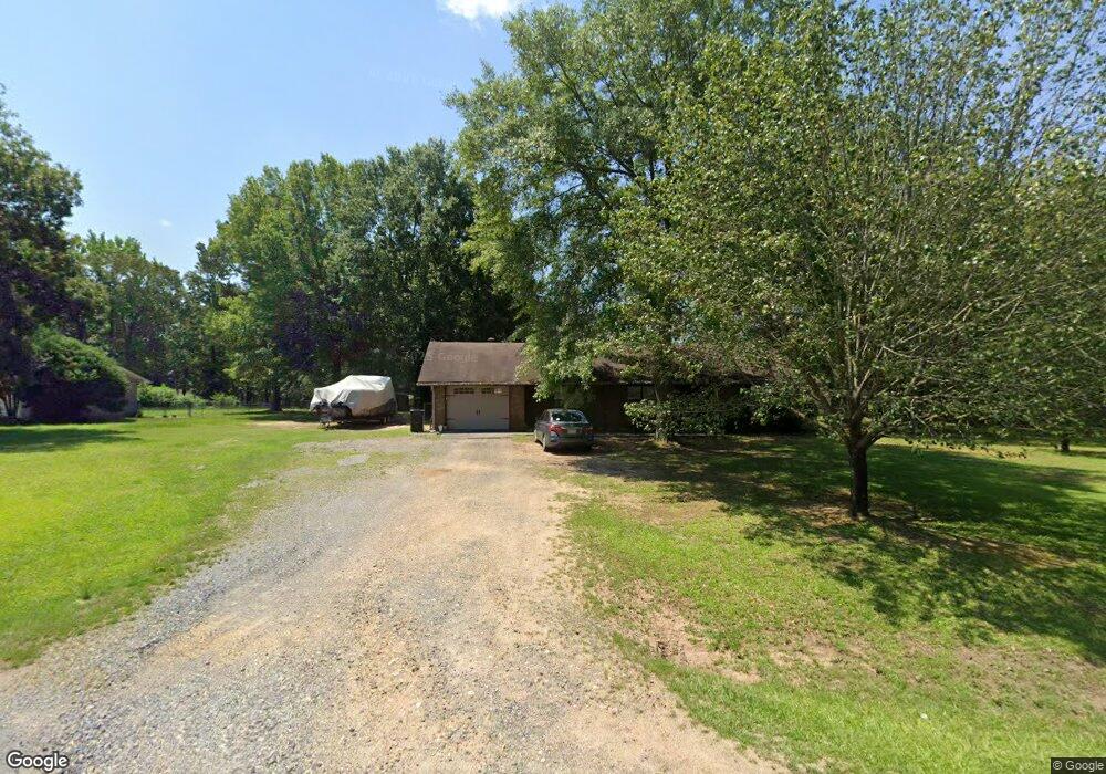
1131 Oakbend Dr Little Rock, AR 72206
Estimated Value: $181,000 - $253,000
--
Bed
2
Baths
1,804
Sq Ft
$126/Sq Ft
Est. Value
About This Home
This home is located at 1131 Oakbend Dr, Little Rock, AR 72206 and is currently estimated at $227,166, approximately $125 per square foot. 1131 Oakbend Dr is a home located in Saline County with nearby schools including Sheridan High School.
Ownership History
Date
Name
Owned For
Owner Type
Purchase Details
Closed on
Feb 11, 2005
Sold by
Furnell Joseph M and Furnell Teresa D
Bought by
Gilbert James Clay
Current Estimated Value
Home Financials for this Owner
Home Financials are based on the most recent Mortgage that was taken out on this home.
Original Mortgage
$103,279
Outstanding Balance
$52,737
Interest Rate
5.82%
Mortgage Type
FHA
Estimated Equity
$174,429
Purchase Details
Closed on
Jan 25, 2000
Bought by
Furnell
Purchase Details
Closed on
Jun 25, 1996
Bought by
Herndon
Purchase Details
Closed on
Feb 15, 1996
Bought by
Herndon
Purchase Details
Closed on
Feb 12, 1996
Bought by
Price
Purchase Details
Closed on
Jun 21, 1995
Bought by
State
Purchase Details
Closed on
Aug 1, 1989
Bought by
Phyllis
Purchase Details
Closed on
Apr 1, 1989
Bought by
Pierce
Create a Home Valuation Report for This Property
The Home Valuation Report is an in-depth analysis detailing your home's value as well as a comparison with similar homes in the area
Home Values in the Area
Average Home Value in this Area
Purchase History
| Date | Buyer | Sale Price | Title Company |
|---|---|---|---|
| Gilbert James Clay | -- | -- | |
| Furnell | $84,000 | -- | |
| Herndon | $72,000 | -- | |
| Herndon | $72,000 | -- | |
| Price | -- | -- | |
| State | -- | -- | |
| Phyllis | -- | -- | |
| Pierce | $56,000 | -- |
Source: Public Records
Mortgage History
| Date | Status | Borrower | Loan Amount |
|---|---|---|---|
| Open | Gilbert James Clay | $103,279 |
Source: Public Records
Tax History Compared to Growth
Tax History
| Year | Tax Paid | Tax Assessment Tax Assessment Total Assessment is a certain percentage of the fair market value that is determined by local assessors to be the total taxable value of land and additions on the property. | Land | Improvement |
|---|---|---|---|---|
| 2025 | $1,439 | $33,253 | $2,000 | $31,253 |
| 2024 | $1,319 | $33,253 | $2,000 | $31,253 |
| 2023 | $1,091 | $33,253 | $2,000 | $31,253 |
| 2022 | $1,078 | $33,253 | $2,000 | $31,253 |
| 2021 | $971 | $27,370 | $3,800 | $23,570 |
| 2020 | $971 | $27,370 | $3,800 | $23,570 |
| 2019 | $971 | $27,370 | $3,800 | $23,570 |
| 2018 | $996 | $27,370 | $3,800 | $23,570 |
| 2017 | $996 | $27,370 | $3,800 | $23,570 |
| 2016 | $1,096 | $26,160 | $3,800 | $22,360 |
| 2015 | $811 | $26,160 | $3,800 | $22,360 |
| 2014 | $811 | $26,160 | $3,800 | $22,360 |
Source: Public Records
Map
Nearby Homes
- 19101 Oaklawn Cove
- 1627 Lorance Dr
- 1024 Ridgewood Dr
- 1641 Lorance Dr
- 1017 Ridgewood Dr
- 2341 Horseshoe Loop
- 000 Warnix Ln
- 000 Nabholtz Rd
- 1102 Wilma Sue
- 000 Hwy 167
- 000 Buddy Dr
- 17825 Cullipher Ln
- 1436 Lakeshore Dr
- 510 Binghamwood Rd
- 7 Amy Ct
- 3042 E Woodson Lateral Rd
- 335 Mckenzie Ln
- 4309 Springlake Cutoff
- 4406 Springlake Cutoff
- 2533 Mail Route Rd
- 1117 Oakbend Dr
- 1213 Oakbend Dr
- 1105 Oaklawn Cir
- 1128 Oakbend Dr
- 1204 Oakbend Dr
- 1007 Oaklawn Cir
- 1116 Oakbend Dr
- 1121 Oaklawn Cir
- 1101 Oakbend Dr
- 1223 Oakbend Dr
- 1100 Oakbend Dr
- 0 Oak Lane Dr
- 401 Oaklawn Cir
- 917 Oaklawn Cir
- 1025 Oakbend Dr
- 1120 Oaklawn Cir
- 421 Oaklawn Cir
- 333 Oaklawn Cir
- 0 Oaklawn Cir Unit 18010185
- 0 Oaklawn Cir Unit 15011458