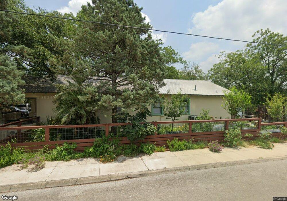
1131 W Martin Luther King Dr San Marcos, TX 78666
Dunbar NeighborhoodEstimated Value: $316,000 - $354,000
--
Bed
--
Bath
1,200
Sq Ft
$280/Sq Ft
Est. Value
About This Home
This home is located at 1131 W Martin Luther King Dr, San Marcos, TX 78666 and is currently estimated at $335,460, approximately $279 per square foot. 1131 W Martin Luther King Dr is a home located in Hays County with nearby schools including Hernandez Elementary School, Dorris Miller Middle School, and San Marcos High School.
Ownership History
Date
Name
Owned For
Owner Type
Purchase Details
Closed on
Jan 15, 2021
Sold by
Thomaides Amy Lynn
Bought by
Thomaides John A
Current Estimated Value
Home Financials for this Owner
Home Financials are based on the most recent Mortgage that was taken out on this home.
Original Mortgage
$150,000
Interest Rate
2.67%
Mortgage Type
New Conventional
Purchase Details
Closed on
Jun 8, 2009
Sold by
Kirwin Patrick Lawrence
Bought by
Kirwin Amy Lynn
Create a Home Valuation Report for This Property
The Home Valuation Report is an in-depth analysis detailing your home's value as well as a comparison with similar homes in the area
Home Values in the Area
Average Home Value in this Area
Purchase History
| Date | Buyer | Sale Price | Title Company |
|---|---|---|---|
| Thomaides John A | -- | Corridor Title Co | |
| Kirwin Amy Lynn | -- | None Available |
Source: Public Records
Mortgage History
| Date | Status | Borrower | Loan Amount |
|---|---|---|---|
| Closed | Thomaides John A | $150,000 | |
| Closed | Kirwin Amy Lynn | $0 |
Source: Public Records
Tax History Compared to Growth
Tax History
| Year | Tax Paid | Tax Assessment Tax Assessment Total Assessment is a certain percentage of the fair market value that is determined by local assessors to be the total taxable value of land and additions on the property. | Land | Improvement |
|---|---|---|---|---|
| 2025 | $2,408 | $197,425 | -- | -- |
| 2024 | $2,408 | $179,477 | $145,590 | $253,170 |
| 2023 | $3,103 | $163,161 | $141,540 | $240,160 |
| 2022 | $5,969 | $291,260 | $104,960 | $186,300 |
| 2021 | $2,972 | $134,844 | $67,470 | $113,650 |
| 2020 | $2,382 | $122,585 | $57,830 | $99,170 |
| 2019 | $2,743 | $111,441 | $57,830 | $96,030 |
| 2018 | $2,505 | $101,310 | $25,700 | $75,610 |
| 2017 | $2,242 | $93,250 | $12,850 | $80,400 |
| 2016 | $2,116 | $88,020 | $12,850 | $75,170 |
| 2015 | $1,681 | $83,750 | $12,850 | $70,900 |
Source: Public Records
Map
Nearby Homes
- 203 S Mitchell St Unit 4
- 1010 Gravel St
- 1011 Gravel St
- 1222 W Hopkins St
- 102 Pitt St
- 812 Gravel St
- 408 Railroad St
- 307 Quarry St
- 833 Belvin St
- 335 Veramendi St
- 309 Ellis St
- 214 Jackman St
- 121 Scott St
- 328 Wavell St
- 527 W San Antonio St
- 216 Armstrong St
- 1128 Invasion St
- 506 W San Antonio St Unit 205
- 813 Bracewood Cir
- 421 W San Antonio St Unit I-3
- 1121 W Martin Luther King Dr
- 1201 W M L K Dr Unit 3
- 1124 Mead St
- 210 S Wilson St
- 1130 W Martin Luther King Dr
- 1119 W Martin Luther King Dr
- 1200 W Martin Luther King Dr
- 214 S Wilson St
- 1128 W Martin Luther King Dr
- 215 S Wilson St
- 1206 W Martin Luther King Dr
- 1117 W Martin Luther King Dr
- 123 S Wilson St
- 1116 W Martin Luther King Dr
- 213 S Wilson St
- 1212 W Martin Luther King Dr
- 1205 W Martin Luther King Dr
- 122 S Wilson St
- 1109 W Martin Luther King Dr
- 117 S Wilson St