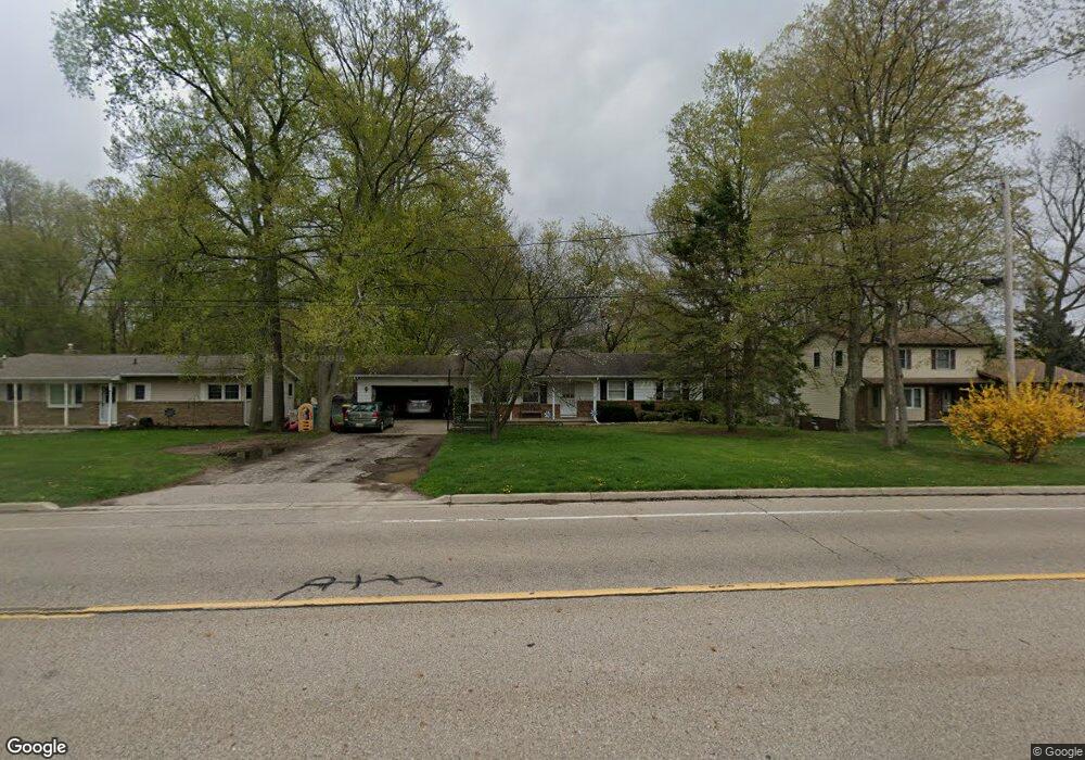
11310 Nixon Rd Grand Ledge, MI 48837
Estimated Value: $245,000 - $289,000
3
Beds
2
Baths
1,196
Sq Ft
$222/Sq Ft
Est. Value
About This Home
This home is located at 11310 Nixon Rd, Grand Ledge, MI 48837 and is currently estimated at $265,571, approximately $222 per square foot. 11310 Nixon Rd is a home located in Eaton County with nearby schools including Delta Center Elementary School, Leon W. Hayes Middle School, and Grand Ledge High School.
Ownership History
Date
Name
Owned For
Owner Type
Purchase Details
Closed on
Sep 16, 2010
Sold by
Alassane Moussa
Bought by
Alassane Cheryl L
Current Estimated Value
Purchase Details
Closed on
Jun 14, 2006
Sold by
Cruthers Gregory S and Cruthers Sylvia L
Bought by
Alassane Moussa and Alassane Cheryl
Home Financials for this Owner
Home Financials are based on the most recent Mortgage that was taken out on this home.
Original Mortgage
$121,920
Outstanding Balance
$72,119
Interest Rate
6.68%
Mortgage Type
Purchase Money Mortgage
Estimated Equity
$193,452
Create a Home Valuation Report for This Property
The Home Valuation Report is an in-depth analysis detailing your home's value as well as a comparison with similar homes in the area
Home Values in the Area
Average Home Value in this Area
Purchase History
| Date | Buyer | Sale Price | Title Company |
|---|---|---|---|
| Alassane Cheryl L | -- | None Available | |
| Alassane Moussa | $152,400 | None Available |
Source: Public Records
Mortgage History
| Date | Status | Borrower | Loan Amount |
|---|---|---|---|
| Open | Alassane Moussa | $121,920 |
Source: Public Records
Tax History Compared to Growth
Tax History
| Year | Tax Paid | Tax Assessment Tax Assessment Total Assessment is a certain percentage of the fair market value that is determined by local assessors to be the total taxable value of land and additions on the property. | Land | Improvement |
|---|---|---|---|---|
| 2025 | $2,746 | $112,400 | $0 | $0 |
| 2024 | $1,435 | $99,900 | $0 | $0 |
| 2023 | $1,337 | $90,400 | $0 | $0 |
| 2022 | $2,312 | $84,300 | $0 | $0 |
| 2021 | $2,207 | $81,000 | $0 | $0 |
| 2020 | $2,178 | $74,800 | $0 | $0 |
| 2019 | $2,147 | $70,680 | $0 | $0 |
| 2018 | $2,014 | $67,700 | $0 | $0 |
| 2017 | $1,972 | $63,700 | $0 | $0 |
| 2016 | -- | $62,100 | $0 | $0 |
| 2015 | -- | $58,600 | $0 | $0 |
| 2014 | -- | $54,762 | $0 | $0 |
| 2013 | -- | $53,900 | $0 | $0 |
Source: Public Records
Map
Nearby Homes
- 11273 Stoney Brook Dr
- 11304 Carousel Dr
- 11254 Jerryson Dr
- 11350 Traverse Dr
- 11169 Jerryson Dr
- The Brinley Plan at Wind Trace - Hometown Series
- 6695 Dickson Dr
- The Amber Plan at Wind Trace - Hometown Series
- The Rutherford Plan at Wind Trace - Designer Series
- The Taylor Plan at Wind Trace - Hometown Series
- The Grayson Plan at Wind Trace - Americana Series
- The Wisteria Plan at Wind Trace - Americana Series
- The Stockton Plan at Wind Trace - Hometown Series
- The Marley Plan at Wind Trace - Americana Series
- The Newport Plan at Wind Trace - Designer Series
- The Balsam Plan at Wind Trace - Americana Series
- The Birkshire II Plan at Wind Trace - Designer Series
- The Fitzgerald Plan at Wind Trace - Americana Series
- The Sebastian Plan at Wind Trace - Designer Series
- The Stafford Plan at Wind Trace - Hometown Series
- 11356 Nixon Rd
- 11356 Nixon
- 11280 Nixon Rd
- 11351 Point of Woods Dr
- 11366 Nixon Rd
- 11325 Nixon Rd
- 11341 Nixon Rd
- 11305 Nixon Rd
- 11365 Point of Woods Dr
- 11374 Nixon Rd
- 11291 Nixon Rd
- 11351 Nixon Rd
- 11266 Nixon Rd
- 11382 Nixon Rd
- 11273 Nixon Rd
- 11306 Brickand Dr
- 11314 Brickand Dr
- 11232 Brickand Dr
- 11411 Point of Woods Dr
- 11385 Nixon Rd