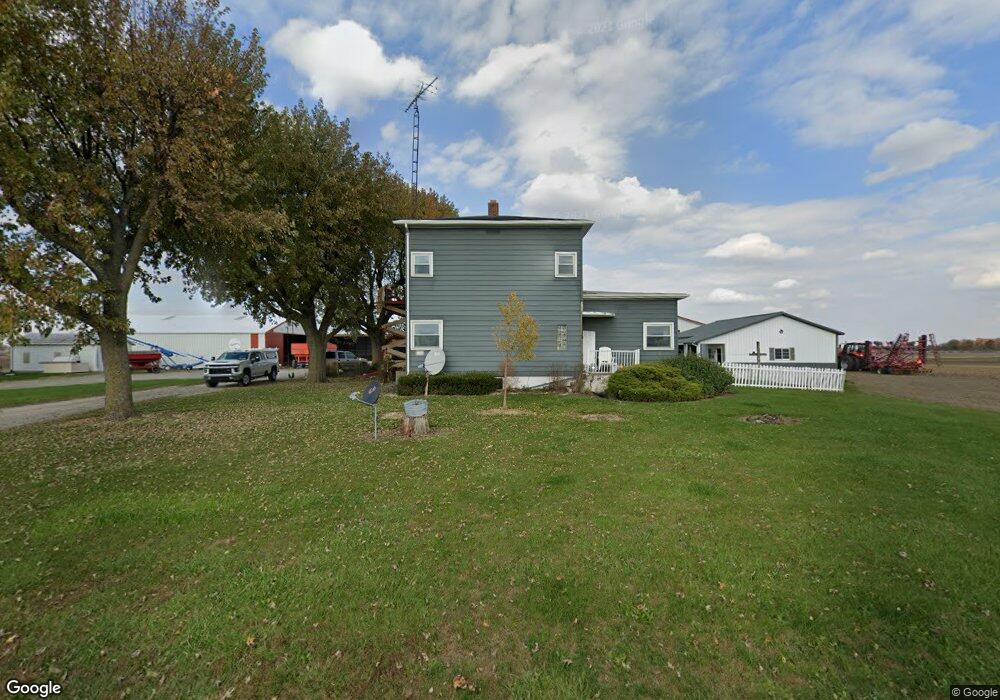
11316 County Highway 53 Upper Sandusky, OH 43351
Estimated Value: $328,000 - $670,329
3
Beds
1
Bath
2,112
Sq Ft
$236/Sq Ft
Est. Value
About This Home
This home is located at 11316 County Highway 53, Upper Sandusky, OH 43351 and is currently estimated at $499,165, approximately $236 per square foot. 11316 County Highway 53 is a home located in Wyandot County with nearby schools including Upper Sandusky High School and St. Peter Elementary School.
Ownership History
Date
Name
Owned For
Owner Type
Purchase Details
Closed on
Mar 8, 2007
Sold by
Fleming Arlene E and Mann Martha J
Bought by
Ross Lary A and Ross Nancy C
Current Estimated Value
Home Financials for this Owner
Home Financials are based on the most recent Mortgage that was taken out on this home.
Original Mortgage
$253,320
Outstanding Balance
$31,598
Interest Rate
6.19%
Mortgage Type
Future Advance Clause Open End Mortgage
Estimated Equity
$467,567
Purchase Details
Closed on
Dec 1, 2001
Bought by
Ross Larry A and Ross Nancy C
Create a Home Valuation Report for This Property
The Home Valuation Report is an in-depth analysis detailing your home's value as well as a comparison with similar homes in the area
Home Values in the Area
Average Home Value in this Area
Purchase History
| Date | Buyer | Sale Price | Title Company |
|---|---|---|---|
| Ross Lary A | $253,325 | None Available | |
| Ross Larry A | $95,000 | -- |
Source: Public Records
Mortgage History
| Date | Status | Borrower | Loan Amount |
|---|---|---|---|
| Open | Ross Lary A | $253,320 |
Source: Public Records
Tax History Compared to Growth
Tax History
| Year | Tax Paid | Tax Assessment Tax Assessment Total Assessment is a certain percentage of the fair market value that is determined by local assessors to be the total taxable value of land and additions on the property. | Land | Improvement |
|---|---|---|---|---|
| 2024 | $4,008 | $158,790 | $60,490 | $98,300 |
| 2023 | $4,008 | $123,260 | $24,960 | $98,300 |
| 2022 | $4,176 | $115,550 | $26,110 | $89,440 |
| 2021 | $3,866 | $115,550 | $26,110 | $89,440 |
| 2020 | $3,885 | $115,550 | $26,110 | $89,440 |
| 2019 | $3,824 | $115,550 | $26,110 | $89,440 |
| 2018 | $3,609 | $110,570 | $34,900 | $75,670 |
| 2017 | $3,748 | $110,570 | $34,900 | $75,670 |
| 2016 | $3,504 | $110,570 | $34,900 | $75,670 |
| 2015 | -- | $104,980 | $29,310 | $75,670 |
| 2014 | -- | $106,250 | $29,310 | $76,940 |
| 2013 | -- | $106,250 | $29,310 | $76,940 |
Source: Public Records
Map
Nearby Homes
- 381 & 383 W Johnson St
- US 30 Sr 23
- 203 203 1/2 E Crawford St
- 221&221 1/2 S 7th St
- 0 State Highway 53 Unit 6132082
- 11650 Township Highway 103
- 379 Spring St
- 225 S Hazel St
- 346 W Hicks St
- 386 W Finley St
- 326 S 8th St
- 602 S 7th St
- 137 N 8th St
- 454 N Sandusky Ave
- 430 S Sandusky Ave
- 417 N 8th St
- 903 N Warpole St
- 606 Polaris Dr
- 305 S 5th St
- 443 N 7th St
- 11119 County Highway 53
- 11713 County Highway 108
- 11002 State Highway 53 W
- 10819 State Highway 53 W
- 10819 Ohio 53
- 11944 County Highway 53
- 10631 State Highway 53 W
- 11188 County Highway 108
- 11004 State Highway 53 W
- 11998 Us Highway 30
- 12048 Co Hwy
- 17408 T H 103
- 123 & 123 1/2 E Hicks St
- 418 & 420 Mcconnell St
- 0 State Hwy 30 Unit 211704
- 0 State Hwy 30 Unit 6093148
- 0 State Highway 53 Unit 6092656
- 1669 Cty Hwy 330
- 11406 County Highway 330