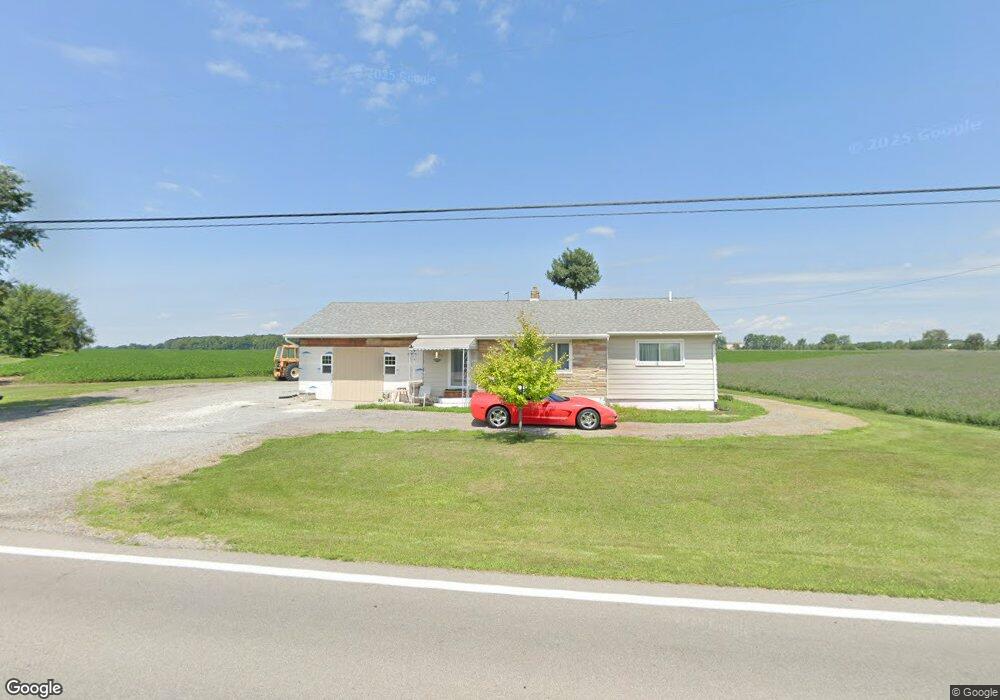
11325 Us Highway 127 West Unity, OH 43570
Estimated Value: $102,000 - $137,000
3
Beds
1
Bath
1,040
Sq Ft
$115/Sq Ft
Est. Value
About This Home
This home is located at 11325 Us Highway 127, West Unity, OH 43570 and is currently estimated at $119,283, approximately $114 per square foot. 11325 Us Highway 127 is a home located in Williams County with nearby schools including Hilltop Elementary School and Hilltop High School.
Ownership History
Date
Name
Owned For
Owner Type
Purchase Details
Closed on
Nov 8, 2016
Sold by
Wendorf Tobey D and Wendorf Lisa S
Bought by
Perez Marcos
Current Estimated Value
Purchase Details
Closed on
Mar 26, 2015
Sold by
Wiler Dolly H and Evans Emma
Bought by
Wendorf Tobey D and Wendorf Lisa S
Purchase Details
Closed on
Nov 15, 2002
Sold by
Wiler Earl E and Wiler Dolly H
Bought by
Wiler Dolly Hazel
Purchase Details
Closed on
Jan 1, 1990
Bought by
Wiler Earl E and Wiler Dolly H
Create a Home Valuation Report for This Property
The Home Valuation Report is an in-depth analysis detailing your home's value as well as a comparison with similar homes in the area
Home Values in the Area
Average Home Value in this Area
Purchase History
| Date | Buyer | Sale Price | Title Company |
|---|---|---|---|
| Perez Marcos | $49,950 | None Available | |
| Wendorf Tobey D | $31,000 | None Available | |
| Wiler Dolly Hazel | -- | -- | |
| Wiler Earl E | -- | -- |
Source: Public Records
Tax History Compared to Growth
Tax History
| Year | Tax Paid | Tax Assessment Tax Assessment Total Assessment is a certain percentage of the fair market value that is determined by local assessors to be the total taxable value of land and additions on the property. | Land | Improvement |
|---|---|---|---|---|
| 2024 | $572 | $25,070 | $5,010 | $20,060 |
| 2023 | $572 | $21,950 | $5,080 | $16,870 |
| 2022 | $973 | $21,040 | $5,080 | $15,960 |
| 2021 | $932 | $21,040 | $5,080 | $15,960 |
| 2020 | $807 | $17,540 | $4,240 | $13,300 |
| 2019 | $787 | $17,540 | $4,240 | $13,300 |
| 2018 | $811 | $17,540 | $4,240 | $13,300 |
| 2017 | $849 | $18,900 | $4,550 | $14,350 |
| 2016 | $826 | $18,900 | $4,550 | $14,350 |
| 2015 | $828 | $18,900 | $4,550 | $14,350 |
| 2014 | $878 | $18,310 | $5,250 | $13,060 |
| 2013 | $440 | $18,310 | $5,250 | $13,060 |
Source: Public Records
Map
Nearby Homes
- 205 Taylor Dr
- 340 S Main St
- 311 W Rings St
- 000 W Jackson
- 16806 US Highway 20a
- 22227 Us Highway 20a
- 18 Cobblestone Rd
- 15664 County Road K
- 16228 County Road N-30
- 305 W Mulberry St
- 301 Horton St
- 0 St Rt 15 Unit 10001011
- 10628 Ohio 15
- 3063 County Road 26-2
- 22018 County Road F
- 0 U S 20
- 5065 County Road 20-50
- 0 County Road 18
- 17738 County Rd E
- 0 County Road F
- 11367 Us Highway 127
- 11367 US Hwy 127
- 11261 Us Highway 127
- 11188 County Road 1950
- 11439 Us Highway 127
- 11100 County Road 1950
- 11100 County Road 19-50
- 11160 Us Highway 127
- 11090 County Road 1950
- 11487 Us Highway 127
- 11066 County Road 1950
- 11044 County Road 1950
- 11020 County Road 19-50
- 11020 County Road 1950
- 10988 County Road 1950
- 19652 County Road K
- 11566 Us Highway 127
- 11627 Us Highway 127
- 11627 U S 127
- 11626 Us Highway 127