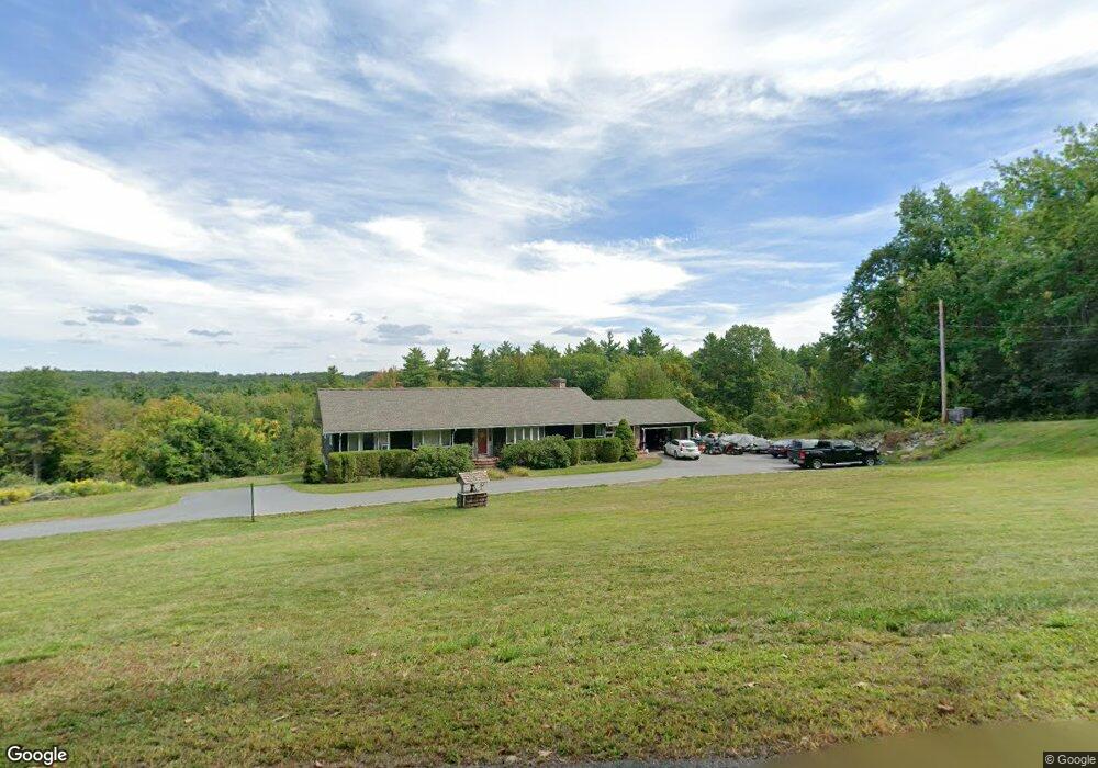
1133 Pearl Hill Rd Fitchburg, MA 01420
Estimated Value: $608,000 - $646,533
3
Beds
4
Baths
3,326
Sq Ft
$189/Sq Ft
Est. Value
About This Home
This home is located at 1133 Pearl Hill Rd, Fitchburg, MA 01420 and is currently estimated at $627,133, approximately $188 per square foot. 1133 Pearl Hill Rd is a home located in Worcester County with nearby schools including Fitchburg High School, Crocker Elementary School, and South Street Elementary School.
Ownership History
Date
Name
Owned For
Owner Type
Purchase Details
Closed on
Nov 21, 2000
Sold by
Caisse Richard P
Bought by
Plume Sharry A and Plume Wayne
Current Estimated Value
Home Financials for this Owner
Home Financials are based on the most recent Mortgage that was taken out on this home.
Original Mortgage
$107,000
Interest Rate
7.78%
Mortgage Type
Purchase Money Mortgage
Create a Home Valuation Report for This Property
The Home Valuation Report is an in-depth analysis detailing your home's value as well as a comparison with similar homes in the area
Home Values in the Area
Average Home Value in this Area
Purchase History
| Date | Buyer | Sale Price | Title Company |
|---|---|---|---|
| Plume Sharry A | $30,000 | -- |
Source: Public Records
Mortgage History
| Date | Status | Borrower | Loan Amount |
|---|---|---|---|
| Open | Plume Sharry A | $88,000 | |
| Closed | Plume Sharry A | $100,000 | |
| Closed | Plume Sharry A | $108,000 | |
| Closed | Plume Sharry A | $107,000 |
Source: Public Records
Tax History Compared to Growth
Tax History
| Year | Tax Paid | Tax Assessment Tax Assessment Total Assessment is a certain percentage of the fair market value that is determined by local assessors to be the total taxable value of land and additions on the property. | Land | Improvement |
|---|---|---|---|---|
| 2025 | $74 | $547,200 | $118,500 | $428,700 |
| 2024 | $7,313 | $493,800 | $88,600 | $405,200 |
| 2023 | $7,161 | $447,000 | $76,200 | $370,800 |
| 2022 | $6,757 | $383,700 | $69,300 | $314,400 |
| 2021 | $6,938 | $364,600 | $67,800 | $296,800 |
| 2020 | $6,763 | $343,100 | $64,800 | $278,300 |
| 2019 | $6,182 | $301,700 | $63,400 | $238,300 |
| 2018 | $5,893 | $280,500 | $62,800 | $217,700 |
| 2017 | $5,761 | $268,100 | $62,800 | $205,300 |
| 2016 | $5,533 | $260,600 | $62,800 | $197,800 |
| 2015 | $5,261 | $254,400 | $61,100 | $193,300 |
| 2014 | $5,104 | $257,400 | $64,100 | $193,300 |
Source: Public Records
Map
Nearby Homes
- 1088 Ashby State Rd
- 9 Sequoia Dr
- 340 New West Townsend Rd
- 840 Fisher Rd
- Lot 6 Old Northfield Rd
- Lot 7 Old Northfield Rd
- Lot 8 Old Northfield Rd
- Lot 3 Old Northfield Rd
- 1178 Northfield Rd
- 277 Stoneybrook Rd
- 58 Stone Brook Ln
- 1 High Rock Rd
- 179 Ashby State Rd
- 162 Fisher Rd
- 481 W Townsend Rd
- 12 W Townsend Rd
- 507/533R W Townsend Rd
- 1249 Richardson Rd
- 1083 Northfield Rd
- 15 Will Thompson Way
- 1161 Pearl Hill Rd
- 55 Gibson Rd
- 1035 Pearl Hill Rd
- 1109 Pearl Hill Rd
- 1030 Pearl Hill Rd
- 305 High Rock Branch Rd
- 1241 Pearl Hill Rd
- 0 Gibson Rd
- 98 Gibson Rd
- 1315 Pearl Hill Rd
- 567 New West Townsend Rd
- 717 New West Townsend Rd
- 810 High Rock Rd
- 870 High Rock Rd
- 1295 Pearl Hill Rd
- 950 Pearl Hill Rd
- 719 New West Townsend Rd
- 961 Pearl Hill Rd
- 1323 Pearl Hill Rd
- 136 Gibson Rd