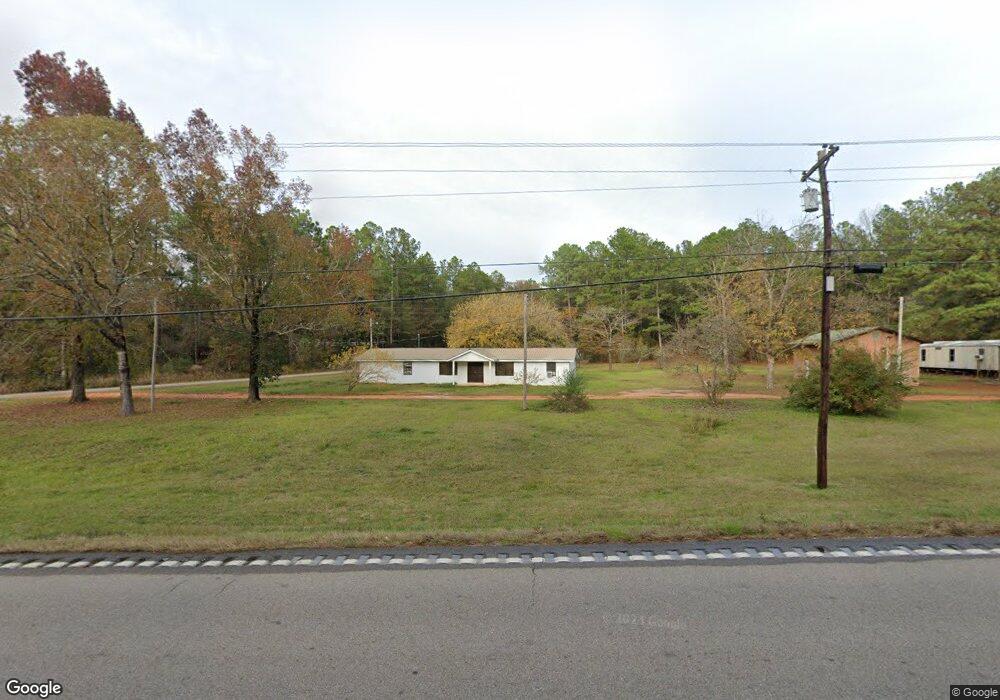
1134 Highway 198 W Lucedale, MS 39452
Estimated Value: $173,000 - $248,000
3
Beds
1
Bath
1,681
Sq Ft
$124/Sq Ft
Est. Value
About This Home
This home is located at 1134 Highway 198 W, Lucedale, MS 39452 and is currently estimated at $208,000, approximately $123 per square foot. 1134 Highway 198 W is a home located in George County with nearby schools including George County High School.
Ownership History
Date
Name
Owned For
Owner Type
Purchase Details
Closed on
May 28, 2020
Sold by
Howard Michael W
Bought by
Boradus William and Brioadus Jennifer
Current Estimated Value
Home Financials for this Owner
Home Financials are based on the most recent Mortgage that was taken out on this home.
Original Mortgage
$26,350
Interest Rate
3.2%
Mortgage Type
New Conventional
Purchase Details
Closed on
May 8, 2020
Sold by
George County Clerk
Bought by
L & A Acquisitions Llc
Home Financials for this Owner
Home Financials are based on the most recent Mortgage that was taken out on this home.
Original Mortgage
$26,350
Interest Rate
3.2%
Mortgage Type
New Conventional
Create a Home Valuation Report for This Property
The Home Valuation Report is an in-depth analysis detailing your home's value as well as a comparison with similar homes in the area
Home Values in the Area
Average Home Value in this Area
Purchase History
| Date | Buyer | Sale Price | Title Company |
|---|---|---|---|
| Boradus William | -- | None Available | |
| L & A Acquisitions Llc | $904 | None Available | |
| L & A Acquisitions Llc | $786 | None Available |
Source: Public Records
Mortgage History
| Date | Status | Borrower | Loan Amount |
|---|---|---|---|
| Closed | Boradus William | $26,350 |
Source: Public Records
Tax History Compared to Growth
Tax History
| Year | Tax Paid | Tax Assessment Tax Assessment Total Assessment is a certain percentage of the fair market value that is determined by local assessors to be the total taxable value of land and additions on the property. | Land | Improvement |
|---|---|---|---|---|
| 2024 | $893 | $7,294 | $0 | $0 |
| 2023 | $892 | $7,296 | $0 | $0 |
| 2022 | $849 | $6,949 | $0 | $0 |
| 2021 | $850 | $6,951 | $0 | $0 |
| 2020 | $365 | $4,455 | $0 | $0 |
| 2019 | $365 | $4,457 | $0 | $0 |
| 2018 | $544 | $4,501 | $0 | $0 |
| 2015 | -- | $4,461 | $0 | $0 |
| 2014 | -- | $4,120 | $0 | $0 |
Source: Public Records
Map
Nearby Homes
- 0 Country Hill Rd
- 120 Readys Dr
- 1109 Country Hill Rd
- 28.3 Acres Sandford Dr
- 0 Ms-63 Unit 4104917
- Country Hill Rd
- 0 Doe Ridge Highland
- 130 Gerry Fallon Rd
- 000 Sanford Rd
- 1272 U S 98
- 116 Finch Rd
- 3281 Main St
- 7 Ac+- Lamar St
- 2203 Fig Farm Rd
- 0 Richard Reeves Rd
- 1151 Beaver Dam Rd
- The Aria Plan at Kings Crossing
- The Freeport Plan at Kings Crossing
- The Aldridge Plan at Kings Crossing
- 134 Live Oak Dr
- 4113 Highway 198 W
- 104 John Luke Mizell Rd
- 142 Ernest Pipkins Rd
- 107 John Luke Mizell Rd
- 118 John Luke Mizell Rd Unit B
- 148 John Luke Mizell Rd
- 188 Ernest Pipkins Rd
- 173 John Luke Mizell Rd
- 132 Myrtle Dr
- 183 Ernest Pipkins Rd
- 1.75ac Hwy 198 W
- 201 Ernest Pipkins Rd
- 218 Highway 198 W
- 164 Bexley Rd S
- 134 David Holland Cir
- 154 Eckhoff Rd
- 105 David Holland Cir
- 154 Sherwood Dr
- 136 Sherwood Dr
- 138 Sherwood Dr