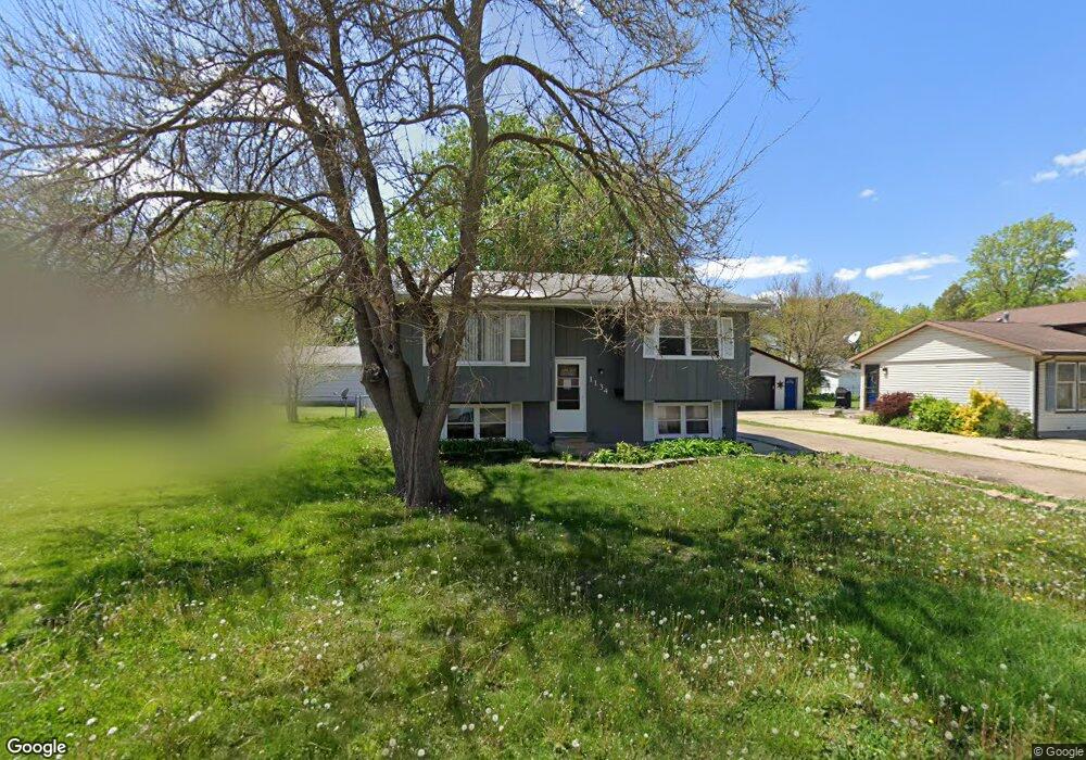
1134 Linbud Ln Waterloo, IA 50701
Alabar Hills NeighborhoodEstimated Value: $166,000 - $190,000
3
Beds
2
Baths
1,359
Sq Ft
$133/Sq Ft
Est. Value
About This Home
This home is located at 1134 Linbud Ln, Waterloo, IA 50701 and is currently estimated at $180,727, approximately $132 per square foot. 1134 Linbud Ln is a home located in Black Hawk County with nearby schools including Becker Elementary School, Central Middle School, and West High School.
Ownership History
Date
Name
Owned For
Owner Type
Purchase Details
Closed on
Feb 21, 2014
Sold by
Styve Jason and Styve Eve Marie
Bought by
Hamilton Prince A
Current Estimated Value
Home Financials for this Owner
Home Financials are based on the most recent Mortgage that was taken out on this home.
Original Mortgage
$99,358
Outstanding Balance
$74,800
Interest Rate
4.24%
Mortgage Type
FHA
Estimated Equity
$105,927
Create a Home Valuation Report for This Property
The Home Valuation Report is an in-depth analysis detailing your home's value as well as a comparison with similar homes in the area
Home Values in the Area
Average Home Value in this Area
Purchase History
| Date | Buyer | Sale Price | Title Company |
|---|---|---|---|
| Hamilton Prince A | $108,500 | Black Hawk County Abstract & |
Source: Public Records
Mortgage History
| Date | Status | Borrower | Loan Amount |
|---|---|---|---|
| Open | Hamilton Prince A | $99,358 |
Source: Public Records
Tax History Compared to Growth
Tax History
| Year | Tax Paid | Tax Assessment Tax Assessment Total Assessment is a certain percentage of the fair market value that is determined by local assessors to be the total taxable value of land and additions on the property. | Land | Improvement |
|---|---|---|---|---|
| 2024 | $3,160 | $155,920 | $16,340 | $139,580 |
| 2023 | $2,646 | $155,920 | $16,340 | $139,580 |
| 2022 | $2,574 | $129,330 | $16,340 | $112,990 |
| 2021 | $2,440 | $129,330 | $16,340 | $112,990 |
| 2020 | $2,374 | $115,370 | $16,340 | $99,030 |
| 2019 | $2,374 | $115,370 | $16,340 | $99,030 |
| 2018 | $2,378 | $115,370 | $16,340 | $99,030 |
| 2017 | $2,454 | $115,370 | $16,340 | $99,030 |
| 2016 | $2,420 | $115,370 | $16,340 | $99,030 |
| 2015 | $2,420 | $115,370 | $16,340 | $99,030 |
| 2014 | $2,466 | $115,370 | $16,340 | $99,030 |
Source: Public Records
Map
Nearby Homes
- 1269 Scott Ave
- 1248 Scott Ave
- 1240 Eleanor Dr
- 1290 Scott Ave
- 1225 Downing Ave
- 1221 Downing Ave
- 1200 St Andrews Ave
- 1268 Saint Andrews Ave
- 1711 Huntington Rd
- 1018 Janney Ave
- 2320 University Ave
- 1325 Huntington Rd
- 437 Ardmore St
- 432 Auburn St
- 725 Harwood Ave
- 104 Bergen Dr
- 102 Bergen Dr
- 1311 Magnolia Pkwy
- 128 Axlewood Dr
- 124 Axlewood Dr
- 1126 Linbud Ln
- 1650 Sager Ave
- 1660 Sager Ave
- 1118 Linbud Ln
- 1133 Littlefield Rd
- 1670 Sager Ave
- 1110 Linbud Ln
- 1127 Littlefield Rd
- 1131 Bobbi Ln
- 1139 Littlefield Rd
- 1133 Bobbi Ln
- 1135 Bobbi Ln
- 1147 Littlefield Rd
- 1137 Bobbi Ln
- 1123 Bobbi Ln
- 1671 Sager Ave
- 1100 Linbud Ln
- 1681 Sager Ave
- 1661 Sager Ave
- 1651 Sager Ave