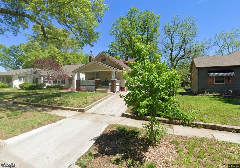
1134 SW High Ave Topeka, KS 66604
Randolph NeighborhoodEstimated Value: $145,000 - $164,000
3
Beds
1
Bath
1,284
Sq Ft
$121/Sq Ft
Est. Value
About This Home
This home is located at 1134 SW High Ave, Topeka, KS 66604 and is currently estimated at $154,727, approximately $120 per square foot. 1134 SW High Ave is a home located in Shawnee County with nearby schools including Buckeye Elementary School, Martin Park Elementary School, and Randolph Elementary School.
Ownership History
Date
Name
Owned For
Owner Type
Purchase Details
Closed on
Apr 10, 2009
Sold by
Lowery Caren and Lowery Ken
Bought by
Staerkel Todd C and Staerkel Heidi R
Current Estimated Value
Purchase Details
Closed on
Apr 23, 2007
Sold by
Hutchinson Lauralyn M and Hutchinson Clifford R
Bought by
Staerkel Todd C and Staerkel Heidi R
Home Financials for this Owner
Home Financials are based on the most recent Mortgage that was taken out on this home.
Original Mortgage
$61,750
Interest Rate
6.1%
Mortgage Type
Purchase Money Mortgage
Create a Home Valuation Report for This Property
The Home Valuation Report is an in-depth analysis detailing your home's value as well as a comparison with similar homes in the area
Home Values in the Area
Average Home Value in this Area
Purchase History
| Date | Buyer | Sale Price | Title Company |
|---|---|---|---|
| Staerkel Todd C | -- | First American Title | |
| Staerkel Todd C | -- | Kansas Secured Title |
Source: Public Records
Mortgage History
| Date | Status | Borrower | Loan Amount |
|---|---|---|---|
| Previous Owner | Staerkel Todd C | $61,750 |
Source: Public Records
Tax History Compared to Growth
Tax History
| Year | Tax Paid | Tax Assessment Tax Assessment Total Assessment is a certain percentage of the fair market value that is determined by local assessors to be the total taxable value of land and additions on the property. | Land | Improvement |
|---|---|---|---|---|
| 2025 | $2,124 | $15,882 | -- | -- |
| 2023 | $2,124 | $14,411 | $0 | $0 |
| 2022 | $1,846 | $12,531 | $0 | $0 |
| 2021 | $1,698 | $10,897 | $0 | $0 |
| 2020 | $1,597 | $10,378 | $0 | $0 |
| 2019 | $1,574 | $10,175 | $0 | $0 |
| 2018 | $1,529 | $9,878 | $0 | $0 |
| 2017 | $1,532 | $9,878 | $0 | $0 |
| 2014 | $1,610 | $10,267 | $0 | $0 |
Source: Public Records
Map
Nearby Homes
- 1181 SW MacVicar Ave
- 1164 SW MacVicar Ave
- 1147 SW Webster Ave
- 2516 SW Huntoon St
- 1022 SW MacVicar Ave
- 1156 SW Woodward Ave
- 1150 SW Collins Ave
- 2812 SW Huntoon St
- 923 SW High Ave
- 1115 SW Billard Ave
- 2012 SW 10th Ave
- 2204 SW Kensington Ct
- 1216 SW College Ave
- 2330 SW Hazelton Ct
- 804 SW High Ave
- 1225 SW Lakeside Dr
- 1355 SW Medford Ave
- 1432 SW MacVicar Ave
- 1421 SW Jewell Ave
- 1327 SW College Ave
- 1140 SW High Ave
- 1130 SW High Ave
- 1124 SW High Ave
- 1142 SW High Ave
- 1137 SW Wayne Ave
- 1133 SW Wayne Ave
- 1120 SW High Ave
- 1143 SW Wayne Ave
- 1133 SW High Ave
- 1116 SW High Ave
- 1129 SW High Ave Unit 5505 SW Drury Lane
- 1129 SW High Ave
- 1147 SW Wayne Ave
- 1137 SW High Ave
- 1125 SW Wayne Ave
- 1125 SW High Ave
- 1141 SW High Ave
- 1123 SW High Ave
- 1145 SW High Ave
- 1112 SW High Ave