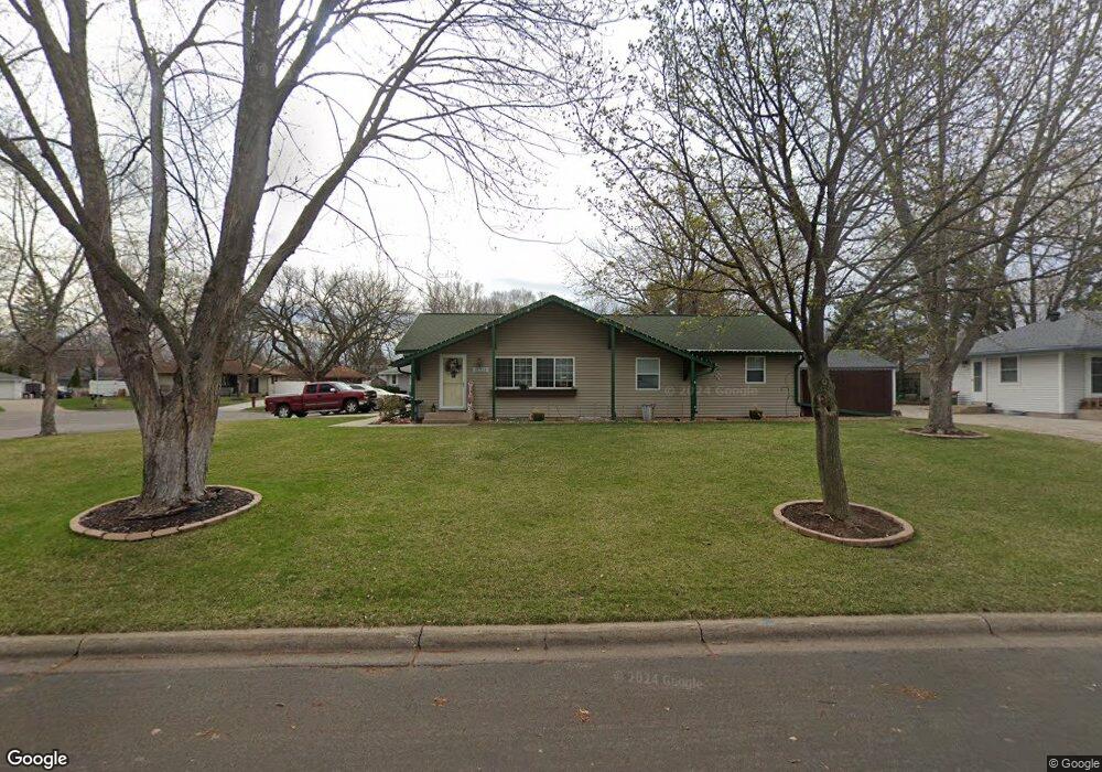
11351 Xavis St NW Coon Rapids, MN 55433
Estimated Value: $320,000 - $354,348
3
Beds
2
Baths
2,496
Sq Ft
$134/Sq Ft
Est. Value
About This Home
This home is located at 11351 Xavis St NW, Coon Rapids, MN 55433 and is currently estimated at $335,087, approximately $134 per square foot. 11351 Xavis St NW is a home located in Anoka County with nearby schools including Lucile Bruner Elementary School, Morris Bye Elementary School, and Laughlin Junior/Senior High School.
Ownership History
Date
Name
Owned For
Owner Type
Purchase Details
Closed on
Feb 25, 2019
Sold by
Us Bank National Association
Bought by
Emry David and Emry Desiree
Current Estimated Value
Home Financials for this Owner
Home Financials are based on the most recent Mortgage that was taken out on this home.
Original Mortgage
$216,600
Outstanding Balance
$190,428
Interest Rate
4.4%
Mortgage Type
New Conventional
Estimated Equity
$144,659
Purchase Details
Closed on
May 22, 2018
Sold by
Larson Kelly B and Larson Shane
Bought by
Us Bank Na and Bank Of America Na
Purchase Details
Closed on
Jan 30, 2004
Sold by
Larson Kelly B and Larson Shane
Bought by
Mathew Bauer
Purchase Details
Closed on
May 24, 1996
Sold by
Dept Of Va
Bought by
Larson Kelly B
Create a Home Valuation Report for This Property
The Home Valuation Report is an in-depth analysis detailing your home's value as well as a comparison with similar homes in the area
Home Values in the Area
Average Home Value in this Area
Purchase History
| Date | Buyer | Sale Price | Title Company |
|---|---|---|---|
| Emry David | $228,000 | Servicielink Llc | |
| Us Bank Na | $315,301 | None Available | |
| Mathew Bauer | $200,000 | -- | |
| Larson Kelly B | $95,200 | -- |
Source: Public Records
Mortgage History
| Date | Status | Borrower | Loan Amount |
|---|---|---|---|
| Open | Emry David | $216,600 | |
| Closed | Larson Kelly B | -- |
Source: Public Records
Tax History Compared to Growth
Tax History
| Year | Tax Paid | Tax Assessment Tax Assessment Total Assessment is a certain percentage of the fair market value that is determined by local assessors to be the total taxable value of land and additions on the property. | Land | Improvement |
|---|---|---|---|---|
| 2025 | $3,439 | $332,500 | $84,000 | $248,500 |
| 2024 | $3,439 | $330,200 | $87,000 | $243,200 |
| 2023 | $3,154 | $319,600 | $76,000 | $243,600 |
| 2022 | $2,950 | $323,700 | $67,000 | $256,700 |
| 2021 | $2,830 | $271,500 | $67,000 | $204,500 |
| 2020 | $2,710 | $255,600 | $62,000 | $193,600 |
| 2019 | $3,460 | $236,400 | $60,000 | $176,400 |
| 2018 | $3,324 | $216,200 | $0 | $0 |
| 2017 | $2,970 | $201,700 | $0 | $0 |
| 2016 | $2,107 | $173,000 | $0 | $0 |
| 2015 | -- | $173,000 | $45,000 | $128,000 |
| 2014 | -- | $137,800 | $36,500 | $101,300 |
Source: Public Records
Map
Nearby Homes
- 11409 Quinn St NW
- 2851 113th Ave NW
- 11809 Zion St NW
- 11000 Swallow St NW
- 11424 Hanson Blvd NW
- 11444 Hanson Blvd NW
- 2862 116th Ave NW
- 11835 Crocus St NW
- 11749 Crooked Lake Blvd NW
- 2400 108th Ave NW
- 2728 109th Ln NW
- 2721 109th Ave NW
- 11036 Hanson Blvd NW Unit 20
- 3020 117th Ave NW
- 12019 Zion St NW
- 11350 Jay St NW
- 11361 Jay St NW
- 2201 108th Ave NW
- 2965 108th Ln NW
- 10648 Wren St NW
- 11339 Xavis St NW
- 11355 Xavis St NW
- 11333 Xavis St NW
- 11346 Xavis St NW
- 11356 Xavis St NW
- 11359 Xavis St NW
- 11327 N Heights Dr NW
- 11334 Xavis St NW
- 11361 Xavis St NW
- 11365 Xavis St NW
- 11321 N Heights Dr NW
- 11366 Xavis St NW
- 11317 N Heights Dr NW
- 11353 N Heights Dr NW
- 11311 N Heights Dr NW
- 11403 Xavis St NW
- 11404 Xavis St NW
- 11332 N Heights Dr NW
- 11340 N Heights Dr NW
- 11330 N Heights Dr NW