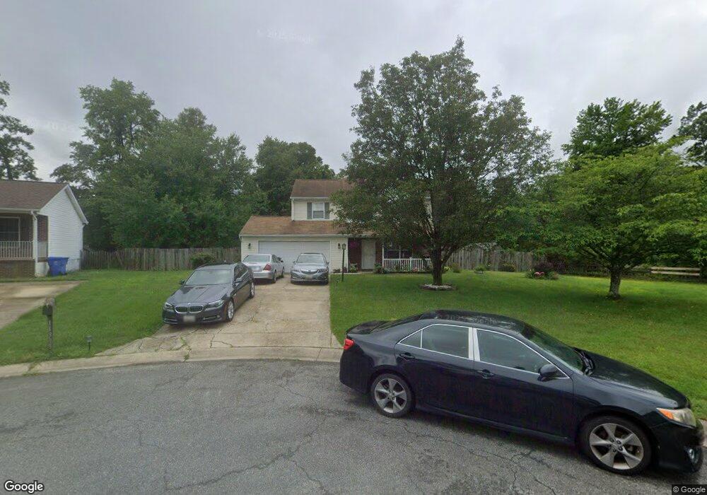
11355 Rockspray Ct Waldorf, MD 20601
Estimated Value: $424,000 - $465,505
Studio
3
Baths
1,872
Sq Ft
$240/Sq Ft
Est. Value
About This Home
This home is located at 11355 Rockspray Ct, Waldorf, MD 20601 and is currently estimated at $450,126, approximately $240 per square foot. 11355 Rockspray Ct is a home located in Charles County with nearby schools including Daniel of St. Thomas Jenifer Elementary School, Mattawoman Middle School, and Westlake High School.
Ownership History
Date
Name
Owned For
Owner Type
Purchase Details
Closed on
Jul 26, 2005
Sold by
Craven Joshua D and Craven Tamara E
Bought by
Langhorne Brian T and Langhorne Diane
Current Estimated Value
Home Financials for this Owner
Home Financials are based on the most recent Mortgage that was taken out on this home.
Original Mortgage
$350,000
Outstanding Balance
$170,227
Interest Rate
5%
Mortgage Type
Adjustable Rate Mortgage/ARM
Estimated Equity
$279,899
Purchase Details
Closed on
Jun 5, 2002
Sold by
Ryan Michael S
Bought by
Craven Joshua D and Craven Tamara E
Purchase Details
Closed on
Sep 10, 1996
Sold by
Kase Builders Inc
Bought by
Ryan Michael S
Purchase Details
Closed on
Aug 22, 1996
Sold by
Swarey Builders Inc
Bought by
Kase Builders Inc
Create a Home Valuation Report for This Property
The Home Valuation Report is an in-depth analysis detailing your home's value as well as a comparison with similar homes in the area
Home Values in the Area
Average Home Value in this Area
Purchase History
| Date | Buyer | Sale Price | Title Company |
|---|---|---|---|
| Langhorne Brian T | $350,000 | -- | |
| Craven Joshua D | $187,000 | -- | |
| Ryan Michael S | $162,000 | -- | |
| Kase Builders Inc | $60,000 | -- |
Source: Public Records
Mortgage History
| Date | Status | Borrower | Loan Amount |
|---|---|---|---|
| Open | Langhorne Brian T | $350,000 | |
| Closed | Kase Builders Inc | -- |
Source: Public Records
Tax History
| Year | Tax Paid | Tax Assessment Tax Assessment Total Assessment is a certain percentage of the fair market value that is determined by local assessors to be the total taxable value of land and additions on the property. | Land | Improvement |
|---|---|---|---|---|
| 2025 | $11,134 | $368,800 | -- | -- |
| 2024 | $4,893 | $347,100 | $126,400 | $220,700 |
| 2023 | $4,638 | $324,533 | $0 | $0 |
| 2022 | $4,245 | $301,967 | $0 | $0 |
| 2021 | $3,721 | $279,400 | $120,400 | $159,000 |
| 2020 | $3,721 | $265,500 | $0 | $0 |
| 2019 | $3,522 | $251,600 | $0 | $0 |
| 2018 | $3,298 | $237,700 | $120,400 | $117,300 |
| 2017 | $3,160 | $227,867 | $0 | $0 |
| 2016 | -- | $218,033 | $0 | $0 |
| 2015 | $2,642 | $208,200 | $0 | $0 |
| 2014 | $2,642 | $208,200 | $0 | $0 |
Source: Public Records
Map
Nearby Homes
- 0 Hamilton Rd Unit MDCH2045568
- 2784 Moran Dr
- 11367 Stony Cove Dr
- 2905 Chalkstone Place
- 2448 Shellcove Ct
- 11222 Flagstaff Place
- 11731 Cygnet Dr
- 2701 Whistling Ct
- 2769 Bear Claw Place
- 2801 Golden Gate Ct
- 2485 Ryce Dr
- 11322 Quietfields St
- 2484 Ryce Dr
- 11519 Shearwater Dr
- 2358 Sequoia Grove St
- 2362 Sequoia Grove St
- 11527 Timberbrook Dr
- 11524 Timberbrook Dr
- 231 Westdale Dr
- 11616 Kipling Dr
- 11359 Rockspray Ct
- 11363 Rockspray Ct
- 2625A Hamilton Rd
- 2625 Hamilton Rd
- 11354 Rockspray Ct
- 2752 Moran Dr
- 2748 Moran Dr
- 11358 Rockspray Ct
- 11362 Rockspray Ct
- 2756 Moran Dr
- 11366 Rockspray Ct
- 2744 Moran Dr
- 11237 Robinwood Ct
- 11241 Robinwood Ct
- 0 Hamilton Rd Unit CH8728022
- 0 Hamilton Rd Unit 1000076623
- 2642 Stanford Place
- 2638 Stanford Place
- 2634 Stanford Place
- 2646 Stanford Place
Your Personal Tour Guide
Ask me questions while you tour the home.