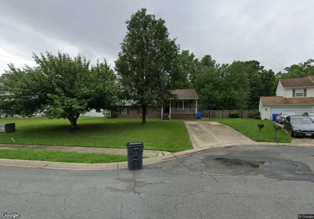
11359 Rockspray Ct Waldorf, MD 20601
Estimated Value: $423,202 - $489,000
--
Bed
--
Bath
2,116
Sq Ft
$217/Sq Ft
Est. Value
About This Home
This home is located at 11359 Rockspray Ct, Waldorf, MD 20601 and is currently estimated at $458,551, approximately $216 per square foot. 11359 Rockspray Ct is a home located in Charles County with nearby schools including Daniel of St. Thomas Jenifer Elementary School, Mattawoman Middle School, and Westlake High School.
Ownership History
Date
Name
Owned For
Owner Type
Purchase Details
Closed on
Mar 7, 2003
Sold by
Erickson Thomas C and Erickson Celestia
Bought by
Knight Darlene
Current Estimated Value
Home Financials for this Owner
Home Financials are based on the most recent Mortgage that was taken out on this home.
Original Mortgage
$199,900
Outstanding Balance
$95,193
Interest Rate
7.37%
Estimated Equity
$363,358
Purchase Details
Closed on
Feb 27, 2003
Sold by
Erickson Thomas C and Erickson Celestia
Bought by
Knight Darlene
Home Financials for this Owner
Home Financials are based on the most recent Mortgage that was taken out on this home.
Original Mortgage
$199,900
Outstanding Balance
$95,193
Interest Rate
7.37%
Estimated Equity
$363,358
Purchase Details
Closed on
Jun 30, 1998
Sold by
Swarey Builders Inc
Bought by
Erickson Thomas C and Erickson Celestia
Create a Home Valuation Report for This Property
The Home Valuation Report is an in-depth analysis detailing your home's value as well as a comparison with similar homes in the area
Home Values in the Area
Average Home Value in this Area
Purchase History
| Date | Buyer | Sale Price | Title Company |
|---|---|---|---|
| Knight Darlene | $199,900 | -- | |
| Knight Darlene | $199,900 | Fidelity National Title Ins | |
| Erickson Thomas C | $140,000 | -- |
Source: Public Records
Mortgage History
| Date | Status | Borrower | Loan Amount |
|---|---|---|---|
| Open | Knight Darlene | $199,900 | |
| Closed | Knight Darlene | -- |
Source: Public Records
Tax History Compared to Growth
Tax History
| Year | Tax Paid | Tax Assessment Tax Assessment Total Assessment is a certain percentage of the fair market value that is determined by local assessors to be the total taxable value of land and additions on the property. | Land | Improvement |
|---|---|---|---|---|
| 2025 | $11,012 | $364,167 | -- | -- |
| 2024 | $4,820 | $341,500 | $126,500 | $215,000 |
| 2023 | $4,621 | $323,367 | $0 | $0 |
| 2022 | $4,288 | $305,233 | $0 | $0 |
| 2021 | $3,992 | $287,100 | $120,500 | $166,600 |
| 2020 | $3,992 | $286,033 | $0 | $0 |
| 2019 | $3,962 | $284,967 | $0 | $0 |
| 2018 | $3,907 | $283,900 | $120,500 | $163,400 |
| 2017 | $3,734 | $271,367 | $0 | $0 |
| 2016 | -- | $258,833 | $0 | $0 |
| 2015 | $2,992 | $246,300 | $0 | $0 |
| 2014 | $2,992 | $246,300 | $0 | $0 |
Source: Public Records
Map
Nearby Homes
- 0 Hamilton Rd Unit MDCH2045568
- 2784 Moran Dr
- 2448 Shellcove Ct
- 2525 Ryce Dr
- 11824 Murre Ct
- 11613 Gallinule Ct
- 11624 Cygnet Dr
- 2498 Ryce Dr
- 11320 Raby Rd
- 2485 Ryce Dr
- 11519 Shearwater Dr
- 2318 Rolling Meadows St
- 11507 Timberbrook Dr
- 231 Westdale Dr
- 11616 Kipling Dr
- 11198 Sewickley St
- 2930 Angel Place
- 2264 Rolling Meadows St
- 11291 Wildmeadows St
- 11310 Wildmeadows St
- 11355 Rockspray Ct
- 11363 Rockspray Ct
- 2625A Hamilton Rd
- 2625 Hamilton Rd
- 11362 Rockspray Ct
- 11354 Rockspray Ct
- 11358 Rockspray Ct
- 11366 Rockspray Ct
- 0 Hamilton Rd Unit CH8728022
- 0 Hamilton Rd Unit 1000076623
- 2752 Moran Dr
- 2748 Moran Dr
- 2634 Stanford Place
- 2630 Stanford Place
- 2638 Stanford Place
- 2642 Stanford Place
- 2646 Stanford Place
- 11241 Robinwood Ct
- 2650 Stanford Place
- 2654 Stanford Place