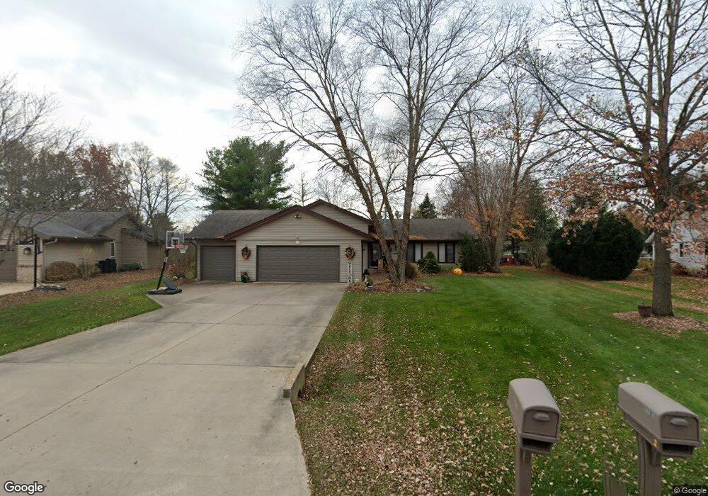
1136 Sandpebble Dr Rockton, IL 61072
Estimated Value: $264,019 - $294,000
3
Beds
--
Bath
1,371
Sq Ft
$203/Sq Ft
Est. Value
About This Home
This home is located at 1136 Sandpebble Dr, Rockton, IL 61072 and is currently estimated at $278,755, approximately $203 per square foot. 1136 Sandpebble Dr is a home located in Winnebago County with nearby schools including Rockton Elementary School, Whitman Post Elementary School, and Stephen Mack Middle School.
Ownership History
Date
Name
Owned For
Owner Type
Purchase Details
Closed on
Jun 22, 2007
Bought by
Tuula Lance D and Tuula Gina M
Current Estimated Value
Create a Home Valuation Report for This Property
The Home Valuation Report is an in-depth analysis detailing your home's value as well as a comparison with similar homes in the area
Home Values in the Area
Average Home Value in this Area
Purchase History
| Date | Buyer | Sale Price | Title Company |
|---|---|---|---|
| Tuula Lance D | $187,000 | -- |
Source: Public Records
Tax History Compared to Growth
Tax History
| Year | Tax Paid | Tax Assessment Tax Assessment Total Assessment is a certain percentage of the fair market value that is determined by local assessors to be the total taxable value of land and additions on the property. | Land | Improvement |
|---|---|---|---|---|
| 2024 | $5,958 | $79,524 | $12,297 | $67,227 |
| 2023 | $5,684 | $70,909 | $10,965 | $59,944 |
| 2022 | $5,403 | $64,780 | $10,017 | $54,763 |
| 2021 | $5,130 | $60,621 | $9,374 | $51,247 |
| 2020 | $5,053 | $58,695 | $9,076 | $49,619 |
| 2019 | $4,959 | $56,541 | $8,743 | $47,798 |
| 2018 | $4,766 | $55,687 | $10,576 | $45,111 |
| 2017 | $4,838 | $53,376 | $10,137 | $43,239 |
| 2016 | $4,600 | $51,626 | $9,805 | $41,821 |
| 2015 | $4,550 | $50,446 | $9,581 | $40,865 |
| 2014 | $4,468 | $50,446 | $9,581 | $40,865 |
Source: Public Records
Map
Nearby Homes
- 367 Timothy Turn
- 12954 Portsmough Ln
- 4227 Berkshire Way
- 706 Pin Oak Rd
- 141 E River St
- 4205 Glenmore Rd
- 634 Cassandra Way
- 14110 Kirane Ct
- 328 Harwich Place
- 117 Strawbridge Dr
- 226 S Blackhawk Blvd
- 14126 Kirane Ct
- 14142 Surf Ct
- 202-4 Kirkstone Place Unit 204 Kirkstone Place
- 702 Washington St
- 0000-03 Nautical Ct
- 0000-04 Nautical Ct
- 1996 Broadmoor Rd
- 614 Bayfield Rd
- 4185 Valerie Rd
- 1142 Sandpebble Dr
- 1128 Sandpebble Dr
- 221 Cork Rd
- 231 Cork Rd
- 1133 Sheppard Rd
- 1109 Sheppard Rd
- 1148 Sandpebble Dr
- 1137 Sheppard Rd
- 1120 Sandpebble Dr
- 1131 Sandpebble Dr
- 241 Cork Rd
- 1141 Sandpebble Dr
- 1205 Sheppard Rd
- 1206 Sandpebble Dr
- 1119 Sandpebble Dr
- 1114 Sandpebble Dr
- 255 Cork Rd
- 1207 Sandpebble Dr
- 1211 Sheppard Rd
- 1140 Armstrong Ave