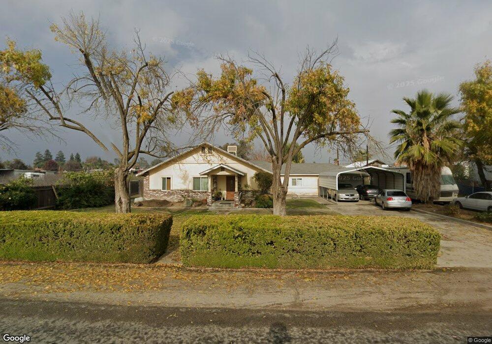
1136 W Gail Ave Tulare, CA 93274
Estimated Value: $259,000 - $371,406
--
Bed
--
Bath
--
Sq Ft
1.9
Acres
About This Home
This home is located at 1136 W Gail Ave, Tulare, CA 93274 and is currently estimated at $323,135. 1136 W Gail Ave is a home located in Tulare County with nearby schools including Heritage Elementary School, Los Tules Middle School, and Tulare Western High School.
Ownership History
Date
Name
Owned For
Owner Type
Purchase Details
Closed on
Mar 23, 2000
Sold by
Andrews David
Bought by
Andrews Kenneth D
Current Estimated Value
Purchase Details
Closed on
Mar 26, 1999
Sold by
Andrews Kenneth D and Andrews Vickie D
Bought by
Andrews David and Andrews Delores
Purchase Details
Closed on
May 12, 1997
Sold by
Andrews Kenneth D
Bought by
Andrews Kenneth D and Andrews Vickie D
Purchase Details
Closed on
Nov 4, 1993
Sold by
Rossiter Dorothy S
Bought by
Andrews Kenneth D and Andrews Vickie D
Home Financials for this Owner
Home Financials are based on the most recent Mortgage that was taken out on this home.
Original Mortgage
$65,250
Interest Rate
6.98%
Create a Home Valuation Report for This Property
The Home Valuation Report is an in-depth analysis detailing your home's value as well as a comparison with similar homes in the area
Home Values in the Area
Average Home Value in this Area
Purchase History
| Date | Buyer | Sale Price | Title Company |
|---|---|---|---|
| Andrews Kenneth D | -- | -- | |
| Andrews David | -- | -- | |
| Andrews Kenneth D | -- | -- | |
| Andrews Kenneth D | $87,000 | Chicago Title Company |
Source: Public Records
Mortgage History
| Date | Status | Borrower | Loan Amount |
|---|---|---|---|
| Previous Owner | Andrews Kenneth D | $65,250 |
Source: Public Records
Tax History Compared to Growth
Tax History
| Year | Tax Paid | Tax Assessment Tax Assessment Total Assessment is a certain percentage of the fair market value that is determined by local assessors to be the total taxable value of land and additions on the property. | Land | Improvement |
|---|---|---|---|---|
| 2025 | $1,964 | $147,877 | $67,990 | $79,887 |
| 2024 | $1,964 | $176,948 | $66,657 | $110,291 |
| 2023 | $1,942 | $175,961 | $65,350 | $110,611 |
| 2022 | $1,889 | $172,856 | $64,069 | $108,787 |
| 2021 | $1,862 | $169,248 | $62,813 | $106,435 |
| 2020 | $1,934 | $171,127 | $62,169 | $108,958 |
| 2019 | $2,064 | $174,586 | $60,950 | $113,636 |
| 2018 | $2,061 | $173,757 | $59,755 | $114,002 |
| 2017 | $2,097 | $174,978 | $58,583 | $116,395 |
| 2016 | $2,262 | $193,477 | $57,434 | $136,043 |
| 2015 | -- | $185,368 | $56,571 | $128,797 |
| 2014 | -- | $191,954 | $55,463 | $136,491 |
Source: Public Records
Map
Nearby Homes
- 1721 Cotton Ct
- 1287 Palo Alto St
- 1149 N E St
- 1695 Cochran Ave
- 384 Mitchell Ave
- 704 Lassen Ave
- 1266 N H St
- 382 Hemmingway Ct
- 830 Alameda St
- 202 W Gail Ave
- 1977 Irving Cir
- 1800 W Merritt Ave
- 770 W Pleasant Ave
- 560 W Pleasant Ave Unit 75
- 560 W Pleasant Ave Unit 26
- 560 W Pleasant Ave Unit 48
- 560 W Pleasant Ave Unit 66
- 560 W Pleasant Ave Unit 51
- 560 W Pleasant Ave Unit 74
- 148 E Gail Ave
- 1202 W Gail Ave
- 1106 W Gail Ave
- 1127 W Gail Ave
- 1239 W Gail Ave
- 1209 W Gail Ave
- 1246 W Gail Ave
- 1067 W Gail Ave
- 1040 W Gail Ave
- 1040 W Gail Ave
- 1650 N West St
- 1743 Cotton Ct
- 1765 Cotton Ct
- 1701 Cotton Ct
- 1777 Cotton Ct
- 955 W Gail Ave
- 1785 Cotton Ct
- 1826 N West St
- 1793 Cotton Ct
- 1610 N West St
- 1799 Cotton Ct