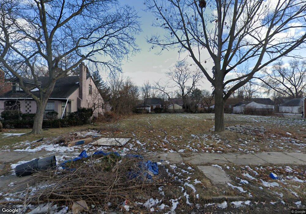
11362 Roxbury St Detroit, MI 48224
Yorkshire Woods NeighborhoodEstimated Value: $144,000 - $193,000
--
Bed
1
Bath
964
Sq Ft
$167/Sq Ft
Est. Value
About This Home
This home is located at 11362 Roxbury St, Detroit, MI 48224 and is currently estimated at $160,602, approximately $166 per square foot. 11362 Roxbury St is a home located in Wayne County with nearby schools including Carleton Elementary School, Edward 'Duke' Ellington Conservatory of Music and Art, and Charles L. Spain Elementary-Middle School.
Ownership History
Date
Name
Owned For
Owner Type
Purchase Details
Closed on
Jan 12, 2017
Sold by
Sabree Eric R
Bought by
Detroit Land Bank Authority
Current Estimated Value
Purchase Details
Closed on
Feb 20, 2004
Sold by
Crosby Ondrea Janine
Bought by
Graham Sylvester
Home Financials for this Owner
Home Financials are based on the most recent Mortgage that was taken out on this home.
Original Mortgage
$85,500
Interest Rate
8.77%
Mortgage Type
Purchase Money Mortgage
Purchase Details
Closed on
May 27, 1998
Sold by
Quarles Eric J
Bought by
Crosby Ondrea J
Create a Home Valuation Report for This Property
The Home Valuation Report is an in-depth analysis detailing your home's value as well as a comparison with similar homes in the area
Home Values in the Area
Average Home Value in this Area
Purchase History
| Date | Buyer | Sale Price | Title Company |
|---|---|---|---|
| Detroit Land Bank Authority | -- | None Available | |
| Graham Sylvester | -- | Commonwealth Land Title | |
| Crosby Ondrea J | $78,000 | -- |
Source: Public Records
Mortgage History
| Date | Status | Borrower | Loan Amount |
|---|---|---|---|
| Previous Owner | Graham Sylvester | $85,500 |
Source: Public Records
Tax History Compared to Growth
Tax History
| Year | Tax Paid | Tax Assessment Tax Assessment Total Assessment is a certain percentage of the fair market value that is determined by local assessors to be the total taxable value of land and additions on the property. | Land | Improvement |
|---|---|---|---|---|
| 2025 | -- | $0 | $0 | $0 |
| 2024 | -- | $0 | $0 | $0 |
| 2023 | $0 | $0 | $0 | $0 |
| 2022 | -- | $0 | $0 | $0 |
| 2021 | $0 | $0 | $0 | $0 |
| 2020 | $2,185 | $0 | $0 | $0 |
| 2019 | $2,185 | $0 | $0 | $0 |
| 2018 | $0 | $800 | $0 | $0 |
| 2017 | $13 | $700 | $0 | $0 |
| 2016 | $1,646 | $18,600 | $0 | $0 |
| 2015 | $1,860 | $18,600 | $0 | $0 |
| 2013 | $2,585 | $25,845 | $0 | $0 |
| 2010 | -- | $37,892 | $2,006 | $35,886 |
Source: Public Records
Map
Nearby Homes
- 11380 Roxbury St
- 11101 Beaconsfield St
- 11508 Lakepointe St
- 11235 Roxbury St
- 11201 Beaconsfield St
- 11225 Roxbury St
- 11539 Lakepointe St
- 11210 Beaconsfield St
- 11611 Morang Dr
- 10925 Nottingham Rd
- 11514 Morang Dr
- 11382 Rossiter St
- 11540 Wayburn St
- 11528 Wayburn St
- 11106 Nottingham Rd
- 11537 Roxbury St
- 10857 Nottingham Rd
- 10898 Nottingham Rd
- 10851 Nottingham Rd
- 11811 Morang Dr
- 11354 Roxbury St
- 11372 Roxbury St
- 11344 Roxbury St
- 11336 Roxbury St
- 11390 Roxbury St
- 11137 Beaconsfield St
- 11367 Roxbury St
- 11359 Roxbury St
- 11328 Roxbury St
- 11375 Roxbury St
- 11165 Beaconsfield St
- 11157 Beaconsfield St
- 11398 Roxbury St
- 11151 Beaconsfield St
- 11175 Beaconsfield St
- 11381 Roxbury St
- 11320 Roxbury St
- 11391 Roxbury St Unit Bldg-Unit
- 11391 Roxbury St
- 11406 Roxbury St