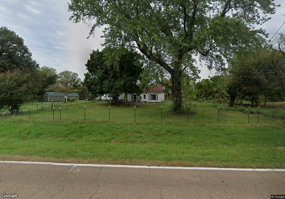
11367 Highway 211 Newbern, TN 38059
Estimated Value: $94,779 - $150,000
Studio
1
Bath
1,392
Sq Ft
$89/Sq Ft
Est. Value
About This Home
This home is located at 11367 Highway 211, Newbern, TN 38059 and is currently estimated at $124,445, approximately $89 per square foot. 11367 Highway 211 is a home located in Dyer County with nearby schools including Newbern Elementary School, Northview Middle School, and Dyer County High School.
Ownership History
Date
Name
Owned For
Owner Type
Purchase Details
Closed on
May 10, 2021
Sold by
Darnall Nancy and Darnall Terry Gene
Bought by
Darnall Zachery R
Current Estimated Value
Home Financials for this Owner
Home Financials are based on the most recent Mortgage that was taken out on this home.
Original Mortgage
$63,600
Outstanding Balance
$57,299
Interest Rate
3%
Mortgage Type
VA
Estimated Equity
$67,146
Purchase Details
Closed on
Jul 21, 2014
Sold by
Haltom Vercie
Bought by
Darnall Terry Gene and Darnall Nancy
Purchase Details
Closed on
May 2, 1994
Bought by
Haltom Vercie
Purchase Details
Closed on
Aug 24, 1992
Bought by
Parnell William R and Parnell Tami K
Purchase Details
Closed on
Mar 8, 1989
Bought by
Kerrr Clyde and Kerrr Margaret B
Purchase Details
Closed on
Apr 27, 1949
Bought by
Mcintosh C L
Create a Home Valuation Report for This Property
The Home Valuation Report is an in-depth analysis detailing your home's value as well as a comparison with similar homes in the area
Home Values in the Area
Average Home Value in this Area
Purchase History
| Date | Buyer | Sale Price | Title Company |
|---|---|---|---|
| Darnall Zachery R | $63,600 | Dyer Land Title Company Inc | |
| Darnall Terry Gene | -- | -- | |
| Haltom Vercie | $47,500 | -- | |
| Parnell William R | $30,000 | -- | |
| Kerrr Clyde | $60,000 | -- | |
| Mcintosh C L | -- | -- |
Source: Public Records
Mortgage History
| Date | Status | Borrower | Loan Amount |
|---|---|---|---|
| Open | Darnall Zachery R | $63,600 |
Source: Public Records
Tax History
| Year | Tax Paid | Tax Assessment Tax Assessment Total Assessment is a certain percentage of the fair market value that is determined by local assessors to be the total taxable value of land and additions on the property. | Land | Improvement |
|---|---|---|---|---|
| 2025 | $342 | $19,450 | $4,050 | $15,400 |
| 2023 | $330 | $13,425 | $2,650 | $10,775 |
| 2022 | $318 | $13,425 | $2,650 | $10,775 |
| 2021 | $318 | $13,425 | $2,650 | $10,775 |
| 2020 | $328 | $13,425 | $2,650 | $10,775 |
| 2019 | $307 | $11,600 | $2,650 | $8,950 |
| 2018 | $307 | $11,600 | $2,650 | $8,950 |
| 2017 | $307 | $11,600 | $2,650 | $8,950 |
| 2016 | $307 | $11,600 | $2,650 | $8,950 |
| 2015 | $290 | $11,600 | $2,650 | $8,950 |
| 2014 | $290 | $11,600 | $2,650 | $8,950 |
Source: Public Records
Map
Nearby Homes
- 1358 Palestine Rd
- 783 Sharps Ferry Rd
- 674 Templeton Loop
- 314 Palestine Rd
- 1643 Templeton Loop
- 907 Granite Dr
- 0 Biffle Rd
- 610 N Grayson St
- 445 Tater Hill Rd
- 211 Washington St
- 506 E Main St
- 310 N Grayson St
- 216 N Grayson St
- 209 Clearview Acres Dr
- 221 S Grayson St
- 482 Forrester Rd
- 805 W Main St
- 885 W Wind Drive Extension
- 168 Churchton Subdivision Rd
- 188 Mill St
- 11198 Highway 211
- 1180 Charles Moore Rd E
- 11194 Highway 211
- 1072 Charles Moore Rd E
- 1058 Charles Moore Rd E
- 1006 Charles Moore Rd E
- 1321 Charles Moore Rd E
- 986 Charles Moore Rd E
- 936 Charles Moore Rd E
- 898 Charles Moore Rd E
- 11279 Highway 211
- 873 Charles Moore Rd E
- 10985 Highway 211
- 10920 Highway 211
- 10863 Highway 211
- 720 Charles Moore Rd E
- 11880 Highway 211
- 10855 Highway 211
- 10836 Highway 211
- 710 Charles Moore Rd E Unit E
Your Personal Tour Guide
Ask me questions while you tour the home.