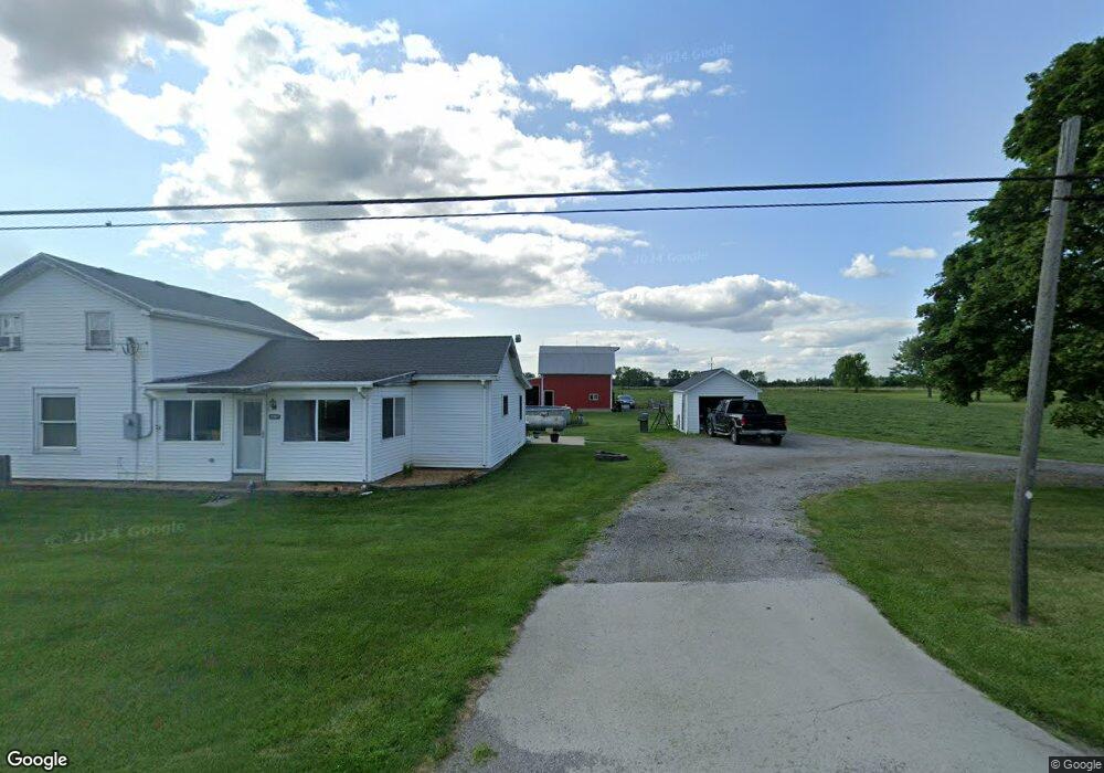
11367 Us Highway 127 West Unity, OH 43570
Estimated Value: $151,000 - $226,000
3
Beds
1
Bath
1,535
Sq Ft
$125/Sq Ft
Est. Value
About This Home
This home is located at 11367 Us Highway 127, West Unity, OH 43570 and is currently estimated at $191,828, approximately $124 per square foot. 11367 Us Highway 127 is a home located in Williams County with nearby schools including Hilltop Elementary School and Hilltop High School.
Ownership History
Date
Name
Owned For
Owner Type
Purchase Details
Closed on
Feb 28, 2012
Sold by
Lammon Larry
Bought by
Lammon Rebecca L
Current Estimated Value
Purchase Details
Closed on
Jun 25, 2007
Sold by
Fannie Mae
Bought by
Lammon Larry
Home Financials for this Owner
Home Financials are based on the most recent Mortgage that was taken out on this home.
Original Mortgage
$59,200
Outstanding Balance
$35,870
Interest Rate
6.37%
Mortgage Type
Purchase Money Mortgage
Estimated Equity
$155,958
Purchase Details
Closed on
Feb 22, 2007
Sold by
Thompson Tony M and Cu Members Mortgage A Division
Bought by
Federal National Mortgage Association
Purchase Details
Closed on
Nov 27, 1995
Sold by
Hensley Susan Q
Bought by
Johns Doyle Le
Purchase Details
Closed on
Nov 4, 1994
Bought by
Johns Doyle Le
Create a Home Valuation Report for This Property
The Home Valuation Report is an in-depth analysis detailing your home's value as well as a comparison with similar homes in the area
Purchase History
| Date | Buyer | Sale Price | Title Company |
|---|---|---|---|
| Lammon Rebecca L | -- | None Available | |
| Lammon Larry | $74,000 | Louisvill Title | |
| Federal National Mortgage Association | $66,667 | None Available | |
| Johns Doyle Le | $40,100 | -- | |
| Johns Doyle Le | $40,100 | -- |
Source: Public Records
Mortgage History
| Date | Status | Borrower | Loan Amount |
|---|---|---|---|
| Open | Lammon Larry | $59,200 |
Source: Public Records
Tax History
| Year | Tax Paid | Tax Assessment Tax Assessment Total Assessment is a certain percentage of the fair market value that is determined by local assessors to be the total taxable value of land and additions on the property. | Land | Improvement |
|---|---|---|---|---|
| 2025 | $2,079 | $56,460 | $17,470 | $38,990 |
| 2024 | $2,079 | $56,460 | $17,470 | $38,990 |
| 2023 | $2,097 | $44,660 | $15,330 | $29,330 |
| 2022 | $2,040 | $44,660 | $15,330 | $29,330 |
| 2021 | $1,979 | $44,660 | $15,330 | $29,330 |
| 2020 | $1,703 | $37,350 | $12,920 | $24,430 |
| 2019 | $1,674 | $37,350 | $12,920 | $24,430 |
| 2018 | $1,595 | $37,350 | $12,920 | $24,430 |
| 2017 | $1,576 | $35,040 | $10,920 | $24,120 |
| 2016 | $1,727 | $35,040 | $10,920 | $24,120 |
| 2015 | $1,494 | $35,040 | $10,920 | $24,120 |
| 2014 | $1,494 | $31,850 | $9,940 | $21,910 |
| 2013 | $1,468 | $31,850 | $9,940 | $21,910 |
Source: Public Records
Map
Nearby Homes
- 613 W Jackson St
- 611 W Jackson St
- 000 W Jackson
- 502 N Lincoln St
- 402 N Liberty St
- 902 E Church St
- 9019 19-50 Rd
- 11017 County Road 22
- 22227 Us Highway 20a
- 8437 18 Rd
- 21184 20n Rd Unit Tract 1
- 21184 20n Rd Unit Tract 3
- 20-n Road Unit Tract 2
- 8520 County Road 16
- 8520 Williams County Road 16
- 14640 U S 20a
- 301 Horton St
- 10918 Ohio 15
- 0 St Rt 15 Unit 10001011
- 303 E Curtis St
- 11367 US Hwy 127
- 11325 Us Highway 127
- 11439 Us Highway 127
- 11261 Us Highway 127
- 11487 Us Highway 127
- 11188 County Road 1950
- 11100 County Road 1950
- 11100 County Road 19-50
- 11090 County Road 1950
- 11160 Us Highway 127
- 11566 Us Highway 127
- 11066 County Road 1950
- 11044 County Road 1950
- 11020 County Road 19-50
- 11020 County Road 1950
- 11627 Us Highway 127
- 11627 U S 127
- 11626 Us Highway 127
- 10988 County Road 1950
- 19652 County Road K
Your Personal Tour Guide
Ask me questions while you tour the home.