Estimated Value: $206,000 - $251,000
3
Beds
3
Baths
1,998
Sq Ft
$114/Sq Ft
Est. Value
About This Home
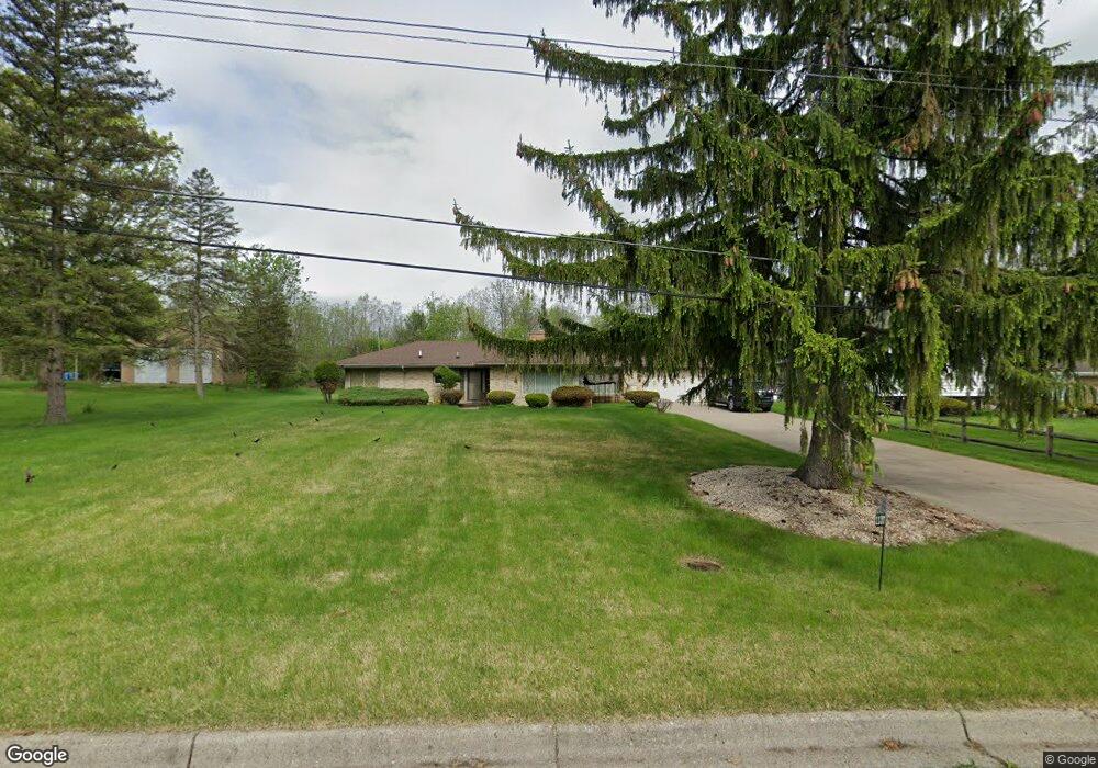
This home is located at 1137 Carter Dr, Flint, MI 48532 and is currently estimated at $227,988, approximately $114 per square foot. 1137 Carter Dr is a home located in Genesee County with nearby schools including Carman-Ainsworth High School, Genesee STEM Academy, and St. Paul Lutheran School.
Ownership History
Date
Name
Owned For
Owner Type
Purchase Details
Closed on
Apr 12, 2013
Sold by
Banks Anita C
Bought by
Banks Anita and Banks Willie
Current Estimated Value
Purchase Details
Closed on
Oct 5, 2012
Sold by
Mcclendon Ryan and Estate Of Anthony Wayne Falls
Bought by
Banks Anita C
Purchase Details
Closed on
Aug 29, 2011
Sold by
Banks Anita C and Fails Anthony
Bought by
Banks Anita and Banks Willie
Purchase Details
Closed on
Dec 28, 2010
Sold by
Fails Anthony
Bought by
Fails Anthony and Banks Anita Celeste
Purchase Details
Closed on
Jun 1, 2010
Sold by
Morgan Jimmy L and Morgan Lizzie M
Bought by
Fails Anthony
Create a Home Valuation Report for This Property
The Home Valuation Report is an in-depth analysis detailing your home's value as well as a comparison with similar homes in the area
Home Values in the Area
Average Home Value in this Area
Purchase History
| Date | Buyer | Sale Price | Title Company |
|---|---|---|---|
| Banks Anita | -- | None Available | |
| Banks Anita C | -- | None Available | |
| Banks Anita | -- | None Available | |
| Fails Anthony | -- | None Available | |
| Fails Anthony | $91,000 | Liberty Title |
Source: Public Records
Tax History Compared to Growth
Tax History
| Year | Tax Paid | Tax Assessment Tax Assessment Total Assessment is a certain percentage of the fair market value that is determined by local assessors to be the total taxable value of land and additions on the property. | Land | Improvement |
|---|---|---|---|---|
| 2025 | $2,203 | $117,600 | $0 | $0 |
| 2024 | $1,143 | $112,900 | $0 | $0 |
| 2023 | $1,091 | $92,600 | $0 | $0 |
| 2022 | $954 | $74,300 | $0 | $0 |
| 2021 | $1,940 | $66,800 | $0 | $0 |
| 2020 | $980 | $61,100 | $0 | $0 |
| 2019 | $966 | $51,800 | $0 | $0 |
| 2018 | $1,813 | $45,800 | $0 | $0 |
| 2017 | $1,747 | $45,800 | $0 | $0 |
| 2016 | $1,790 | $42,500 | $0 | $0 |
| 2015 | $1,622 | $42,500 | $0 | $0 |
| 2014 | $962 | $40,800 | $0 | $0 |
| 2012 | -- | $43,700 | $43,700 | $0 |
Source: Public Records
Map
Nearby Homes
- 1058 Cora Dr
- 1068 S Graham Rd
- Graham Rd N Graham Rd
- 4022 Beecher Rd
- 000 Devenish Ln
- 3528 Beecher Rd
- 1090 Cabot Dr
- 1136 Gilbert St
- 1193 Normandy Terrace Dr
- 1260 Gilbert St
- 1159 N Linden Rd
- 3360 Beecher Rd
- 2174 Mill Rd
- 3350 Beecher Rd
- 2 Charter Dr
- 1112 Lask Dr
- 3522 Ridgecliffe Dr
- 5021 Forest Side Dr
- 3493 Ridgecliffe Dr
- 3309 Beecher Rd