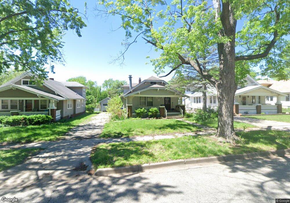
1137 SW High Ave Topeka, KS 66604
Randolph NeighborhoodEstimated Value: $140,000 - $178,000
3
Beds
2
Baths
1,272
Sq Ft
$127/Sq Ft
Est. Value
About This Home
This home is located at 1137 SW High Ave, Topeka, KS 66604 and is currently estimated at $160,999, approximately $126 per square foot. 1137 SW High Ave is a home located in Shawnee County with nearby schools including Buckeye Elementary School, Martin Park Elementary School, and Randolph Elementary School.
Ownership History
Date
Name
Owned For
Owner Type
Purchase Details
Closed on
Mar 22, 2017
Sold by
Lasseter James A and Lasseter Rebecca A
Bought by
Lasseter Megan M and Lasseter James A
Current Estimated Value
Purchase Details
Closed on
Oct 7, 2010
Sold by
Lasseter James and Lasseter Rebecca
Bought by
Lasseter James A and Lasseter Rebecca A
Purchase Details
Closed on
Sep 15, 2008
Sold by
Kufahl Lyndon J and Kufahl Anne E
Bought by
Lasseter James and Lasseter Rebecca
Home Financials for this Owner
Home Financials are based on the most recent Mortgage that was taken out on this home.
Original Mortgage
$75,900
Interest Rate
6.54%
Mortgage Type
New Conventional
Create a Home Valuation Report for This Property
The Home Valuation Report is an in-depth analysis detailing your home's value as well as a comparison with similar homes in the area
Home Values in the Area
Average Home Value in this Area
Purchase History
| Date | Buyer | Sale Price | Title Company |
|---|---|---|---|
| Lasseter Megan M | -- | None Available | |
| Lasseter Megan M | -- | None Available | |
| Lasseter James A | -- | None Available | |
| Lasseter James | -- | Lawyers Title Of Topeka Inc |
Source: Public Records
Mortgage History
| Date | Status | Borrower | Loan Amount |
|---|---|---|---|
| Closed | Lasseter James | $75,900 |
Source: Public Records
Tax History Compared to Growth
Tax History
| Year | Tax Paid | Tax Assessment Tax Assessment Total Assessment is a certain percentage of the fair market value that is determined by local assessors to be the total taxable value of land and additions on the property. | Land | Improvement |
|---|---|---|---|---|
| 2025 | $2,204 | $16,438 | -- | -- |
| 2023 | $2,204 | $14,915 | $0 | $0 |
| 2022 | $1,913 | $12,969 | $0 | $0 |
| 2021 | $1,759 | $11,278 | $0 | $0 |
| 2020 | $1,655 | $10,741 | $0 | $0 |
| 2019 | $1,631 | $10,530 | $0 | $0 |
| 2018 | $1,584 | $10,223 | $0 | $0 |
| 2017 | $1,587 | $10,223 | $0 | $0 |
| 2014 | $1,603 | $10,223 | $0 | $0 |
Source: Public Records
Map
Nearby Homes
- 1164 SW MacVicar Ave
- 1181 SW MacVicar Ave
- 1147 SW Webster Ave
- 1022 SW MacVicar Ave
- 1150 SW Collins Ave
- 1115 SW Woodward Ave
- 923 SW High Ave
- 2516 SW Huntoon St
- 1156 SW Woodward Ave
- 1115 SW Billard Ave
- 2812 SW Huntoon St
- 2012 SW 10th Ave
- 2204 SW Kensington Ct
- 2330 SW Hazelton Ct
- 1225 SW Lakeside Dr
- 1216 SW College Ave
- 829 SW Oakley Ave
- 1355 SW Medford Ave
- 1432 SW MacVicar Ave
- 1421 SW Jewell Ave
- 1133 SW High Ave
- 1141 SW High Ave
- 1129 SW High Ave Unit 5505 SW Drury Lane
- 1129 SW High Ave
- 1145 SW High Ave
- 1132 SW Medford Ave
- 1136 SW Medford Ave
- 1125 SW High Ave
- 1128 SW Medford Ave
- 1148 SW Medford Ave
- 1126 SW Medford Ave
- 1140 SW High Ave
- 1123 SW High Ave
- 1134 SW High Ave
- 1142 SW High Ave
- 1149 SW High Ave
- 1130 SW High Ave
- 1124 SW Medford Ave
- 1151 SW High Ave
- 1124 SW High Ave