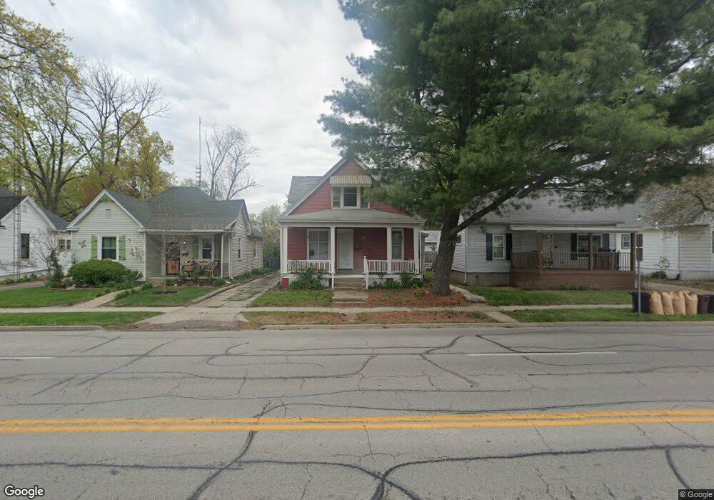
1137 W Lawrence Ave Springfield, IL 62704
Historic West Side NeighborhoodEstimated Value: $70,061 - $115,000
3
Beds
3
Baths
2,218
Sq Ft
$39/Sq Ft
Est. Value
About This Home
This home is located at 1137 W Lawrence Ave, Springfield, IL 62704 and is currently estimated at $85,515, approximately $38 per square foot. 1137 W Lawrence Ave is a home located in Sangamon County with nearby schools including Dubois Elementary School, U.S. Grant Middle School, and Springfield High School.
Ownership History
Date
Name
Owned For
Owner Type
Purchase Details
Closed on
Aug 13, 2020
Sold by
Poynter Richard E and Poynter Sharon
Bought by
Foster Family Limited Partners
Current Estimated Value
Home Financials for this Owner
Home Financials are based on the most recent Mortgage that was taken out on this home.
Original Mortgage
$43,500
Outstanding Balance
$22,961
Interest Rate
2.9%
Mortgage Type
New Conventional
Estimated Equity
$62,554
Create a Home Valuation Report for This Property
The Home Valuation Report is an in-depth analysis detailing your home's value as well as a comparison with similar homes in the area
Home Values in the Area
Average Home Value in this Area
Purchase History
| Date | Buyer | Sale Price | Title Company |
|---|---|---|---|
| Foster Family Limited Partners | $38,000 | Prairie Land Title |
Source: Public Records
Mortgage History
| Date | Status | Borrower | Loan Amount |
|---|---|---|---|
| Open | Foster Family Limited Partners | $43,500 |
Source: Public Records
Tax History
| Year | Tax Paid | Tax Assessment Tax Assessment Total Assessment is a certain percentage of the fair market value that is determined by local assessors to be the total taxable value of land and additions on the property. | Land | Improvement |
|---|---|---|---|---|
| 2024 | $1,279 | $15,231 | $4,668 | $10,563 |
| 2023 | $1,230 | $13,912 | $4,264 | $9,648 |
| 2022 | $1,183 | $13,197 | $4,045 | $9,152 |
| 2021 | $1,143 | $12,703 | $3,894 | $8,809 |
| 2020 | $1,121 | $12,722 | $3,900 | $8,822 |
| 2019 | $2,516 | $29,001 | $3,886 | $25,115 |
| 2018 | $2,438 | $28,860 | $3,866 | $24,994 |
| 2017 | $2,388 | $28,487 | $3,816 | $24,671 |
| 2016 | $2,341 | $28,071 | $3,760 | $24,311 |
| 2015 | $2,318 | $27,735 | $3,715 | $24,020 |
| 2014 | $2,284 | $27,556 | $3,691 | $23,865 |
| 2013 | $2,233 | $27,556 | $3,691 | $23,865 |
Source: Public Records
Map
Nearby Homes
- 709 S Douglas Ave
- 817 S Park Ave
- 545 S Lincoln Ave
- 615 S English Ave
- 1316 W Lawrence Ave
- 1125 Williams Blvd
- 342 S Douglas Ave
- 423 S Adelia St
- 1037 W Woodland Ave
- 1020 S Macarthur Blvd
- 318 S State St
- 215 S Macarthur Blvd
- 631 W Edwards St
- 1212 South Grand Ave W Unit B126
- 112 N Macarthur Blvd
- 447 W Cook St
- 504 Williams St
- 1425 S Lincoln Ave
- 706 South Grand Ave W
- 236 N English Ave
- 1133 W Lawrence Ave
- 1139 W Lawrence Ave
- 1129 W Lawrence Ave
- 1141 W Lawrence Ave
- 1143 W Lawrence Ave
- 1145 W Lawrence Ave
- 1134 W Cook St
- 1132 W Lawrence Ave
- 720 S Illinois St
- 1142 W Lawrence Ave
- 1123 W Lawrence Ave
- 1136 W Cook St
- 1128 W Cook St
- 1130 W Cook St
- 1142 W Cook St
- 716 S Illinois St
- 1146 W Lawrence Ave
- 712 S Illinois St
- 1119 W Lawrence Ave
- 1124 W Lawrence Ave
Your Personal Tour Guide
Ask me questions while you tour the home.