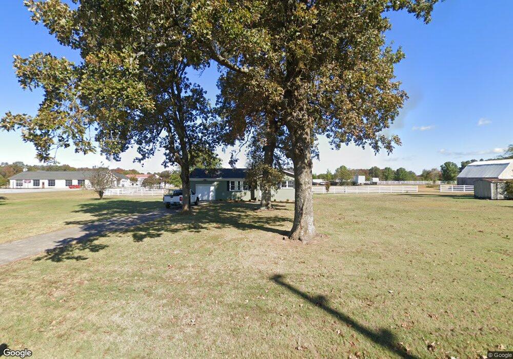
1138 Poor Farm Rd Murray, KY 42071
Estimated Value: $143,568 - $232,000
2
Beds
1
Bath
1,218
Sq Ft
$164/Sq Ft
Est. Value
About This Home
This home is located at 1138 Poor Farm Rd, Murray, KY 42071 and is currently estimated at $199,642, approximately $163 per square foot. 1138 Poor Farm Rd is a home located in Calloway County with nearby schools including North Calloway Elementary School, Calloway County Middle School, and Calloway County High School.
Ownership History
Date
Name
Owned For
Owner Type
Purchase Details
Closed on
Oct 7, 2022
Sold by
Ray Emeline Marie and Ray Mitchell
Bought by
Coleman Wildie and Coleman Barbara J
Current Estimated Value
Purchase Details
Closed on
Nov 30, 2018
Sold by
Mitchell Ray Mitchell Eaker and Mitchell Ray
Bought by
Ray Mitchell T and Ray Emeline Marie
Home Financials for this Owner
Home Financials are based on the most recent Mortgage that was taken out on this home.
Original Mortgage
$94,000
Interest Rate
4.8%
Mortgage Type
Credit Line Revolving
Purchase Details
Closed on
Dec 30, 2008
Sold by
Vaught Robert E and Vaught Sara
Bought by
Ray Mitchell
Home Financials for this Owner
Home Financials are based on the most recent Mortgage that was taken out on this home.
Original Mortgage
$45,000
Interest Rate
5.48%
Mortgage Type
Future Advance Clause Open End Mortgage
Create a Home Valuation Report for This Property
The Home Valuation Report is an in-depth analysis detailing your home's value as well as a comparison with similar homes in the area
Home Values in the Area
Average Home Value in this Area
Purchase History
| Date | Buyer | Sale Price | Title Company |
|---|---|---|---|
| Coleman Wildie | $13,500 | -- | |
| Ray Mitchell T | -- | None Available | |
| Ray Mitchell | $45,000 | None Available | |
| Ray Mitchell | $45,000 | None Available |
Source: Public Records
Mortgage History
| Date | Status | Borrower | Loan Amount |
|---|---|---|---|
| Previous Owner | Ray Mitchell T | $94,000 | |
| Previous Owner | Ray Mitchell | $45,000 |
Source: Public Records
Tax History Compared to Growth
Tax History
| Year | Tax Paid | Tax Assessment Tax Assessment Total Assessment is a certain percentage of the fair market value that is determined by local assessors to be the total taxable value of land and additions on the property. | Land | Improvement |
|---|---|---|---|---|
| 2024 | $813 | $90,000 | $0 | $0 |
| 2023 | $657 | $70,000 | $0 | $0 |
| 2022 | $671 | $70,000 | $0 | $0 |
| 2021 | $683 | $70,000 | $0 | $0 |
| 2020 | $581 | $60,000 | $0 | $0 |
| 2019 | $550 | $60,000 | $0 | $0 |
| 2018 | $444 | $50,000 | $0 | $0 |
| 2017 | $432 | $50,000 | $0 | $0 |
| 2016 | $427 | $50,000 | $0 | $0 |
| 2015 | $423 | $50,000 | $0 | $0 |
| 2011 | $393 | $50,000 | $0 | $0 |
Source: Public Records
Map
Nearby Homes
- 1087 Poor Farm Rd
- 0000 Brinn Rd
- 363 Grant Rd
- 00 N 16th St
- 1612 N 16th St
- 1 Logan Trail
- 1005 Southwood Dr
- 000 Keepers Way Unit Tract A
- 000 Keepers Way
- 906 Southwood Dr
- 1105 State Route 121 N Unit 1163 State Route 121
- Lot 17 Jordyn Bailey Rd
- 904 Coldwater Rd Unit 900 Coldwater Road
- 0 U S 641 N
- 202 John Purdom Dr
- 1417 Longwood Dr
- 701 N 18th St
- 1705 Ryan Ave
- 1201 Chestnut St
- 0 Chestnut St
- 1258 Poor Farm Rd
- 1080 Poor Farm Rd
- 1395 Poor Farm Rd
- 1303 Poor Farm Rd
- 979 Poor Farm Rd
- 970 Poor Farm Rd
- 2545 Brinn Rd
- 2545 Brinn Rd
- 00 Brinn Rd
- 888 Poor Farm Rd
- 2614 Brinn Rd
- 2690 Brinn Rd
- 2683 Brinn Rd
- 2474 Brinn Rd
- 863 Poor Farm Rd
- 2314 Brinn Rd
- 2237 Brinn Rd
- 2241 Brinn Rd
- 2106 Brinn Rd
- 2191 Brinn Rd