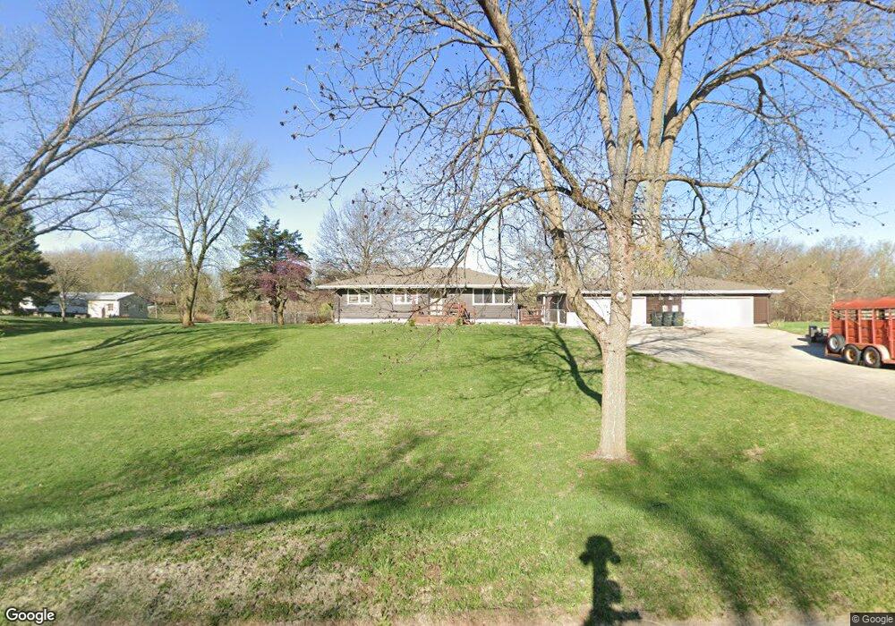
11388 Woodland Trail Council Bluffs, IA 51503
Estimated Value: $445,000 - $563,000
3
Beds
2
Baths
1,700
Sq Ft
$293/Sq Ft
Est. Value
About This Home
This home is located at 11388 Woodland Trail, Council Bluffs, IA 51503 and is currently estimated at $497,488, approximately $292 per square foot. 11388 Woodland Trail is a home located in Pottawattamie County with nearby schools including E.A. Kreft Primary School, Titan Hill Intermediate School, and Lewis Central Middle School.
Ownership History
Date
Name
Owned For
Owner Type
Purchase Details
Closed on
Dec 23, 2020
Sold by
Robey Robert G and Estate Of Gerald H Robey
Bought by
Benton Jonathan Jay
Current Estimated Value
Home Financials for this Owner
Home Financials are based on the most recent Mortgage that was taken out on this home.
Original Mortgage
$350,000
Outstanding Balance
$311,660
Interest Rate
2.71%
Mortgage Type
VA
Estimated Equity
$185,828
Create a Home Valuation Report for This Property
The Home Valuation Report is an in-depth analysis detailing your home's value as well as a comparison with similar homes in the area
Home Values in the Area
Average Home Value in this Area
Purchase History
| Date | Buyer | Sale Price | Title Company |
|---|---|---|---|
| Benton Jonathan Jay | $350,000 | None Available |
Source: Public Records
Mortgage History
| Date | Status | Borrower | Loan Amount |
|---|---|---|---|
| Open | Benton Jonathan Jay | $350,000 |
Source: Public Records
Tax History Compared to Growth
Tax History
| Year | Tax Paid | Tax Assessment Tax Assessment Total Assessment is a certain percentage of the fair market value that is determined by local assessors to be the total taxable value of land and additions on the property. | Land | Improvement |
|---|---|---|---|---|
| 2025 | $4,050 | $417,200 | $92,700 | $324,500 |
| 2024 | $4,050 | $376,200 | $80,600 | $295,600 |
| 2023 | $3,870 | $376,200 | $80,600 | $295,600 |
| 2022 | $4,050 | $331,000 | $68,200 | $262,800 |
| 2021 | $5,800 | $331,000 | $68,200 | $262,800 |
| 2020 | $3,658 | $265,600 | $58,600 | $207,000 |
| 2019 | $3,818 | $265,600 | $58,600 | $207,000 |
| 2018 | $3,730 | $265,600 | $58,600 | $207,000 |
| 2017 | $3,730 | $219,381 | $47,652 | $171,729 |
| 2015 | $3,114 | $219,381 | $47,652 | $171,729 |
| 2014 | $3,138 | $219,381 | $47,652 | $171,729 |
Source: Public Records
Map
Nearby Homes
- 11494 Woodland Trail
- 15.74 AC Dumfries Ave
- 11059 Dumfries Ave
- 11635 Dumfries Ave
- 11749 Dumfries Ave
- 21253 Ashwood Ln
- 12626 Greystone Ct
- 11704 240th St
- 1330 Rolling Hills Loop
- Lot 15 Grandfield
- 21823 Chestnut Rd
- 21085 Abbey Rd
- LOT 1 -2 Overland Trail
- 18000 Bunge Ave
- 17850 Bunge Ave
- 55.25 AC M L 192nd St
- 23267 Highway 92
- 23013 Cayuse St
- 23088 Cayuse St
- 22954 Cattail Bend
- 11404 Woodland Trail
- 11403 Woodland Trail
- 11338 Woodland Trail
- 11466 Woodland Trail
- 11423 Woodland Trail
- 11306 Woodland Trail
- 11448 Woodland Trail
- 11287 Walnut Ridge
- 11323 Walnut Ridge
- 11431 Woodland Trail
- 20 Briar Ridge Dr
- 11291 Woodland Trail
- 11320 Walnut Ridge
- 11277 Walnut Ridge
- 11463 Woodland Trail
- 15 Briar Ridge Dr
- 25 Briar Ridge Dr
- 5 Briar Ridge Dr
- 165 Briar Ridge Dr
- 155 Briar Ridge Dr