1139 Smartt Station Rd Morrison, TN 37357
Estimated payment $339/month
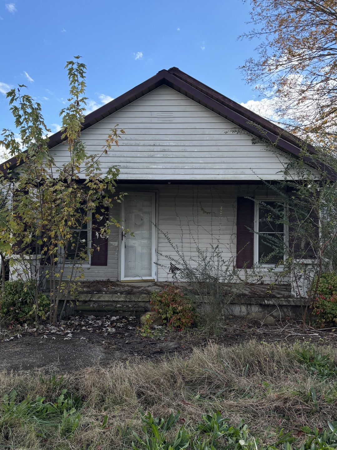
Highlights
- Traditional Architecture
- Covered Patio or Porch
- No Heating
- No HOA
- 1 Car Garage
- Property has 1 Level
About This Home
PENDING BEFORE PRINT
Listing Agent
Benchmark Realty, LLC Brokerage Phone: 6155426602 License #341936 Listed on: 11/09/2025

Home Details
Home Type
- Single Family
Est. Annual Taxes
- $287
Year Built
- Built in 1953
Parking
- 1 Car Garage
Home Design
- Traditional Architecture
- Metal Roof
- Vinyl Siding
Interior Spaces
- 1,008 Sq Ft Home
- Property has 1 Level
Bedrooms and Bathrooms
- 2 Main Level Bedrooms
- 1 Full Bathroom
Schools
- Hickory Creek Elementary School
- Warren County Middle School
- Warren County High School
Utilities
- No Cooling
- No Heating
- Septic Tank
Additional Features
- Covered Patio or Porch
- 2.4 Acre Lot
Community Details
- No Home Owners Association
Listing and Financial Details
- Assessor Parcel Number 078 04709 000
Map
Home Values in the Area
Average Home Value in this Area
Tax History
| Year | Tax Paid | Tax Assessment Tax Assessment Total Assessment is a certain percentage of the fair market value that is determined by local assessors to be the total taxable value of land and additions on the property. | Land | Improvement |
|---|---|---|---|---|
| 2025 | $287 | $27,600 | $0 | $0 |
| 2024 | $287 | $14,575 | $3,725 | $10,850 |
| 2023 | $287 | $14,575 | $3,725 | $10,850 |
| 2022 | $287 | $14,575 | $3,725 | $10,850 |
| 2021 | $287 | $14,575 | $3,725 | $10,850 |
| 2020 | $243 | $14,575 | $3,725 | $10,850 |
| 2019 | $278 | $12,375 | $3,475 | $8,900 |
| 2018 | $243 | $12,375 | $3,475 | $8,900 |
| 2017 | $243 | $12,375 | $3,475 | $8,900 |
| 2016 | $243 | $12,375 | $3,475 | $8,900 |
| 2015 | $247 | $12,375 | $3,475 | $8,900 |
| 2014 | $250 | $12,375 | $3,475 | $8,900 |
| 2013 | $250 | $12,510 | $0 | $0 |
Property History
| Date | Event | Price | List to Sale | Price per Sq Ft |
|---|---|---|---|---|
| 11/09/2025 11/09/25 | Pending | -- | -- | -- |
| 11/09/2025 11/09/25 | For Sale | $60,000 | -- | $60 / Sq Ft |
Purchase History
| Date | Type | Sale Price | Title Company |
|---|---|---|---|
| Trustee Deed | $48,700 | None Available | |
| Warranty Deed | $63,000 | -- | |
| Deed | $7,800 | -- |
Mortgage History
| Date | Status | Loan Amount | Loan Type |
|---|---|---|---|
| Previous Owner | $64,285 | Commercial |
Source: Realtracs
MLS Number: 3042895
APN: 078-047.09
Disclaimer: Certain information contained herein is derived from information provided by parties other than Homes.com. All information provided is deemed reliable, but is not guaranteed to be accurate and should be independently verified.
![]() Based on information submitted to the MLS GRID. All data is obtained from various sources and may not have been verified by broker or MLS GRID. Supplied Open House Information is subject to change without notice. All information should be independently reviewed and verified for accuracy. Properties may or may not be listed by the office/agent presenting the information. Some IDX listings have been excluded from this website.
Based on information submitted to the MLS GRID. All data is obtained from various sources and may not have been verified by broker or MLS GRID. Supplied Open House Information is subject to change without notice. All information should be independently reviewed and verified for accuracy. Properties may or may not be listed by the office/agent presenting the information. Some IDX listings have been excluded from this website.
The Digital Millennium Copyright Act of 1998, 17 U.S.C. § 512 (the “DMCA”) provides recourse for copyright owners who believe that material appearing on the Internet infringes their rights under U.S. copyright law. If you believe in good faith that any content or material made available in connection with our website or services infringes your copyright, you (or your agent) may send us a notice requesting that the content or material be removed, or access to it blocked.
Notices must be sent in writing by email to DMCAnotice@MLSGrid.com.
The DMCA requires that your notice of alleged copyright infringement include the following information:
(1) description of the copyrighted work that is the subject of claimed infringement;
(2) description of the alleged infringing content and information sufficient to permit us to locate the content;
(3) contact information for you, including your address, telephone number and email address;
(4) a statement by you that you have a good faith belief that the content in the manner complained of is not authorized by the copyright owner, or its agent, or by the operation of any law;
(5) a statement by you, signed under penalty of perjury, that the information in the notification is accurate and that you have the authority to enforce the copyrights that are claimed to be infringed; and
(6) a physical or electronic signature of the copyright owner or a person authorized to act on the copyright owner’s behalf. Failure to include all of the above information may result in the delay of the processing of your complaint.
- 163 Loss Crouch Rd
- 1053 Arch Cope Rd
- 200 Pine Ave
- 5048 Manchester Hwy
- 52 Cherry Ln
- 307 Pine Ave
- 724 Miriah Dr
- 5944 Manchester Hwy
- 990 Miriah Dr
- 315 Brandon Dr
- 681 Hennessee Ave
- 357 Miriah Dr
- 0 Hennessee Ave Unit RTC2815345
- 0 Manchester Hwy Unit RTC2817165
- 0 Manchester Hwy Unit RTC2706275
- 0 Manchester Hwy Unit RTC2797636
- 0 Manchester Hwy Unit 220028
- 146 Simons Blvd
- 57 Simons Blvd
- 0 Garrison Dr